

Strong Storms in the Birmingham Metro
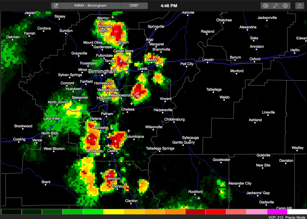
Composite reflectivity which shows precipitation at all levels. This look more impressive than what is reaching the ground, but shows suspended precip that can come down shortly.
Several strong storms are located across the Birmingham Metro at this hour.
They developed in the intense heating of the day where the mercury reached at least 98F at the Birmingham Airport and 96F at the Shelby County Airport. Intersecting boundaries and waves in the atmosphere played a role as well.
At 455, they extend from Pinson through Roebuck to Vestavia and over into northeastern Shelby County north of Sterrett then to west of Alabaster and Montevallo with additional storms near Calera.
The storm in northeastern Shelby County will have to be watched as a well defined outflow boundary is about to intersect with it, which should lead to intensification.
Watch for lightning and be prepared for strong wind gusts to over 60 mph if any of the storms briefly become severe. Heavy rain will also be possible but flooding doesn’t look like much of an issue.
Category: Alabama's Weather
About the Author (Author Profile)
Bill Murray is the President of The Weather Factory. He is the site's official weather historian and a weekend forecaster. He also anchors the site's severe weather coverage. Bill Murray is the proud holder of National Weather Association Digital Seal #0001 @wxhistorianSubscribe
If you enjoyed this article, subscribe to receive more just like it.


