

Drier Air Arrives Tonight
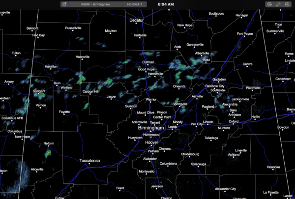
RADAR CHECK: We have a few light showers over North Alabama as the begins… moving east…
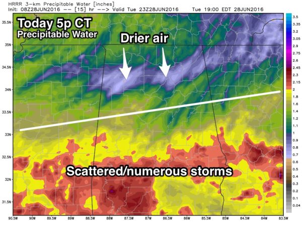
We will maintain the chance of scattered showers and thunderstorms today, but by afternoon, drier air will cover the northern third of the state, and the highest coverage of showers and storms will shift down into the areas south of I-20.
The high today will be close to 90 degree, but come places won’t get out of the 80s since showers are forming earlier in the day.
TOMORROW THROUGH FRIDAY: Dry air will cover the northern half of the state on these three days, and we expect generally shower-free conditions with partly to mostly sunny days and fair nights. Highs will be close to 90 tomorrow and Thursday, with low 90s Friday. Showers will be confined to the southern part of the state, and even there they should be pretty widely spaced.
FOURTH OF JULY WEEKEND: Moisture slowly returns, but it still looks Saturday and Sunday will be mostly dry with only widely scattered afternoon showers. Scattered showers and storms should be a little more numerous on Monday (July 4), but even then it certainly won’t be a “wash out”. Temperatures will be seasonal for early July with highs in the low to mid 90s.
Then, the rest of next week looks very routine for mid-summer with hot, humid days and the risk of “scattered, mostly afternoon and evening showers and thunderstorms”. Highs will be in the 90s. See the Weather Xtreme video for maps, graphics, and more details.
TROPICS: The Atlantic basin remains quiet, and tropical storm formation it not expected through the holiday weekend.
AT THE BEACH: Routine summer weather continues through the Fourth of July weekend on the coast from Panama City Beach over to Gulf Shores. About 6 to 8 hours of sunshine daily with the risk of scattered thunderstorms. Highs 87-90 on the immediate coast, with low to mid 90s inland. Sea water temperatures are mostly in the mid to upper 80s. See a very detailed Gulf Coast forecast here.
WEATHER BRAINS: Don’t forget you can listen to our weekly 90 minute netcast anytime on the web, or on iTunes. This is the show all about weather featuring many familiar voices, including our meteorologists here at ABC 33/40. Scroll down for the show notes on the new episode we recorded last night.
CONNECT: You can find me on all of the major social networks…
Facebook
Twitter
Google Plus
Instagram
I will be doing a safety meeting for ALAGASCO today in Gadsden… look for the next Weather Xtreme video here by 4:00 this afternoon… enjoy the day!
Category: Alabama's Weather
About the Author (Author Profile)
James Spann is one of the most recognized and trusted television meteorologists in the industry. He holds the AMS CCM designation and television seals from the AMS and NWA. He is a past winner of the Broadcast Meteorologist of the Year from both professional organizations.Subscribe
If you enjoyed this article, subscribe to receive more just like it.


