

Midday Nowcast: Cloudy, Cooler, and Some Showers Possible
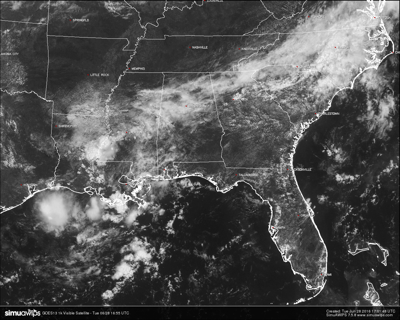
Currently on the visible satellite image, clouds are stretching across much of north and central Alabama, with a few also covering the skies in the southwestern part of the state. The rest of the state are enjoying mostly clear skies.
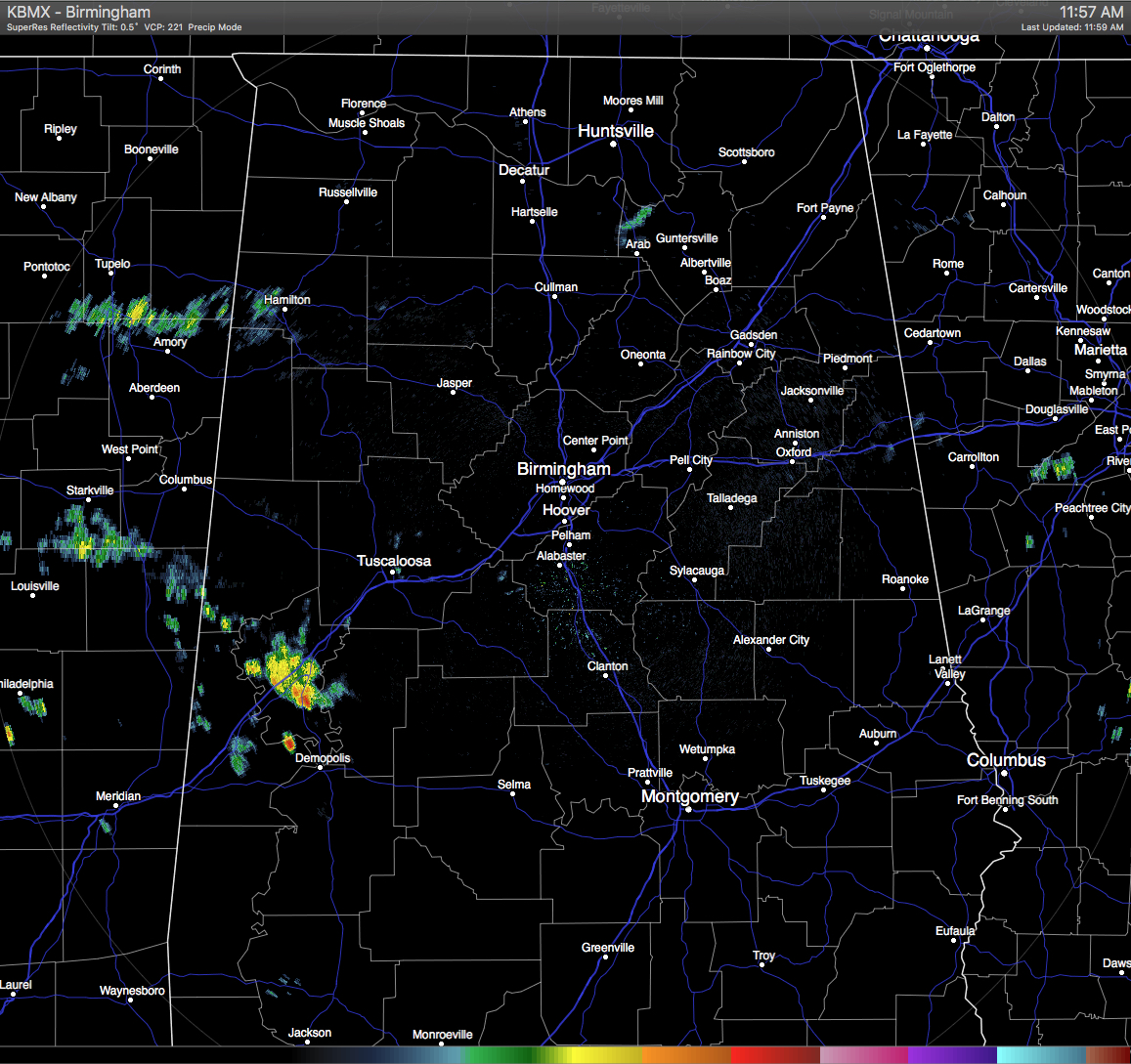
Currently on the radar, a decent shower is located over the north and central parts of Greene County and stretching over into west-central Hale County. A few more light showers are located in western Marion and extreme northern Lamar Counties, with another shower located in northwestern Marshall County.
TODAY’S WEATHER: For most areas in Central Alabama, skies will be mostly cloudy. A weak stationary boundary that stretches across the state from west to east is located near the I-85 and U.S. 80 corridor. It will start to move southward as a front will be making its way into the state later this evening. Showers and thunderstorms are expected to develop around and along the boundary, especially south of I-20, but instability for Central Alabama will be capped and storms will not be all that strong. Afternoon highs will be held in check today and will only reach the upper 80s to near 90.
CODE YELLOW AIR QUALITY: The Air Quality Index for the Birmingham Metropolitan Area will be in the “Code Yellow” (moderate range) for ozone and particulate matter. People who are unusually sensitive should consider limiting prolonged outdoor exertion.
TODAY’S CLIMATOLOGY FOR BIRMINGHAM: The normal high for June 28th is 89, while the normal low is 68. The record high for today was set back in 1931 at 104. The record low was set back in 1968 at 53.
WEDNESDAY’S WEATHER: For the northern half of the state, partly to mostly sunny skies, with drier air and generally rain-free. Afternoon highs will be at or near 90. Any shower activity will be confined to the southern parts of the state, and even there they should be isolated in nature.
HEADED TO THE BEACH: Routine summer weather continues through the Fourth of July weekend on the coast from Panama City Beach over to Gulf Shores. About 6 to 8 hours of sunshine daily with the risk of scattered thunderstorms. Highs 87-90 on the immediate coast, with low to mid 90s inland. Sea water temperatures are mostly in the mid to upper 80s. See a very detailed Gulf Coast forecast here.
THE TROPICS: The Atlantic basin remains quiet, and tropical storm formation is not expected through the holiday weekend.
WEATHERBRAINS: This is the show all about weather featuring many familiar voices, including our meteorologists at ABC 33/40. Last night, we talked Oklahoma weather with the folks from OK First. You can listen anytime on the web, or on iTunes. You can find it here.
ADVERTISE WITH US: Deliver your message to a highly engaged audience by advertising on the AlabamaWX.com website. The site enjoyed 10.2 MILLION pageviews in the past 12 months. Don’t miss out! We can customize a creative, flexible and affordable package that will suit your organization’s needs. Contact me, Bill Murray, at (205) 687-0782 and let’s talk.
Category: Alabama's Weather
About the Author (Author Profile)
Scott Martin is an operational meteorologist, professional graphic artist, musician, husband, and father. Not only is Scott a member of the National Weather Association, but he is also the Central Alabama Chapter of the NWA president. Scott is also the co-founder of Racecast Weather, which provides forecasts for many racing series across the USA. He also supplies forecasts for the BassMaster Elite Series events including the BassMaster Classic.Subscribe
If you enjoyed this article, subscribe to receive more just like it.


