

Midday Nowcast: Rain To The South, Drier Air Moving In Today
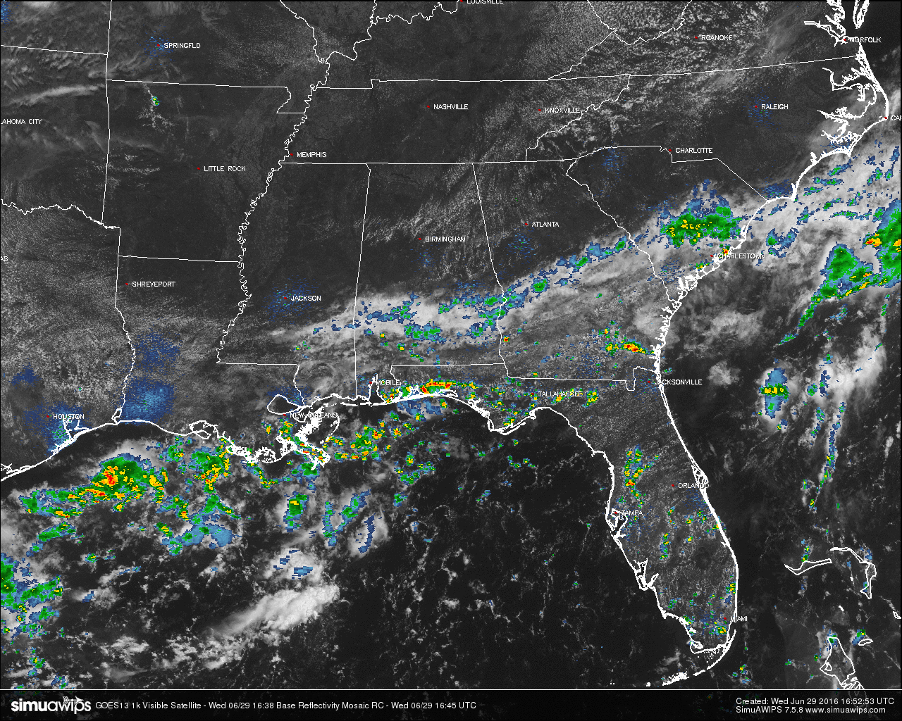
Skies across much of Central Alabama are clear with a few cumulus clouds floating overhead. Radar at this point is dry for areas north of a line from Demopolis to Selma to Montgomery to Opelika. South of that line, scattered showers are almost affecting at least some part of each county.
TEMPERATURES AT THIS HOUR: You can tell on the observations map where cloud cover and rainfall is affecting temperatures. In the northern half of the state, temperatures are up in the mid to upper 80s. In the southern half of the state, low to mid 80s can be found. Here is a list of temperature observations from around the state:
Birmingham: 87
Anniston: 89
Tuscaloosa: 88
Muscle Shoals: 84
Huntsville: 88
Alexander City: 88
Montgomery: 81
Dothan: 85
Mobile: 84
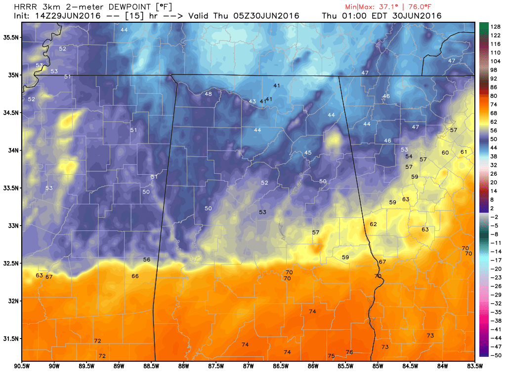
HRRR Model: Dewpoints valid at midnight.
TODAY’S WEATHER: Drier air is moving into North Alabama, and the dewpoints will start to fall this afternoon and evening. Skies will be generally clear, with just a few cumulus clouds hiding the sunshine every now and then. Even though rain chances for the area is not exactly zero, best chances will stay around or below the U.S. 80 and I-85 corridors. Afternoon highs will be at or near 90.
CODE YELLOW AIR QUALITY: The Air Quality Index for the Birmingham Metropolitan Area will be in the “Code Yellow” (moderate range) for ozone and particulate matter. People who are unusually sensitive should consider limiting prolonged outdoor exertion.
TODAY’S CLIMATOLOGY FOR BIRMINGHAM: The normal high for June 29th is 90, while the normal low is 70. The record high for today was set back in 1931 at 106. The record low was set back in 1974 at 57.
THURSDAY’S WEATHER: Lower dewpoints and more stable air will be over much of North and Central Alabama tomorrow. Rain chances will stay confined to the southern part of the state. Skies will be mostly clear to partly cloudy, with highs at or near 90.
HEADED TO THE BEACH: Pretty standard summer weather continues on the coast from Gulf Shores over to Panama City Beach through the Fourth of July weekend. About 6 to 8 hours of sunshine each day with the risk of scattered showers and thunderstorms. Highs on the immediate coast will be in the upper 80s, with 90s inland. Sea water temperatures are mostly in the mid to upper 80s. See a very detailed Gulf Coast forecast here.
THE TROPICS: The Atlantic basin remains quiet, and tropical storm formation is not expected through the holiday weekend.
WEATHERBRAINS: This is the show all about weather featuring many familiar voices, including our meteorologists at ABC 33/40. This week, we talked Oklahoma weather with the folks from OK First. You can listen anytime on the web, or on iTunes. You can find it here.
ADVERTISE WITH US: Deliver your message to a highly engaged audience by advertising on the AlabamaWX.com website. The site enjoyed 10.2 MILLION pageviews in the past 12 months. Don’t miss out! We can customize a creative, flexible and affordable package that will suit your organization’s needs. Contact me, Bill Murray, at (205) 687-0782 and let’s talk.
Category: Alabama's Weather
About the Author (Author Profile)
Scott Martin is an operational meteorologist, professional graphic artist, musician, husband, and father. Not only is Scott a member of the National Weather Association, but he is also the Central Alabama Chapter of the NWA president. Scott is also the co-founder of Racecast Weather, which provides forecasts for many racing series across the USA. He also supplies forecasts for the BassMaster Elite Series events including the BassMaster Classic.Subscribe
If you enjoyed this article, subscribe to receive more just like it.


