

Showers Few And Far Between Through Sunday
CALM SUMMER WEATHER: On the maps this morning a surface boundary is near U.S. 80 (Demopolis to Selma to Montgomery to Opelika)… drier air is over North Alabama, and temperatures have reached the upper 50s at places like Cullman and Fort Payne. Our Skywatcher at Black Creek, just northeast of Gadsden, reports 58 degrees at daybreak. Accordingly, the best chance of a pop up afternoon storm today will be south of that front, over the southern counties of Alabama.
The chance of a shower for North Alabama is not zero, but the risk is so small for any one given point that we won’t mention it in the forecast. The high today will be at or just over 90 degrees in most spots with a partly to mostly sunny sky.
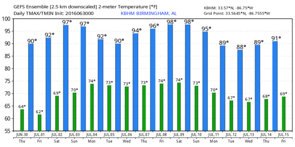
TOMORROW THROUGH SUNDAY: The surface boundary over Central Alabama will slowly lose it’s identity, but the air over the northern half of the state will remain pretty dry for early July. We will mention “isolated storms” during the afternoon and evening hours, but many communities will remain dry on these three days. The chance of any one spot getting wet each afternoon is about one in five. Heat levels will creep up, with highs in the 92-96 degree range.
MONDAY: Another surface front will approach from the north, and we expect an increase in the number of scattered showers and storms for Independence Day. Still, no “wash-out”… just be ready for a passing storm if you have something planned outside.
And, the rest of next week looks pretty routine with hot, humid days and the risk of “scattered, mostly afternoon and evening showers and storms”. See the Weather Xtreme video for maps, graphics, and more details.
TROPICS: The Atlantic basin is still very quiet, and tropical storm formation is not expected through the holiday weekend.
AT THE BEACH: Pretty standard summer weather for the Gulf Coast from Gulf Shores over to Panama City Beach through the weekend; about 6 to 8 hours of sunshine each day with the usual risk of a passing storm from time to time. Highs will be in the upper 80s on the immediate coast, with 90s inland.
To clear up confusion, there is no “flesh eating bacteria” in the Gulf waters of Northwest Florida or South Alabama… please read this well written article by Jeremy Pate of WJHG-TV in Panama City that explains the situation very clearly.
See a very detailed Gulf Coast forecast here.
WEATHER BRAINS: Don’t forget you can listen to our weekly 90 minute netcast anytime on the web, or on iTunes. This is the show all about weather featuring many familiar voices, including our meteorologists here at ABC 33/40.
CONNECT: You can find me on all of the major social networks…
Facebook
Twitter
Google Plus
Instagram
Look for the next Weather Xtreme video here by 4:00 this afternoon… enjoy the day!
Category: Alabama's Weather
About the Author (Author Profile)
James Spann is one of the most recognized and trusted television meteorologists in the industry. He holds the AMS CCM designation and television seals from the AMS and NWA. He is a past winner of the Broadcast Meteorologist of the Year from both professional organizations.Subscribe
If you enjoyed this article, subscribe to receive more just like it.


