

Hot & Humid, Scattered Storms
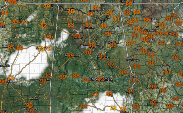
Early this afternoon, much of the state is seeing plenty of sunshine, and that has allowed temperatures to warm well into the 80s and 90s. There are a few areas of clouds, associated with storms currently ongoing across parts of the state. Through the afternoon hours, we should continue to see cloud cover expand over the state as more storms develop across the area.
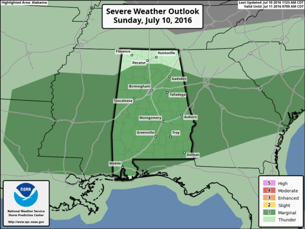
The SPC maintains the “marginal risk” of severe storms this afternoon and evening. The main concern today with the storms will be damaging wind gusts associated with wet microbursts. In addition to the wind, storms today could produce hail, plus a lot of lightning, and very heavy rainfall. Just like we saw yesterday, where the storms go, they could produce localized areas of flash flooding.
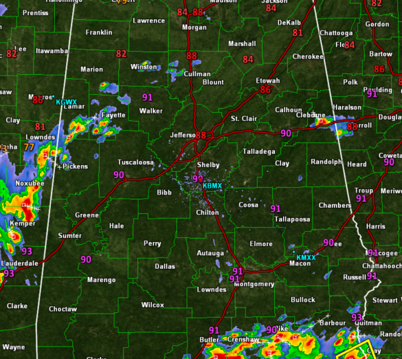
Checking the radar this afternoon, we are tracking a few storms across west Alabama, with additional storms in Mississippi. These storms are tracking towards the east. Also, a rather strong storm is located in Cleburne County in East Alabama, as well as more storms down across the Southeastern portions of the state. The next few hours, we should see additional storms develop, and these will have to potential to briefly become severe.
Category: Alabama's Weather
About the Author (Author Profile)
Macon, Georgia Television Chief Meteorologist, Birmingham native, and long time Contributor on AlabamaWX. Stormchaser. I did not choose Weather, it chose Me. College Football Fanatic. @Ryan_StinnetSubscribe
If you enjoyed this article, subscribe to receive more just like it.


