

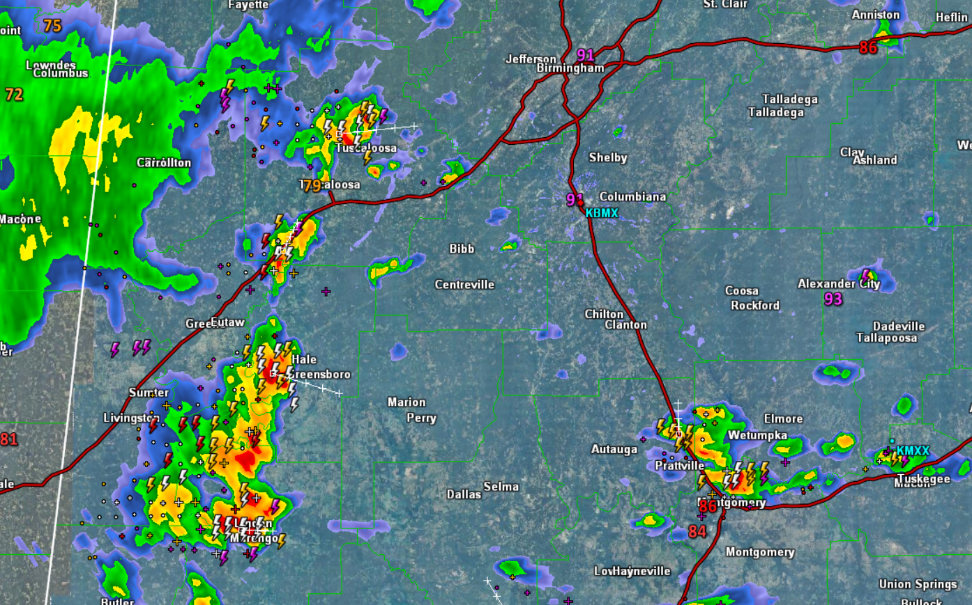
Lots of Lightning with Storms over West Alabama
It is the hottest part of the day and storms are bubbling up across the Alabama landscape. We are seeing numerous storms throughout the state, and in North/Central Alabama, the strongest storms currently are over western portions of the state and are shifting east through the state. Locations along the U.S. 43 corridor from Tuscaloosa, down through Demopolis are experiencing the most intense activity currently.
Storms today are producing intense rainfall, small hail, an abundance of lightning, and there is the threat of a few damaging wind gusts associated with wet microburst. At this time, no storms are severe in the area, but we have seen a few severe storms in other portions of the state.
Additional storms are developing around the Montgomery area and lifting towards the northeast. What you see is what you get the rest of the day. Showers and storms will continue to develop the next several hours, but should begin to wind down after sunset.
Click image to enlarge.
Category: Alabama's Weather
About the Author (Author Profile)
Macon, Georgia Television Chief Meteorologist, Birmingham native, and long time Contributor on AlabamaWX. Stormchaser. I did not choose Weather, it chose Me. College Football Fanatic. @Ryan_StinnetSubscribe
If you enjoyed this article, subscribe to receive more just like it.


