

Strong Storms Pushing Through Central Alabama
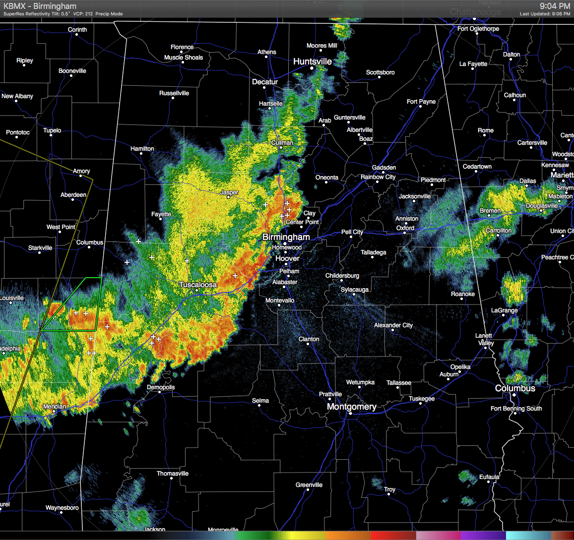
A line of pretty intense thunderstorms are pushing through Central Alabama at this time. The line stretches from the AL/TN state line in Madison and Jackson counties, back to the south-southwest down into Bibb and Perry counties, and back to the west in Meridian, Mississippi.
The strongest part of the line is located in the southwestern parts of Jefferson County where some rainfall estimates are up to 1.8 inches within the last hour. Lightning is starting to ease a little, but still some area of intense strikes. Most of the rainfall has fallen in the northern Jefferson County areas, where there are several radar rainfall estimates of 1.8 inches, especially just west of Warrior and Kimberly.
Strong gusty winds up to 40 MPH can be expected with these storms, along with some small hail, heavy rainfall, and copious amounts of cloud-to-ground lightning.
This will probably be the last round of storms for the night, as another line has entered the western parts of Mississippi, and will probably enter the state sometime between Midnight and 2AM. These storms have several severe thunderstorm warnings on them, and a severe thunderstorm watch is in effect until 1AM for much of Central Mississippi.
Category: Alabama's Weather, Severe Weather
About the Author (Author Profile)
Scott Martin is an operational meteorologist, professional graphic artist, musician, husband, and father. Not only is Scott a member of the National Weather Association, but he is also the Central Alabama Chapter of the NWA president. Scott is also the co-founder of Racecast Weather, which provides forecasts for many racing series across the USA. He also supplies forecasts for the BassMaster Elite Series events including the BassMaster Classic.Subscribe
If you enjoyed this article, subscribe to receive more just like it.


