

Heat and Showers in Forecast
Traveling weather systems remain well north of the Southeast US, so we are looking at a weather pattern that will not be changing much over the next seven days. There will be minor changes, but they will be subtle and we really won’t see any drastic changes to the weather with heat and showers holding spots in the forecast.
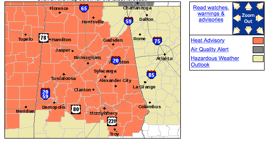
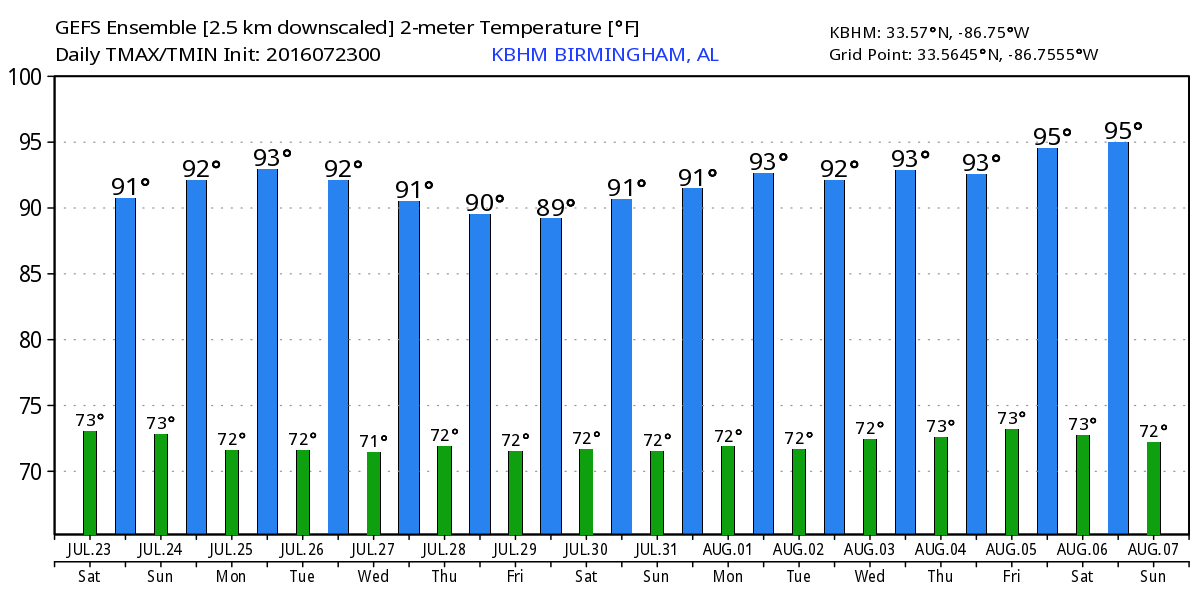
There is a subtle weakness in the 500 millibar pattern in the vicinity of West Tennessee early this morning which was helping to generate showers over Northeast Mississippi and Northwest Alabama. Movement of these showers was southeastward and the motion should gradually become more southward during the late morning. A heat advisory remained in place this morning for the northern two thirds of Alabama, but the presence of the weakness aloft along with the presence of additional clouds could mean that we won’t quite reach heat index values of 105. While we might not reach the “official” criteria for the heat advisory, it will remain hot and steamy. I expect highs today to generally top out in the middle 90s, but the upper 90s are possible generally south and southeast of Birmingham.
For beachgoers, summer weather continues along the Gulf Coast from Dauphin Island to Panama City Beach this weekend and into next week. There will be about 7 to 9 hours of sunshine each day with an occasional passing thunderstorm. Highs will be around 89 on the immediate coast with mid to upper 90s inland. See a very detailed Gulf Coast forecast here.
Looking southward, the Atlantic Basin remains quiet, while Frank and Georgette, both tropical storms, were spinning in the Eastern Pacific, neither a threat to land areas.
And as you might expect, the SPC has the risk for organized severe storms confined to the northern tier of the US from the Great Lakes to New England for the next three days. And there is little likelihood that this pattern will change through the week ahead.
Ridging remains the primary feature across the southern tier of the US through the week ahead with only some subtle changes to the pattern. As short waves move across Canada, they will have at least some effect on the ridging by pushing the bulk of the ridge back west beginning Monday and continuing through the middle of the week and into next weekend. The influence of this weak troughiness should be enough to lower our high temperatures some as highs stick in the lower and middle 90s. Morning lows will remain steady, too, with values in the 70 to 75 degree range. And while I would love to say something different than “chance of thunderstorms” in the daily forecast, there is no real pattern change which would warrant saying anything different. Due to the spotty nature of these storms, there is no real relief seen for the drought conditions affecting the northern two-thirds of Alabama during the next week.
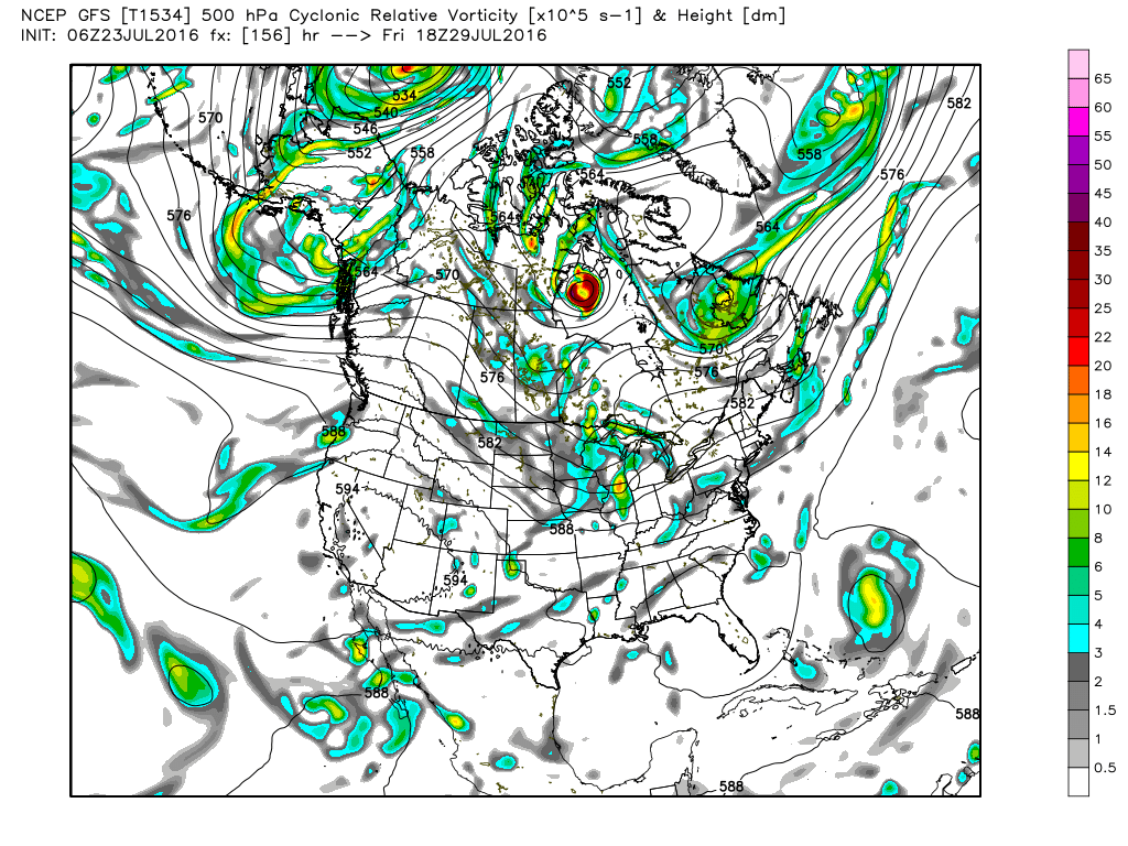
Looking into voodoo country, the GFS is big on bringing the ridge back into the Central US as we head into the first few days of August. And the GFS holds the ridge there once again as we head out to August 7th.
I expect to have the next Weather Xtreme Video posted here first thing on Sunday morning. You can check back here regularly for updates on how the Alabama weather scene is changing. Enjoy your day and Godspeed.
-Brian-
Category: Uncategorized
About the Author (Author Profile)
Brian Peters is one of the television meteorologists at ABC3340 in Birmingham and a retired NWS Warning Coordination Meteorologist. He handles the weekend Weather Xtreme Videos and forecast discussion and is the Webmaster for the popular WeatherBrains podcast.Subscribe
If you enjoyed this article, subscribe to receive more just like it.


