

Summer Marches On
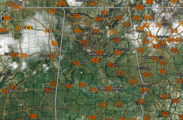
Hot, humid weather continues for the weekend with scattered showers and thunderstorms. Best chance of storms comes during the afternoon and evening hours, but with the moisture-rich air mass in place, a late night or morning shower can not be completely ruled out either. Highs today and tomorrow will range from 90-95 degrees, pretty much what we expect in late July around here.

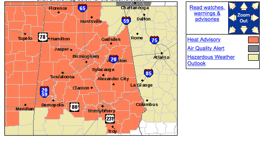
HEAT ADVISORY: The NWS maintains the heat advisory again today, as heat index values will be at or just over 105° at times through out Central Alabama. This should be the last day an advisory is needed for Alabama for the next week or so, but there is still plenty of summer left.
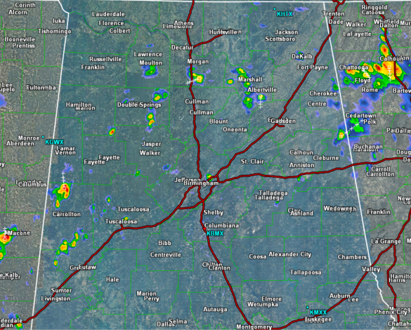
RADAR CHECK: Early this afternoon, we are watching a few showers and storms that are ongoing, but these are rather isolated and confined to northern portions of the state. Through the afternoon, we will continue to see pockets of convection, that will be producing a lot of lightning, heavy rainfall, and gusty winds. General storm motion is towards the south. Typical of this time of year, what storms that are out there, should wind down after sunset.
Category: Uncategorized
About the Author (Author Profile)
Macon, Georgia Television Chief Meteorologist, Birmingham native, and long time Contributor on AlabamaWX. Stormchaser. I did not choose Weather, it chose Me. College Football Fanatic. @Ryan_StinnetSubscribe
If you enjoyed this article, subscribe to receive more just like it.


