

Heat, Humidity, Isolated Storms
Satellite imagery shows a few clouds across the Alabama sky this morning with temperatures running in the middle and upper 70s. I expect to see a mixture of sun and clouds today with isolated showers and thunderstorms developing in the heat of the afternoon. The weakness at 500 millibars is still evident over the Lower Mississippi River Valley, so I would expect to see thunderstorms more numerous to our west today. Radar was clear for Alabama this morning, but there were a few thunderstorms occurring in the vicinity of Memphis.
The typical summer forecast for the beaches of the Northern Gulf Coast from Dauphin Island east to Panama City includes plenty of sunshine each day, but with the threat of a passing storm from time to time. Highs are around 90 on the beaches while just inland you can expect low to mid 90s. The sea water temperature at the Dauphin Island Sea Lab was 87 degrees. See the complete Gulf Coast 7 Day Planner here.
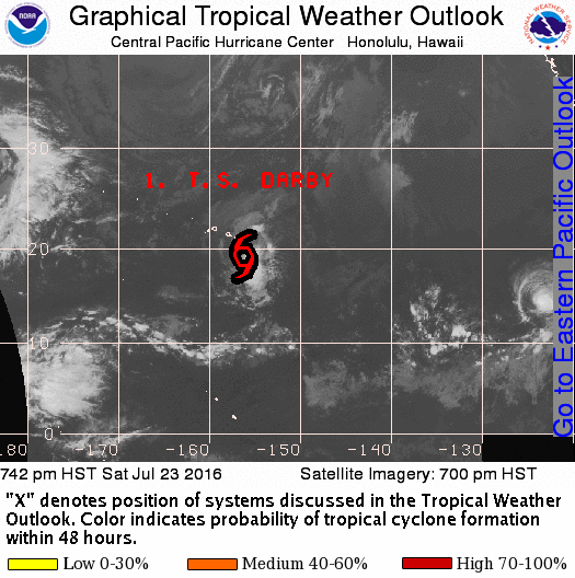
The tropical Atlantic was quiet and is expected to remain quiet for the next several days. Be sure to see the GFS outlook for voodoo country. In the Eastern North Pacific, Tropical Storm Frank and Hurricane Georgette were spinning away from land. In the Central North Pacific, Tropical Storm Darby was bringing some wind and heavy rain to the Hawaiian Islands.
SPC has no specific areas outlooked for severe weather for the next several days with just some marginal areas along and ahead of the frontal system moving through the northern tier of the US.
The upper air pattern remains in a ridge into the first of the week, but a series of upper troughs manage to split the ridge with centers over the Four Corners area and just off the Southeast US coast by Tuesday. The one off the South Carolina coast pushes into the Southeast US on Wednesday, but another strong trough is forecast to dig into the Great Lakes area on Thursday and Friday potentially bringing a front into Tennessee by Friday. And the overall troughiness is forecast to stick with us into the weekend.
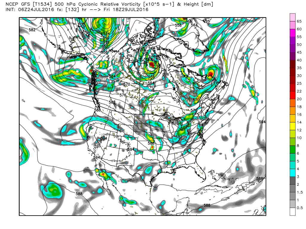
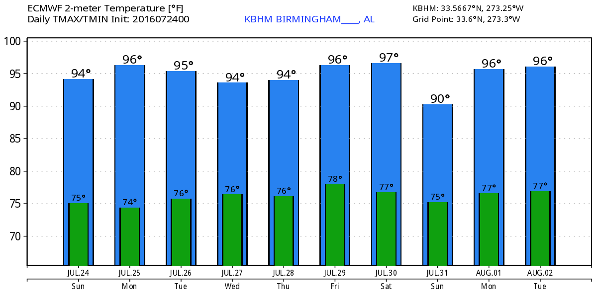
For the first half of the week ahead, I expect to see isolated thunderstorms driven by the heat of the day with highs in the lower and middle 90s. But as we head into the latter part of the week from Thursday into the weekend, rain chances appear likely to go up with the combination of the upper troughiness and the presence of the weak front edging into the northern part of the Southeast US. The lowering of the heights along with the presence of more clouds and more thunderstorms should combine to drop our temperatures back to around 90. The GFS MOS guidance takes the high Friday all the way into the middle 80s, and I’m just not buying that much of a change.
It is interesting to note that the ECMWF 500 millibar pattern is in fairly close agreement to the pattern of the GFS, but the ECMWF only drops temperatures back to around 90.
The really big surprise comes as we venture out into voodoo country. The GFS builds the upper ridge back into the Central and eastern US from Sunday through Wednesday. The surprise is the appearance of what appears to be a tropical system in the Bahamas. By Friday, August 5th, the tropical system strengthens and moves northward into the Carolinas while the upper ridge is pushed back to the west. The ridge builds east again by August 8th as the tropical system heads northeastward into the northern Atlantic. But remember, this is voodoo. By the time James has the next Weather Xtreme Video on Monday morning, this whole notion of a tropical system for early August may be completely gone.
I appreciate you tuning into the blog for the Weather Xtreme Video. Mr. Spann is taking some additional time off, so I believe my next video will come next Thursday morning. Remember, it continues to be hot, so just use some common sense and don’t overdo it whether working or playing in the outdoors. Have a great day and Godspeed.
-Brian-
Category: Uncategorized
About the Author (Author Profile)
Brian Peters is one of the television meteorologists at ABC3340 in Birmingham and a retired NWS Warning Coordination Meteorologist. He handles the weekend Weather Xtreme Videos and forecast discussion and is the Webmaster for the popular WeatherBrains podcast.Subscribe
If you enjoyed this article, subscribe to receive more just like it.


