

Break in the Heat Continues
The break in the heat is going to stick with us for the day and into the start of the weekend. The high at the Birmingham Shuttlesworth International Airport yesterday was 89 degrees which is actually 2 degrees below the 30-year average for late July which is 91. Tuscaloosa recorded an 89, too, while Anniston-Oxford hit 90.
We have weak troughiness aloft which is going to stick around for the next couple of days, so I expect to see showers remain a bid more numerous along with more clouds helping to keep the afternoon highs in check. Most places will be dancing around the 90-degree mark.
For beachgoers, look for 7 to 9 hours of sunshine daily on the coast from Panama City Beach over to Dauphin Island through the weekend with the usual risk of a passing storm from time to time. Highs on the immediate coast 87 to 90 with low to mid 90s inland. See a very detailed Gulf Coast forecast here.
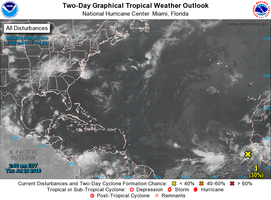
Tropical Atlantic remains quiet with just the one one area of disturbed weather way out in the Atlantic south of the Cape Verde Islands. The GFS is not doing much with that system. Frank continues to whirl in the Eastern North Pacific away from land with a second area of disturbed weather being carefully watched. Completing the tropical parade is Tropical Storm Mirinae which is moving into Vietnam as it weakens.
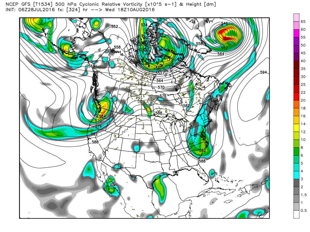
Showers and thunderstorms will remain a bit more numerous through Saturday especially across the northern third of Alabama. But by Sunday and Monday the upper troughiness we’ve seen over the eastern half of the country – and enjoyed for the break in the excessive heat – will be eased eastward as the upper ridge over the Southwest US pushes eastward. The upper ridge will be the most influential on our weather around midweek, though the 594 height contour will certainly not be as impressive as we’ve seen over the last couple of weeks.
By Thursday, the upper ridge begins to weaken slightly. But this will put our highs back into the 90s for the first half of next week. Showers and thunderstorms will be driven primarily by the heat of the afternoon, so look for them to be isolated most days with the majority of people remaining dry. Morning lows will be steady in the 70 to 75 degree range.
Looking out into voodoo country, the GFS is rather bullish on another fairly deep trough over the eastern US for much of the Week 2 period. This pattern keeps Alabama in the in-between area with the trough axis along the East Coast and the ridge axis from Texas to the western Great Lakes. This certainly favors a warm period without any evidence of any extreme heat. Watch the video for a little surprise from the GFS for the long range period.
James Spann is on vacation for the next week, so we will be on a one-a-day Weather Xtreme Video schedule through the middle of next week. I plan to post the next Weather Xtreme Video by 7:30 or so on Friday morning. Enjoy your day and Godspeed.
-Brian-
Category: Uncategorized
About the Author (Author Profile)
Brian Peters is one of the television meteorologists at ABC3340 in Birmingham and a retired NWS Warning Coordination Meteorologist. He handles the weekend Weather Xtreme Videos and forecast discussion and is the Webmaster for the popular WeatherBrains podcast.Subscribe
If you enjoyed this article, subscribe to receive more just like it.


