

Showers Numerous Today
The early morning satellite image showed cloudy skies across about the northern half of Alabama, and radar was even picking up on areas of some sprinkles or very light rain. The upper air flow has been slow to change so the overall weakness in the 500 millibar pattern should help to keep us in more numerous showers once again today. Those more prevalent showers along with the widespread cloud cover should help to keep temperatures in check for one more day with highs in the upper 80s. The high in Birmingham yesterday was only 88 degrees, that’s 3 degrees below average. Very hard to call this a cold spell, but when we are in late July and the highs only reach the upper 80s, I’ll take it!
Beachgoers can expect scattered showers and storms along the beaches of Alabama and Northwest Florida. Rain chances will ratchet up just a bit by midweek next week. Highs will be around 89 with morning lows in the upper 70s. Waves will generally be running less than one foot, except around thunderstorms, so the rip current threat should be low. You can find a detailed Gulf Coast forecast here.
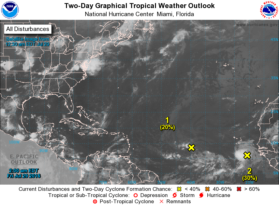
The tropical Atlantic has become a bit more active with two disturbances under the watchful eye of the National Hurricane Center. Both are a long way from threatening any land areas, and they will stay that way for several days to come.
Severe weather risk for the next several days remains low, too. SPC has an area in an arc through the Central Plains running from southern Indiana in an arc through Oklahoma and then north into Southwest South Dakota. Days 2 and 3 have only small areas of marginal risk.
The GFS model is going to hold the weakness in our area today, but for the weekend and into Monday it looks like it weakens and moves eastward. This should result in a drop in the number and coverage of showers as highs climb back into the lower 90s. By Tuesday the upper heat ridge to our west begins to push into the Lower Mississippi River Valley and by Wednesday it has arrived. This keeps us in those daily chances for showers with highs in the lower and middle 90s.
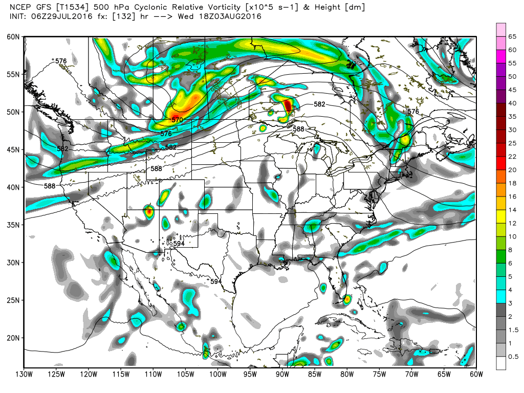
Thursday and Friday an easterly wave appears in the 500 millibar flow, and that wave could help to push up shower chances some and knock a couple of degrees off the highs. It will still be fairly hot with highs in the lower 90s.
The long range forecast – also known as voodoo country – had a bit of a surprise for us yesterday. Well, there’s another surprise today – and it’s not the same surprise. Yesterday the GFS was hinting at something tropical in the western Gulf. That feature is gone today – is that a real surprise to anyone? But in its place the GFS is developing a deep trough along the East Coast of the US and closing off a low that is forecast to migrate west. While not out of the question, this pattern looks a little suspicious.
Just a reminder that while James Spann is on vacation I’ll be maintaining a one-a-day Weather Xtreme Video. So I plan to have the next one posted here around 7 am or so on Saturday. Enjoy the day, and Godspeed.
-Brian-
Category: Uncategorized
About the Author (Author Profile)
Brian Peters is one of the television meteorologists at ABC3340 in Birmingham and a retired NWS Warning Coordination Meteorologist. He handles the weekend Weather Xtreme Videos and forecast discussion and is the Webmaster for the popular WeatherBrains podcast.Subscribe
If you enjoyed this article, subscribe to receive more just like it.


