

Scattered Showers Each Day
A fairly typical summer-type weather pattern will produce scattered showers once again across North and Central Alabama. Surface high pressure will help to keep things warm with highs in the range of 89 to 92. The upper air pattern continued to show weak troughiness along the Mississippi River, but this will gradually weaken with time as the upper ridge to our west becomes stronger and pushes into the eastern US.
Typical summer weather will persist for the beaches of the Northern Gulf Coast. More sun than clouds, but there will be a few passing storms from time to time. Highs will be around 90 on the beaches while just inland you can expect low to mid 90s. See a very detailed Gulf Coast forecast here.
SPC has designated a small slight risk area in Southwest South Dakota and Northwest Nebraska for Day 1. Day 2 and Day 3 feature only a couple of marginal risk areas in the Central and North Central US.
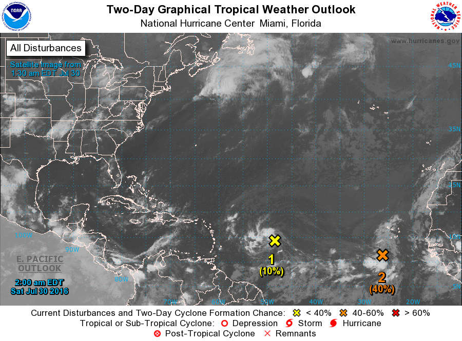
The tropical Atlantic is still quiet with just the two areas of concern. The first one was located near 50W and the second one was near 25W. Both are showing primarily westerly tracks, but the chances for further development appear more likely for the second system. The spaghetti plots on both areas suggest some potential for the disturbed areas to reach the Caribbean, but that is still days away.
The latest GFS model run at 06Z has become much more bullish on the strength of the upper ridge. The ridge starts out over the Southwest US, but as the upper troughiness along the Mississippi River weakens and moves east, the upper ridge pushes eastward eventually stretching from coast to coast by midweek. The ridge maintains a position over the Lower Mississippi River Valley from Wednesday through next Saturday. This means that our weather should remain hot and humid with daily chances for showers and thunderstorms. There will probably be some daily variations in thunderstorm chances, but those are likely to be driven by small scale features that are close to impossible to predict more than a few hours in advance. Temperatures for Central Alabama will remain in the lower and middle 90s for highs while our morning lows will be in the 70s. The latter half of the week ahead may see heat indices approach the 105-degree mark, so a heat advisory may be required later next week.
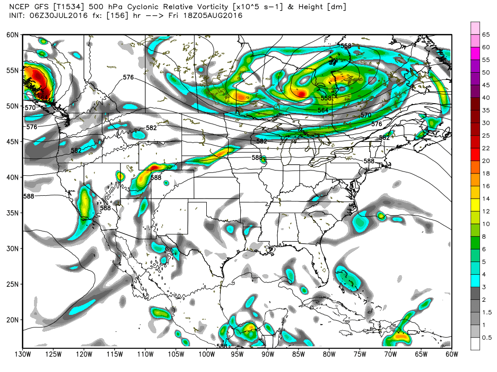
The bullishness of the GFS on the upper ridge carries over into voodoo country. In fact, all of Week 2 is dominated by the upper ridge centered primarily over the Central US. Interesting to note that the closed upper low the GFS had yesterday is only a memory today.
I expect to post the next Weather Xtreme Video here around 7 am or so on Sunday. Check the blog often for updates on the Alabama weather picture. Enjoy your day, and Godspeed.
-Brian-
Category: Uncategorized
About the Author (Author Profile)
Brian Peters is one of the television meteorologists at ABC3340 in Birmingham and a retired NWS Warning Coordination Meteorologist. He handles the weekend Weather Xtreme Videos and forecast discussion and is the Webmaster for the popular WeatherBrains podcast.Subscribe
If you enjoyed this article, subscribe to receive more just like it.


