

Storms Pushing Through Jefferson County, Soon Into St. Clair County
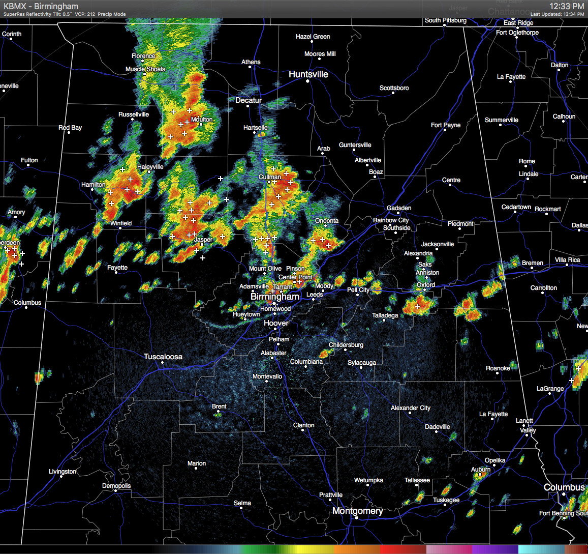
Strong thunderstorms are continuing to push through Jefferson County, with the strongest ones lined up from near Clay to Birmingham to Ensley. These storms were still moving eastward at 25 MPH. The NWS has issued a Significant Weather Advisory for Northeastern Jefferson and Southwestern St. Clair Counties until 1:15 PM for the threat of pea-size hail, wind gusts in excess of 40 MPH, and dangerous cloud-to-ground lightning. If you are in the path of these storms, please stay indoors until it they pass. Communities in the path of these storms are listed below:
BIRMINGHAM…VESTAVIA HILLS…HOMEWOOD…MOUNTAIN BROOK…TRUSSVILLE…
GARDENDALE…IRONDALE…LEEDS…MOODY…FAIRFIELD…FULTONDALE…
SPRINGVILLE…ODENVILLE…CENTER POINT… PLEASANT GROVE…CLAY…
PINSON…TARRANT…MARGARET AND ARGO.
There are more storms building back to the west of these, and each contain copious amounts of rainfall along with dangerous cloud-to-ground lightning. All of these are moving to the east. Much of the northern parts of Central Alabama will should receive decent amounts of rain today.
Category: Uncategorized
About the Author (Author Profile)
Scott Martin is an operational meteorologist, professional graphic artist, musician, husband, and father. Not only is Scott a member of the National Weather Association, but he is also the Central Alabama Chapter of the NWA president. Scott is also the co-founder of Racecast Weather, which provides forecasts for many racing series across the USA. He also supplies forecasts for the BassMaster Elite Series events including the BassMaster Classic.Subscribe
If you enjoyed this article, subscribe to receive more just like it.


