

Heads Up Shelby and Talladega Counties for Strong Storms
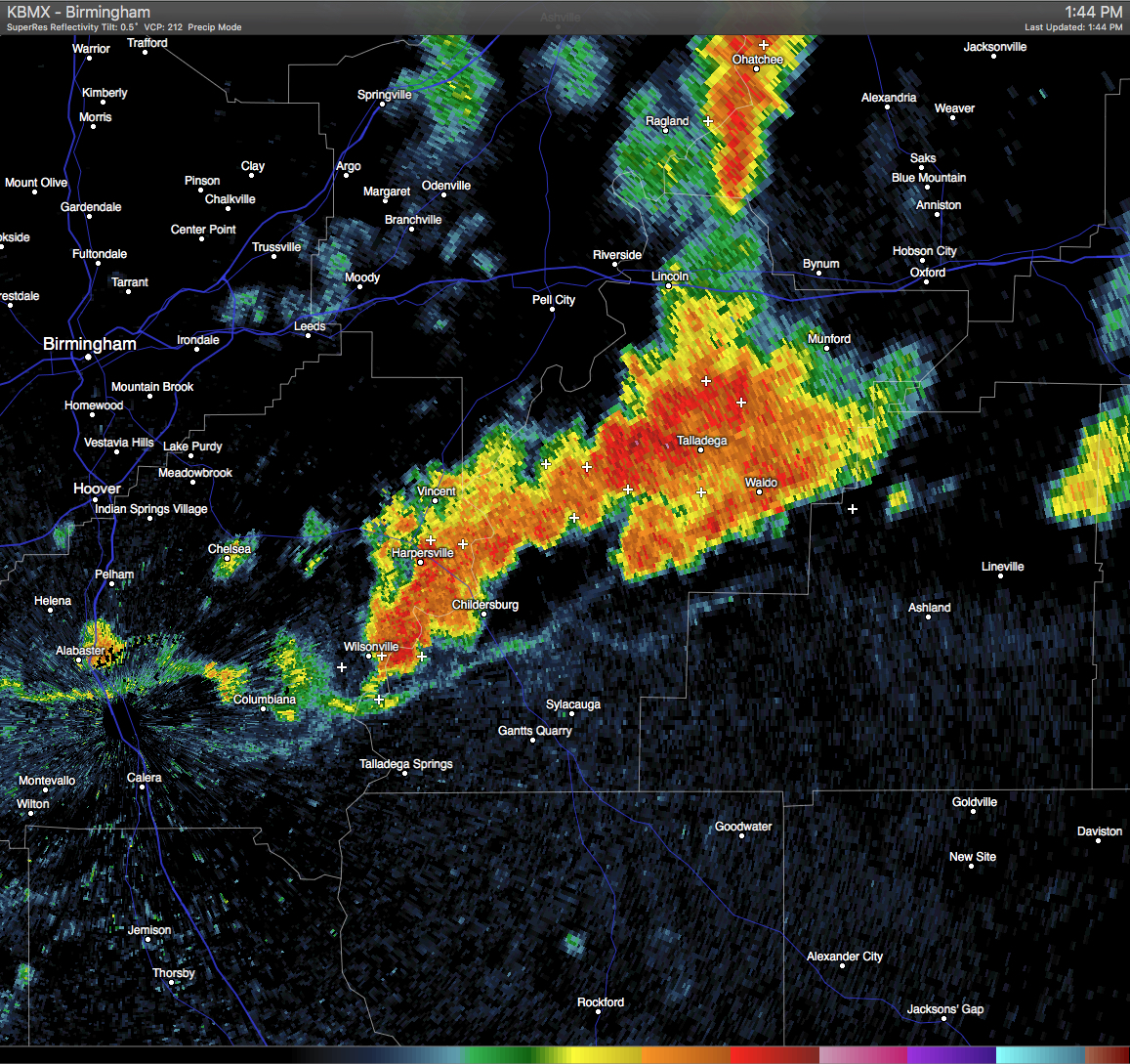
Strong thunderstorms are moving through East-Central Shelby and Southwestern Talladega Counties, with the strongest one located over Wilsonville. These storms are moving southeastward at 20 MPH. The NWS has issued a Significant Weather Advisory for East-Central Shelby and Southwestern Talladega Counties until 2:30 PM for the threat of pea-size hail, wind gusts in excess of 40 MPH, and dangerous cloud-to-ground lightning. If you are in the path of these storms, please stay indoors until it they pass. Communities in the path of these storms are listed below:
SYLACAUGA…CHILDERSBURG…WILSONVILLE…HARPERSVILLE…FAYETTEVILLE…
WINTERBORO…LAY LAKE…GASTON STEAM PLANT…CEDAR CREEK…ALABAMA 4H CENTER…
MIGNON…BEESWAX CREEK PARK…GANTTS QUARRY…SYLACAUGA MUNICIPAL AIRPORT
AND VARNONS.
Category: Uncategorized
About the Author (Author Profile)
Scott Martin is an operational meteorologist, professional graphic artist, musician, husband, and father. Not only is Scott a member of the National Weather Association, but he is also the Central Alabama Chapter of the NWA president. Scott is also the co-founder of Racecast Weather, which provides forecasts for many racing series across the USA. He also supplies forecasts for the BassMaster Elite Series events including the BassMaster Classic.Subscribe
If you enjoyed this article, subscribe to receive more just like it.


