

Heads Up Clay County for Strong Thunderstorms
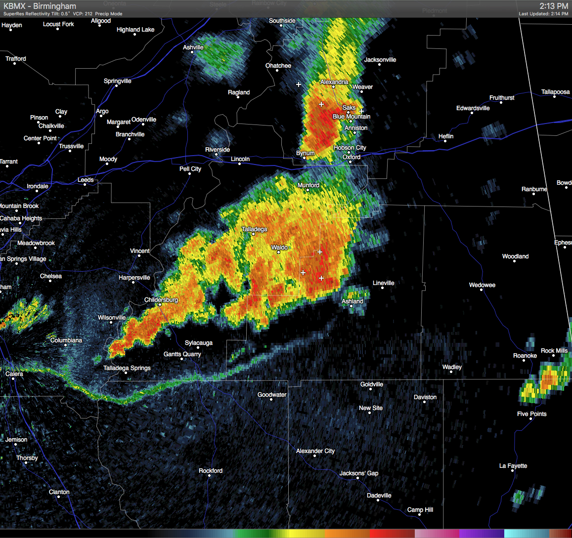
Strong thunderstorms are moving through Clay County, with the strongest one located in a line stretching from near Mount Cheaha to just south of Waldo. These storms are moving southeastward at 10 MPH. The NWS has issued a Significant Weather Advisory for Clay County until 3:00 PM for the threat of wind gusts in excess of 40 MPH and dangerous cloud-to-ground lightning. If you are in the path of these storms, please stay indoors until it they pass. Communities in the path of these storms are listed below:
LINEVILLE…ASHLAND…BARFIELD…ROSELLE…GUNTHERTOWN…CRAGFORD…
MELLOW VALLEY…LAKE CHINNABEE…MILLERVILLE AND MOTLEY.
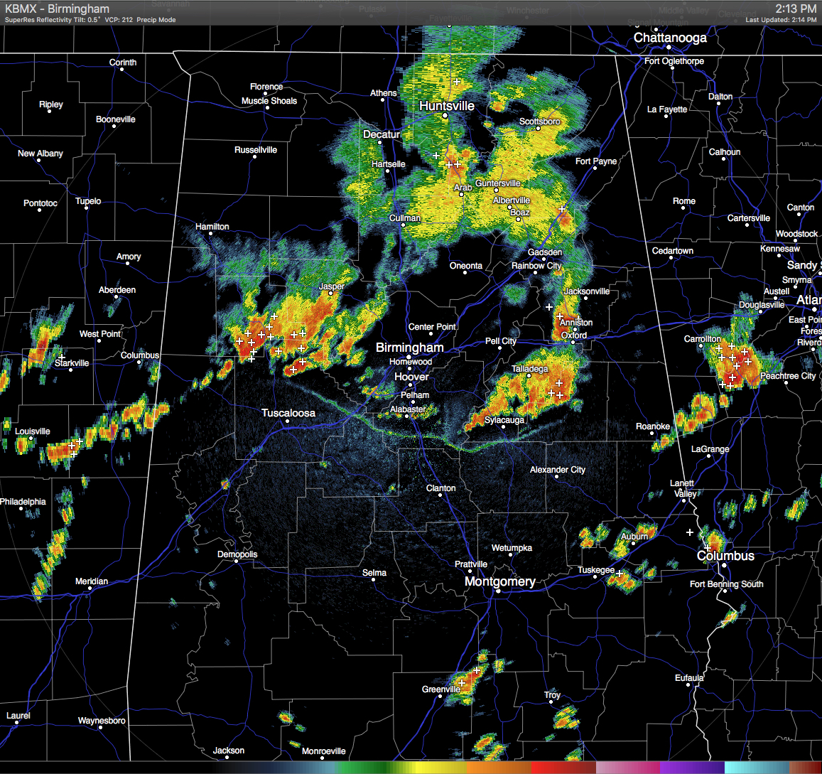
Another cluster of strong storms are making their way through Fayette, Walker, Tuscaloosa, and Jefferson Counties. Lots of cloud-to-ground lightning and heavy rainfall are associated with these storms. General movement is to the east, but development is spreading to the south behind an outflow boundary from these storms.
Category: Uncategorized
About the Author (Author Profile)
Scott Martin is an operational meteorologist, professional graphic artist, musician, husband, and father. Not only is Scott a member of the National Weather Association, but he is also the Central Alabama Chapter of the NWA president. Scott is also the co-founder of Racecast Weather, which provides forecasts for many racing series across the USA. He also supplies forecasts for the BassMaster Elite Series events including the BassMaster Classic.Subscribe
If you enjoyed this article, subscribe to receive more just like it.


