

More Heat and Humidity
Hazy, hot, and humid weather for another day. Temperatures are well into the 90s along and west of Interstate 65, while a few areas in East Alabama are holding on to upper 80s early this afternoon.
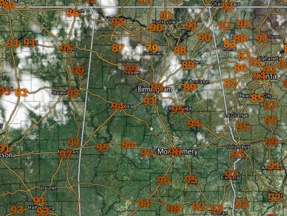
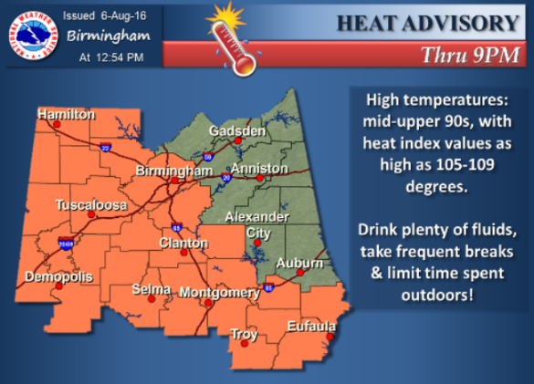
Nevertheless it is rather muggy out there and heat index values are at or over 100° and some locations are in the heat advisory criteria of 105° or greater. That is why we continue to see a heat advisory in effect for much of Central Alabama.
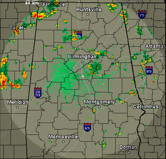
We are beginning to see those daily showers and storms develop across the state this afternoon. The general motion of the storms today is once again towards the south. The showers/storms, widely spaced are producing very heavy rainfall, lots of lightning, and gusty winds. These should continue through the afternoon and evening hours, and all activity should wind down after sunset and most of the activity by midnight. If you do see rain today, you could also be one of those spots that see fog develop after midnight.
FOR SUNDAY: Better rain chances are ahead for tomorrow as a weak shortwave will move across the Southeast. It will be another hot and humid day, but temperatures should be held down into the lower 90s. Expect more in the way of scattered showers and storms tomorrow.
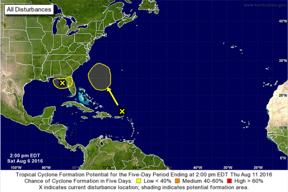
TROPICS HEATING UP: Quickly, Earl is gone and the remnants are fading away over the mountains of Central Mexico. Two areas of unsettled weather the NHC is monitoring for the potential of development the next several days. Feature one is closest to home and is an area of cloudiness and thunderstorms associated with a trough of low pressure is located over the northeastern Gulf of Mexico. Some slight development is possible before the system moves inland over the southeastern United States in a couple of days. Regardless of development, heavy rainfall over northern Florida is anticipated. The NHC gives this feature a 20% of development the next five days. Feature two is a tropical wave producing disorganized cloudiness and Showers just north of Puerto Rico and the adjacent Atlantic. This activity is expected to move northwestward and northward, and an area of low pressure could form in the Atlantic by the middle of next week between Florida and Bermuda. This feature also has been give a 20% of development from the NHC the next five days.
Category: Alabama's Weather
About the Author (Author Profile)
Macon, Georgia Television Chief Meteorologist, Birmingham native, and long time Contributor on AlabamaWX. Stormchaser. I did not choose Weather, it chose Me. College Football Fanatic. @Ryan_StinnetSubscribe
If you enjoyed this article, subscribe to receive more just like it.


