

Strong Storms West of Birmingham
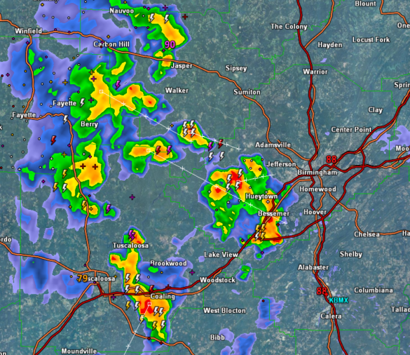
Tracking several clusters of storms across western portions of Jefferson County, as well as Walker, Fayette, and Tuscaloosa counties. Locations such as Bessemer, Hueytown, Oak Grove, Jasper, Berry, Oakman, Peterson, and Coaling are seeing the most intense activity currently. Also, travel along Interstate 20/59 and Interstate 459 is being impacted.
Storms are not severe, but they are producing a lot of lightning and intense rainfall, as well as window shaking thunder. The good thing is that these storms are providing some heat relief, knocking temperatures from the 90s, down into the upper 70s and lower 80s.
These clusters of storms are generally tracking towards the south, and should continue the next few hours. Most of the thunderstorm activity will begin to slowly wind down after sunset, and all rain should dissipate by 10 or 11PM.
Category: Alabama's Weather
About the Author (Author Profile)
Macon, Georgia Television Chief Meteorologist, Birmingham native, and long time Contributor on AlabamaWX. Stormchaser. I did not choose Weather, it chose Me. College Football Fanatic. @Ryan_StinnetSubscribe
If you enjoyed this article, subscribe to receive more just like it.


