

Some Heavy Upslope Rains over E/NE Alabama This Morning
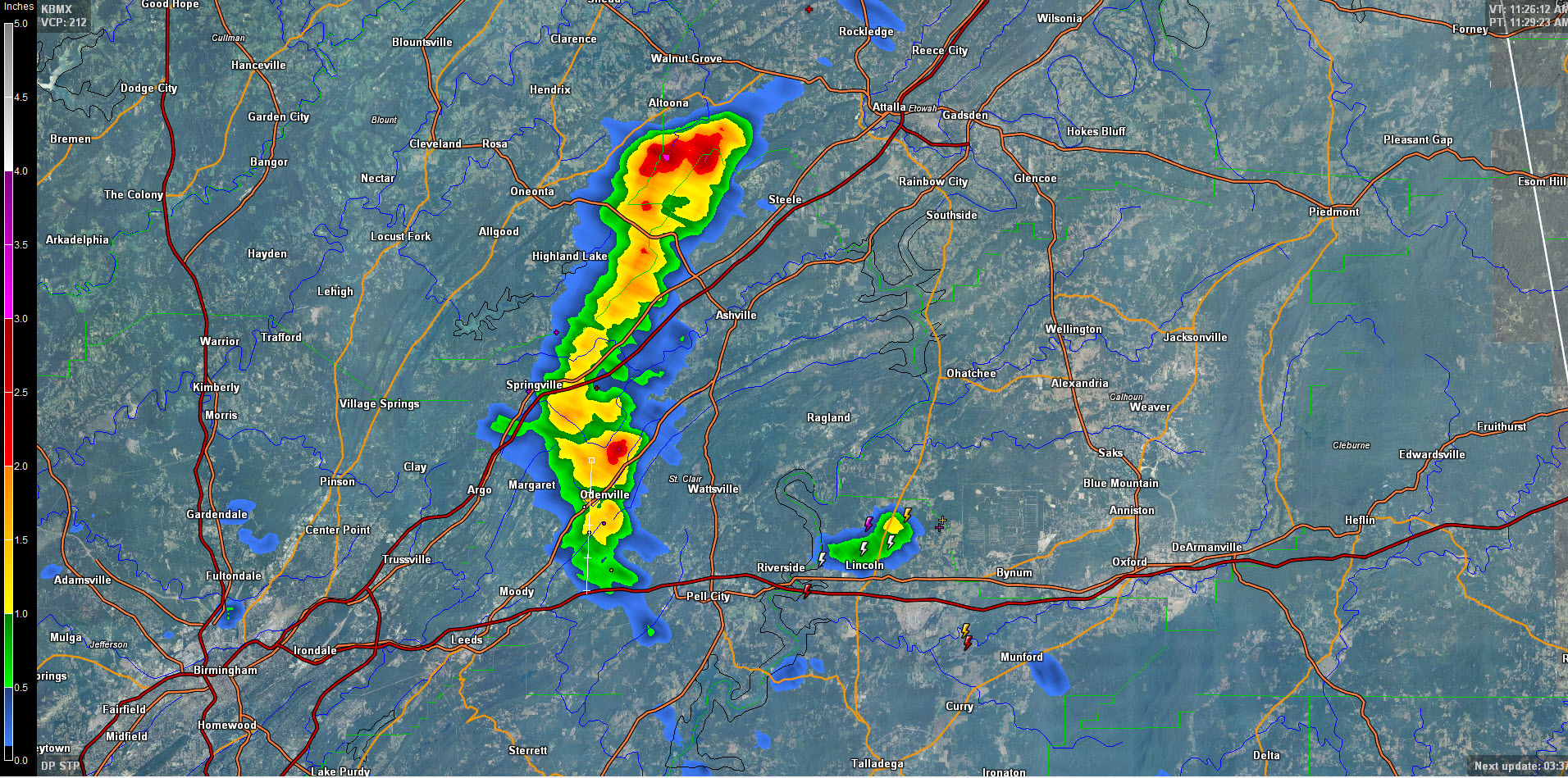
Interesting setup across Alabama this morning as an extremely moist airmass was at least for a time, being lifted up by the mountains and foothills of Northeast and East Alabama, resulting in really heavy rainfall for parts of Etowah, St. Clair and Blount Counties.

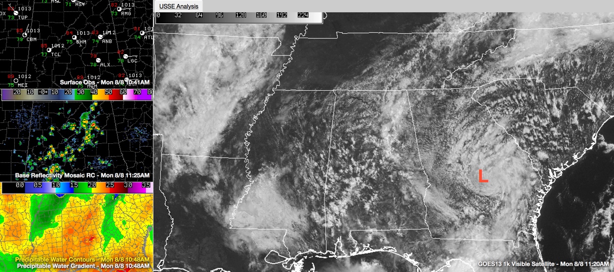
The upslope conditions are being caused by an easterly low level flow around low pressure over South Georgia. The airmass that is being lifted has precipitable water values that are near the climatological maximums for early August. Precipitable water values are approaching 2.4 inches across the I-59 corridor.
Radar estimates indicate that the nearly stationary movement and very efficient rainfall processes produced 2-3 inches of rain along the Blount/Etowah County Line this morning. More heavy rain has fallen north of Odenville along US-411 in St. Clair County.
Convection is beginning to increase all across Central Alabama as well, in the areas which have seen the sun drive temperatures in to the middle 80s.
A strong thunderstorm was developing near Lincoln, with a good bit of lightning in it and echo tops over 40,000 feet.
Everything is drifting generally to the west southwest or southwest in the easterly flow.
Category: Alabama's Weather
About the Author (Author Profile)
Bill Murray is the President of The Weather Factory. He is the site's official weather historian and a weekend forecaster. He also anchors the site's severe weather coverage. Bill Murray is the proud holder of National Weather Association Digital Seal #0001 @wxhistorianSubscribe
If you enjoyed this article, subscribe to receive more just like it.


