

Shower Chances Down a Little
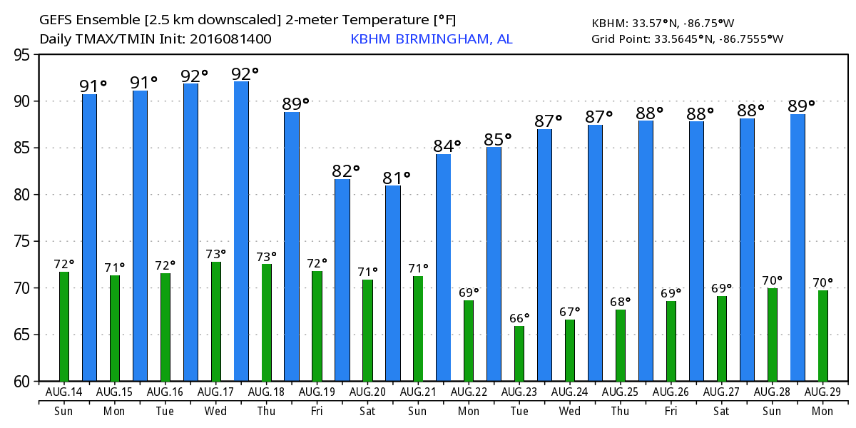
Not quite as much stratus clouds across Alabama this morning with the day starting out in the lower 70s. There was fog once again mainly across the southeast quadrant of Alabama. Like yesterday, the radar was clear this morning. Fortunately that weak upper low that has brought record rainfall and flooding to southern Louisiana has drifted a little further west, so we should be back to a more typical pattern of isolated showers generated in the heat of the afternoon. A front remained to our northwest stretching from East Texas across the Ohio River Valley into northern New York. Highs should be in the 89 to 92 range across Central Alabama, pretty typical for the middle of August.
If you are headed toward the beaches of Alabama and Northwest Florida, the weather continues to improve as a more typical summer pattern with daily chances for showers and thunderstorms is the forecast for the week ahead. Highs along the beach will be in the upper 80s with overnight lows in the upper 70s. The sea water temperature at the Dauphin Island Sea Lab was 83 degrees. See the complete Gulf Coast 7 Day Planner here.
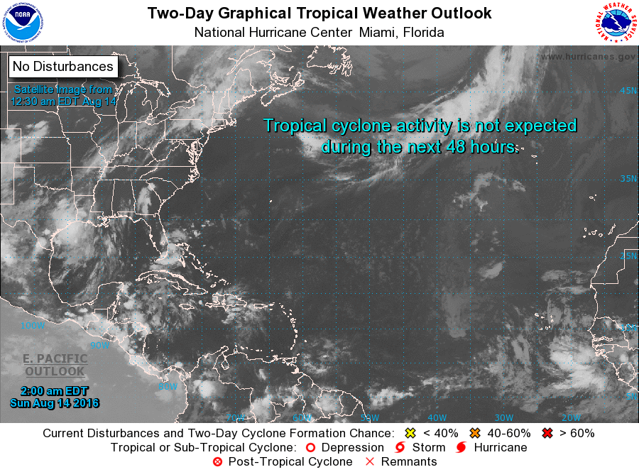
Tropical Atlantic remained quiet this morning. In the eastern Pacific, there are now two areas of disturbed weather, however, neither is likely to develop into a storm for several days.
Even the severe weather outlooks remain fairly tame. There are two marginal risk areas today from northern West Virginia to southern Maine and in western South Dakota. Day 2 has a marginal risk area in the eastern Dakotas. Day 3 sees the action pick up a little with a slight risk area in southern New York and eastern Pennsylvania surrounded by a marginal risk that stretches westward into the Ohio River Valley. There is also a marginal risk area centered on Iowa.
Unfortunately the rain is not over for southern Louisiana and East Texas. That weak upper low that has been responsible for so much rain – some places reporting as much as 26 inches as of yesterday – is going to keep rain falling for East Texas and Southwest Louisiana northward along the front into southern Illinois for the next few days. Amounts will be around 5 inches in Southeast Texas with 6 to 7 inches in an area from southern Arkansas to southern Illinois. These are also the areas where flash flood watches can be found.
Slightly drier air over Alabama today through Tuesday should help to keep any showers that develop pretty isolated. Temperatures will rise into the range of 89 to 92 each day through Tuesday.
Our attention will be on the front to our northwest that will sag ever so slowly into our area by Wednesday and Thursday. This should increase rain chances once again. That together with more clouds as moisture levels rise should keep our highs in the upper 80s.
Another front may make its way into the Southeast by next weekend as the upper flow becomes more northwesterly with the development of a long wave trough over the eastern half of the country. It still looks promising for us to see that first front with a real air mass change around the 22nd which is just edging into voodoo country. Again the presence of more clouds and more numerous showers should keep highs in the 80s, maybe a day or two in the lower 80s (partially wishful thinking).
Unfortunately that air mass change may not last long. The GFS is suggesting slight ridging around the 25th of August with substantial ridging just to our west around the 29th. This certainly means that the summer heat may not be over just yet, but that first front of some significance gives us additional incentive to get through the heat of late August and early September.
James Spann will be back with the next edition of the Weather Xtreme Video first thing Monday morning. I’m excited to be emceeing the introduction of the newest Belles for the Helena Belles this evening. This is a tremendous service organization and I’m so honored to have a small role in their activities. I hope that you enjoy your day. Godspeed.
-Brian-
Category: Alabama's Weather
About the Author (Author Profile)
Brian Peters is one of the television meteorologists at ABC3340 in Birmingham and a retired NWS Warning Coordination Meteorologist. He handles the weekend Weather Xtreme Videos and forecast discussion and is the Webmaster for the popular WeatherBrains podcast.Subscribe
If you enjoyed this article, subscribe to receive more just like it.


