

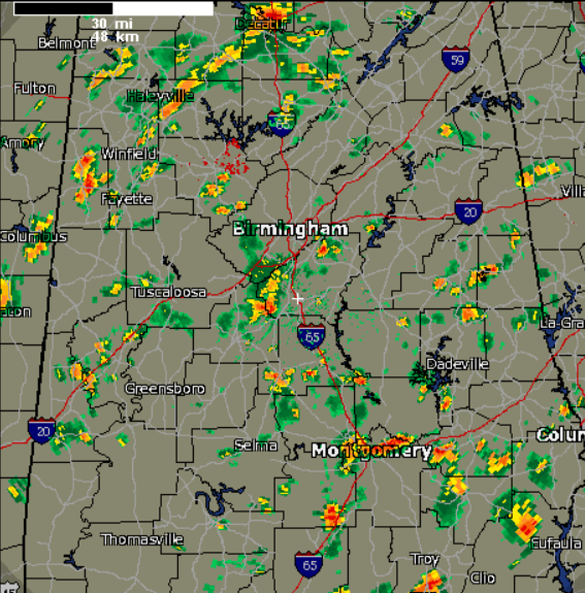
Active Afternoon Radar
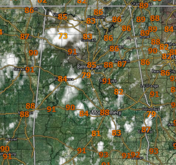
A very tropical air mass remains in place across Alabama this weekend. Temperatures are in the upper 80s and lower 90s for much of the area. We are seeing a mix of sun and clouds, with numerous showers and a few storms covering the radar map this afternoon.
Much of this activity is moving towards the east-northeast a fairly quick clip and these showers/storms are producing brief heavy downpours, some gusty winds, and lightning. This activity will continue through the afternoon, evening, and should slowly dissipate during the overnight hours.
MORE STORMS SUNDAY: The weather will once again be unsettled across the state tomorrow. Sunday will be a day very similar to today as scattered to numerous showers and storms are expected, with more clouds than suns, as we wait on the front approaching from the north. Highs tomorrow will likely be in the upper 80s tomorrow, with some lower 90s across southern communities.
Category: Alabama's Weather
About the Author (Author Profile)
Macon, Georgia Television Chief Meteorologist, Birmingham native, and long time Contributor on AlabamaWX. Stormchaser. I did not choose Weather, it chose Me. College Football Fanatic. @Ryan_StinnetSubscribe
If you enjoyed this article, subscribe to receive more just like it.


