

Watching The Tropics Closely
RADAR CHECK: We have a few widely scattered showers and storms on radar this afternoon… moving slowly to the south…
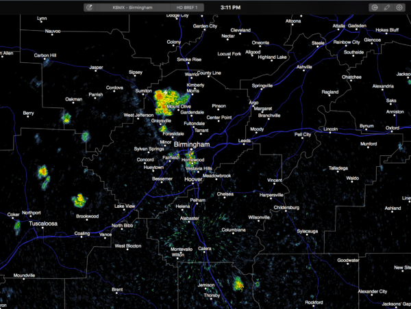
Away from the showers, the sky is partly sunny with temperatures pretty close to 90 degrees. Showers will fade once the sun goes down.
TOMORROW THROUGH THE WEEKEND: The upper ridge across the Deep South won’t change much. Accordingly, the weather won’t change much. Partly sunny, hot, humid days with widely scattered showers and thunderstorms during the afternoon and evening hours. Highs mostly in the low 90s.
And, more than likely, this kind of weather holds through much of next week, and maybe even into the Labor Day weekend. Very classic late summer weather for Alabama.
EYES ON THE TROPICS: Tropical Storm Gaston is expected to become a hurricane tonight in the Central Atlantic; it will recurve over open water and is no threat to land. We continue to focus on an open tropical wave near Puerto Rico, known as “Invest 99L”.
*A hurricane hunter went into the system this morning and found tropical storm force winds, but no low level circulation, so the system remains an open wave for now.
*Until a low level center develops (IF it develops), computer model output will continue to be inconsistent, simple because they don’t know where or how to initialize the system.
*We actually have good model agreement at the moment, the latest runs of the GFS (the American global model) and the ECMWF (the European model) suggest the wave might develop into a weak tropical storm, moving up toward South Florida, then turning northward along the Atlantic coast of Florida without becoming a hurricane. Main impact in this scenario would be heavy rain for parts of the Florida Peninsula.
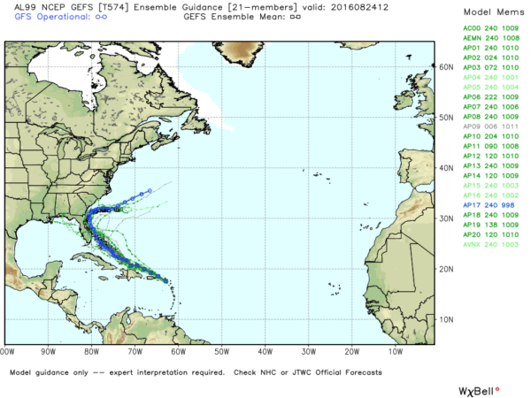
*But again, we stress this is very early in the game, and model output will probably change again. It is simply too early to know the track and intensity of 99L, if it develops at all.
*If 99L becomes a tropical storm, the name will be “Hermine” (her-MEEN).
AT THE BEACH: For now, the weather looks very nice on the Gulf Coast from Gulf Shores over to Panama City Beach, with about 8 to 10 hours of sunshine daily through the weekend, with the risk of widely scattered showers and thunderstorms. Highs in the upper 80s on the immediate coast, with low to mid 90s inland. The weather next week will all depend on the tropical situation, and as stated above it is simply too early to know what will happen.
WEATHER BRAINS: Don’t forget you can listen to our weekly 90 minute netcast anytime on the web, or on iTunes. This is the show all about weather featuring many familiar voices, including our meteorologists here at ABC 33/40.
CONNECT: You can find me on all of the major social networks…
Facebook
Twitter
Google Plus
Instagram
Look for the next Weather Xtreme video here by 7:00 a.m. tomorrow…
Category: Alabama's Weather
About the Author (Author Profile)
James Spann is one of the most recognized and trusted television meteorologists in the industry. He holds the AMS CCM designation and television seals from the AMS and NWA. He is a past winner of the Broadcast Meteorologist of the Year from both professional organizations.Subscribe
If you enjoyed this article, subscribe to receive more just like it.


