

Hot/Muggy Weekend Ahead; Eyes On The Tropics
NO HEAT RELIEF: An upper ridge across the Deep South isn’t going anywhere anytime soon, meaning our weather won’t change much through at least early next week. For today and the weekend, expect partly sunny, hot, humid days with widely scattered, mostly afternoon and evening showers and thunderstorms. Afternoon highs will be in the low to mid 90s, generally in the 91-95 degree range.
We note that next Thursday (September 1) marks the beginning of meteorological fall, but don’t expect any magical cool down. The autumnal equinox comes on September 22, and your odds of an airmass change become much higher by then. Keep in mind the hottest temperature on record in Alabama (112 degrees, recorded at Centerville) came on September 5, 1925.
HIGH SCHOOL FOOTBALL WEATHER: A few widely scattered showers and storms will be in progress across Alabama this evening; chance of any one high school stadium seeing rain around kickoff is about one in five. Most of the showers will end by 8:00 p.m… temperatures will be in the low 80s at kickoff, dropping into the upper 70s by the final whistle. Humidity values will remain sky high tonight.
TROPICS: Tropical Storm Gaston, in the Central Atlantic, is expected to reach hurricane strength again today, but it will recurve into the open Atlantic east of Bermuda, and is no threat to land.
NHC has also identified a weak disturbance over the Gulf of Mexico, well south of Louisiana, but that is not expected to develop.
Great weeping and gnashing of teeth continues over “Invest 99L”, which is really hard to define this morning over the Southeast Bahamas due to strong winds aloft, which continue to shear the system. NOAA P3 (hurricane hunter aircraft) is currently in the vicinity measuring atmospheric conditions.
*Model data is not especially helpful right now since there is no way the system can be initialized with no low level center or structure. Each batch of runs will continue to do the hokey pokey.
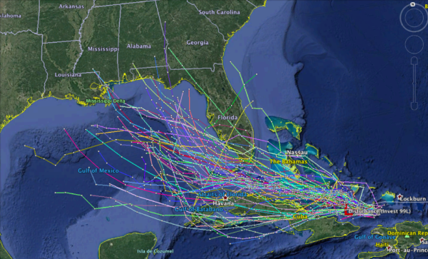
*Concerning global models, the Euro (ECMWF) brings a very weak system across the Florida Peninsula, and then out into the Atlantic well east of Alabama. The GFS brings a weak system up toward the Central Gulf Coast toward the middle of next week, and the Canadian (GEM) brings a slightly stronger system toward Panama City Beach early next week. All three can’t be trusted for the same reason mentioned above at this time.
*There is a very real chance that 99L never develops into a depression or storm. And, if it does, few models show much beyond a weak tropical storm. Rain would be the main issue is land is impacted.
All we can do at this time is just keep watching to see if anything can survive the sheared environment it is in now.
GULF COAST WEATHER: Despite all this tropical weather talk, the weather looks great on the coast from Gulf Shores to Panama City Beach through the weekend, with mostly sunny days, fair nights, and only widely scattered showers or storms. Highs will be in the upper 80s on the immediate coast, with low to mid 90s inland. The weather next week will depend on what happens with 99L, and if there is any impact (and that remains a big “IF”), it should be over by the Labor Day weekend. See a very detailed Gulf Coast forecast here.
WEATHER BRAINS: Don’t forget you can listen to our weekly 90 minute netcast anytime on the web, or on iTunes. This is the show all about weather featuring many familiar voices, including our meteorologists here at ABC 33/40.
CONNECT: You can find me on all of the major social networks…
Facebook
Twitter
Google Plus
Instagram
Look for the next Weather Xtreme video here by 4:00 this afternoon… enjoy the day!
Category: Alabama's Weather
About the Author (Author Profile)
James Spann is one of the most recognized and trusted television meteorologists in the industry. He holds the AMS CCM designation and television seals from the AMS and NWA. He is a past winner of the Broadcast Meteorologist of the Year from both professional organizations.Subscribe
If you enjoyed this article, subscribe to receive more just like it.


