

Midday Nowcast: Hot & Humid With Some Strong Storms Out There
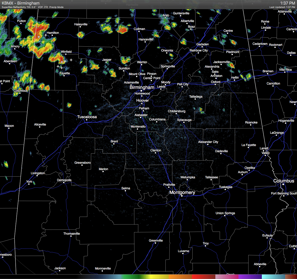
At this hour, scattered showers and thunderstorms are active across the northern half of Central Alabama, with a few of these prompting Significant Weather Advisories on them from the NWS. One has been issued for a storm located near Detroit in Northwestern Marion County, with the main threats being from winds in excess of 40 MPH, frequent cloud-to-ground lightning, and torrential rainfall which could lead to localized flooding. Advisory expires at 2PM. Another advisory has been issued for a cell near Bluff and Winfield in Northwestern Fayette County until 2:15PM with the same threats. All of the rain is moving slowly to the east-northeast.
TEMPERATURES AT THIS HOUR: Here is a list of temperature observations from across the area at this hour:
Birmingham 91
Tuscaloosa 93
Gadsden 91
Anniston 91
Cullman 89
Jasper 95
Alexander City 94
Selma 91
Montgomery 92
CODE YELLOW AIR QUALITY: The Air Quality Index for the Birmingham Metropolitan Area is in the “Code Yellow” for ozone and particulate matter 2.5. Unusually sensitive people should consider limiting prolonged outdoor exertion.
TODAY’S CLIMATOLOGY FOR BIRMINGHAM: The normal high for August 26th is 89, while the normal low is 68. The record high for today was set back in 1943 at 103. The record low was set back in 1966 at 55.
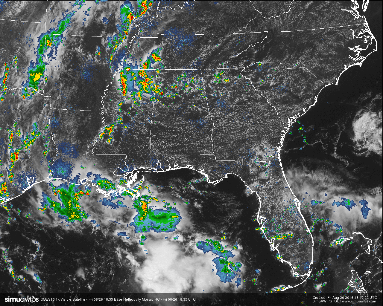
REMAINDER OF TODAY: Another hot and humid day expected for Central Alabama this afternoon, with a small risk for widely scattered showers and thunderstorms. Latest HRRR is showing the better rain chances north of the I-20 corridor. Afternoon highs will be in the low to mid 90s. The odds of any one spot getting rain today will be around one in four.
WEEKEND WEATHER: Much of the same news for the weekend, as it looks like the typical summertime weather pattern will be in place for a while. It will be hot and humid, with partly clear skies, and a small risk for widely scattered afternoon showers and thunderstorms. Afternoon highs will mostly be in the low to mid 90s. The odds of any one spot getting rain will be around one in four.
HEADED TO THE BEACH: The weather looks great on the coast from Gulf Shores to Panama City Beach through the weekend, with mostly sunny days, fair nights, and only widely scattered showers or storms. Highs will be in the upper 80s on the immediate coast, with low to mid 90s inland. The weather next week will depend on what happens with 99L, and if there is any impact (and that remains a big “IF”), it should be over by the Labor Day weekend. See a very detailed Gulf Coast forecast here.
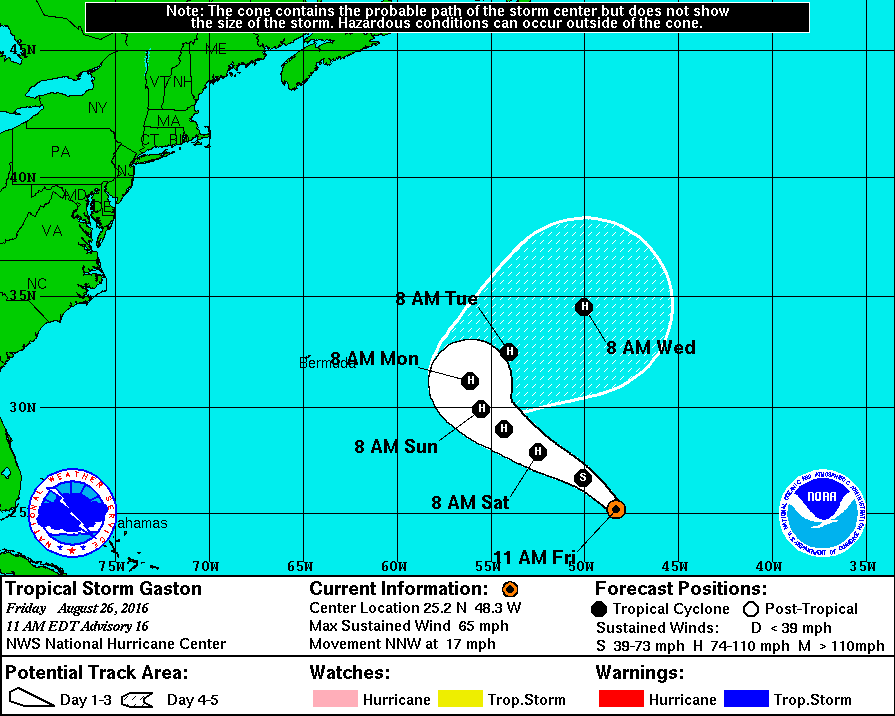
TROPICAL STORM GASTON: This storm is beginning its turn back out to open water, as it is headed to the north-northwest at 17 MPH. Maximum sustained winds at this time are at 65 MPH. Gaston is still expected to become a hurricane again at some point today, but will be no threat to land and recurve well east of Bermuda and back out into the open water.
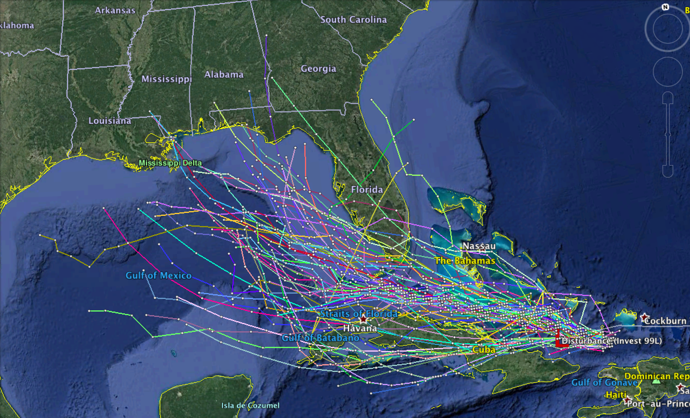
INVEST 99L: Strong winds aloft are continuing to wreak havoc on this wave as shear is keeping any development from happening. Model data is not especially helpful right now since there is no way the system can be initialized with no low level center or structure. Each batch of runs will continue to do the hokey pokey.
Concerning global models, the Euro (ECMWF) brings a very weak system across the Florida Peninsula, and then out into the Atlantic well east of Alabama. The GFS brings a weak system up toward the Central Gulf Coast toward the middle of next week, and the Canadian (GEM) brings a slightly stronger system toward Panama City Beach early next week. All three can’t be trusted for the same reason mentioned above at this time. There is a very real chance that 99L never develops into a depression or storm. And, if it does, few models show much beyond a weak tropical storm. Rain would be the main issue is land is impacted. All we can do at this time is just keep watching to see if anything can survive the sheared environment it is in now.
ON THIS DAY IN 1989: Anchorage, AK, was soaked with a steady rain, and the 24 hour total of 4.12 inches smashed their previous 24 hour precipitation total of 2.10 inches. It also pushed their rainfall total for the month past their previous record for August.
THE BLOG IS ON TWITTER: Be sure to follow the Alabama Wx Weather Blog on Twitter. Just click here to start following our feed.
WEATHERBRAINS: This is the show all about weather featuring many familiar voices, including our meteorologists at ABC 33/40. You can listen anytime on the web, or on iTunes. You can find it here.
ADVERTISE WITH US: Deliver your message to a highly engaged audience by advertising on the AlabamaWX.com website. The site enjoyed 10.2 MILLION pageviews in the past 12 months. Don’t miss out! We can customize a creative, flexible and affordable package that will suit your organization’s needs. Contact Bill Murray at (205) 687-0782.
Category: Alabama's Weather, Severe Weather
About the Author (Author Profile)
Scott Martin is an operational meteorologist, professional graphic artist, musician, husband, and father. Not only is Scott a member of the National Weather Association, but he is also the Central Alabama Chapter of the NWA president. Scott is also the co-founder of Racecast Weather, which provides forecasts for many racing series across the USA. He also supplies forecasts for the BassMaster Elite Series events including the BassMaster Classic.Subscribe
If you enjoyed this article, subscribe to receive more just like it.


