

Midday Nowcast: Hot & Humid, and Still No Sign of Hermine or Ian
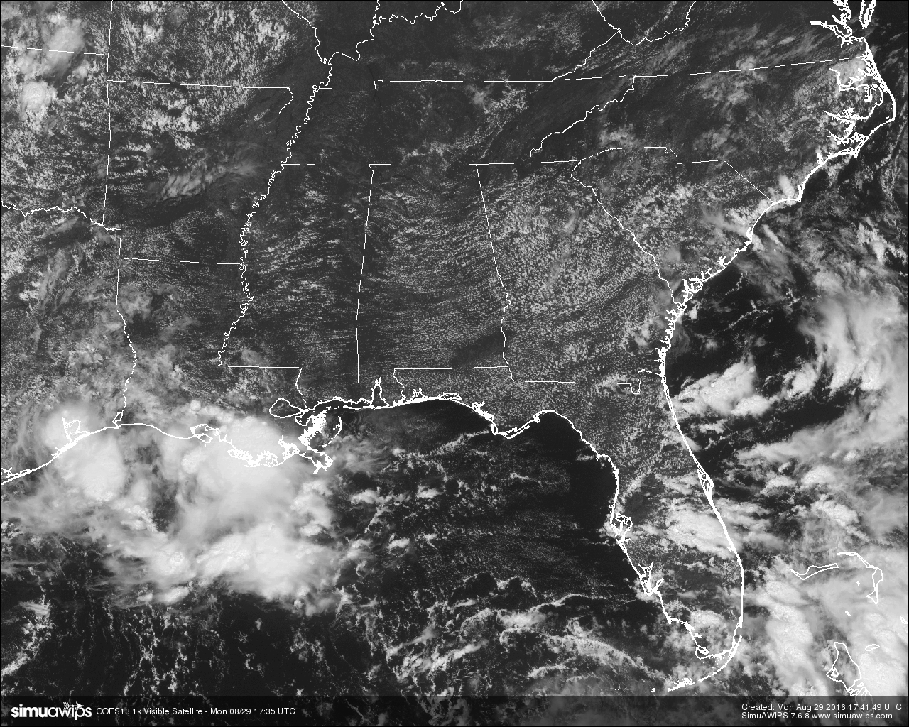
Hot and humid conditions out there at this hour for Central Alabama, with partly to mostly clear skies and no rain on the radar at this moment. Of course the eyes are on Tropical Depression Nine to see if it is going to develop into a storm, and where exactly it is going to go.
TEMPERATURES AT THIS HOUR: Here is a list of temperature observations from across the area at this hour:
Birmingham 91
Tuscaloosa 91
Gadsden 90
Anniston 93
Cullman 87
Jasper 93
Alexander City 90
Selma 91
Montgomery 91
CODE YELLOW AIR QUALITY: The Air Quality Index for the Birmingham Metropolitan Area is in the “Code Yellow” for ozone and particulate matter 2.5. Unusually sensitive people should consider limiting prolonged outdoor exertion.
TODAY’S CLIMATOLOGY FOR BIRMINGHAM: The normal high for August 29th is 89, while the normal low is 68. The record high for today was set back in 1990 at 101. The record low was set back in 1952 at 56.
REMAINDER OF TODAY: Much of the same news as our weather will continue under the influence of the upper ridge across the Southeast. It will be hot and humid, with partly to mostly clear skies, and with a very slight chance of widely scattered afternoon and evening showers and thunderstorms. Afternoon highs will mostly be in the low to mid 90s. The odds of any one spot getting rain is about one in eight.
TUESDAY’S WEATHER: Same forecast on a different day… hot and humid, with partly to mostly clear skies, and with a very slight chance of widely scattered afternoon and evening showers and thunderstorms. Afternoon highs will mostly be in the low to mid 90s. The odds of any one spot getting rain is about one in eight.
HEADED TO THE BEACH: Generally speaking, the weather looks fine on the Central Gulf Coast (Gulf Shores east to Panama City Beach) this weekend, and over the holiday weekend with 7 to 9 hours of sunshine daily and only widely scattered showers. The exception will be at Panama City Beach Thursday as TD 9 passes just to the south… periods of rain are likely on that one day. And, also keep in mind there will be potential for rip tides along the coast this week, especially tomorrow, Wednesday, and Thursday. But, the surf will settle down for the weekend. Highs on the immediate coast will be in the upper 80s, with low 90s inland. See a very detailed Gulf Coast forecast here.
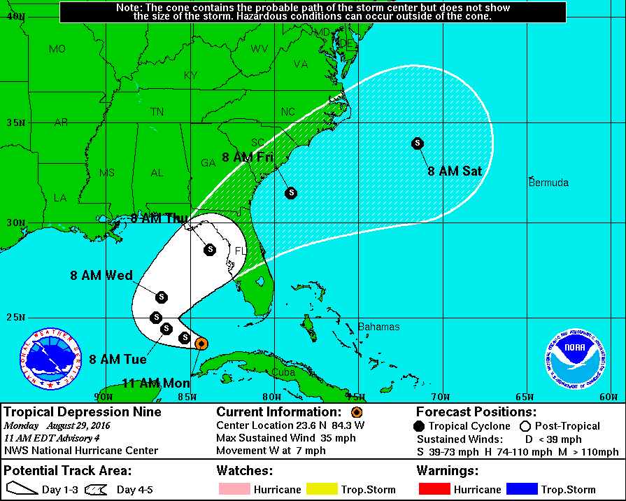
TROPICAL DEPRESSION NINE: Aircraft investigated the cyclone this morning and could not find any winds of tropical storm force, so it is still a depression. Another flight through the cyclone is scheduled this afternoon which would give a better estimate of the strength of the system. The NHC track has the center turning northeast over the Gulf of Mexico, cutting across North Florida Thursday. Not too important to focus on the center since this will, most likely, still be pretty disorganized. It will have no direct impact on Alabama, although it will help to pull down drier air late this week. The main issue with the system is rain for the Florida Peninsula (not the panhandle), and dangerous surf/rip tides. Most of the rain over the Florida Peninsula will fall today through Thursday. The rain won’t be continuous, however, and the sun will be out at times.
REST OF THE TROPICS: There are two other systems on the board; Hurricane Gaston is in the Central Atlantic, and is recurving well east of Bermuda, and is no threat to land. Tropical Depression Eight is struggling this morning with hardly any convection; it has potential to become a weak tropical storm, and should recurve into the Atlantic just off the Outer Banks of North Carolina.
ON THIS DAY IN 2005: Hurricane Katrina made landfall in Plaquemines Parish in southeastern Louisiana early on the day with maximum sustained winds near 125 mph, a strong category-three, and the third most-intense landfalling hurricane in U.S. history. The center of the hurricane passed just east of New Orleans, where winds gusted over 100 mph. Widespread devastation and unprecedented flooding occurred, submerging at least 80 percent of the city as levees failed. Farther east, powerful winds and a devastating storm surge of 20-30 feet raked the Mississippi coastline, including Gulfport and Biloxi, where Gulf of Mexico floodwaters spread several miles inland. Rainfall amounts of 8-10 inches were common along and to the east of the storm’s path.
THE BLOG IS ON TWITTER: Be sure to follow the Alabama Wx Weather Blog on Twitter. Just click here to start following our feed.
WEATHERBRAINS: This is the show all about weather featuring many familiar voices, including our meteorologists at ABC 33/40. You can listen anytime on the web, or on iTunes. You can find it here.
ADVERTISE WITH US: Deliver your message to a highly engaged audience by advertising on the AlabamaWX.com website. The site enjoyed 10.2 MILLION pageviews in the past 12 months. Don’t miss out! We can customize a creative, flexible and affordable package that will suit your organization’s needs. Contact Bill Murray at (205) 687-0782.
Category: Alabama's Weather
About the Author (Author Profile)
Scott Martin is an operational meteorologist, professional graphic artist, musician, husband, and father. Not only is Scott a member of the National Weather Association, but he is also the Central Alabama Chapter of the NWA president. Scott is also the co-founder of Racecast Weather, which provides forecasts for many racing series across the USA. He also supplies forecasts for the BassMaster Elite Series events including the BassMaster Classic.Subscribe
If you enjoyed this article, subscribe to receive more just like it.


