

Midday Nowcast: A Few Showers Out There; No Change in TD9 Yet
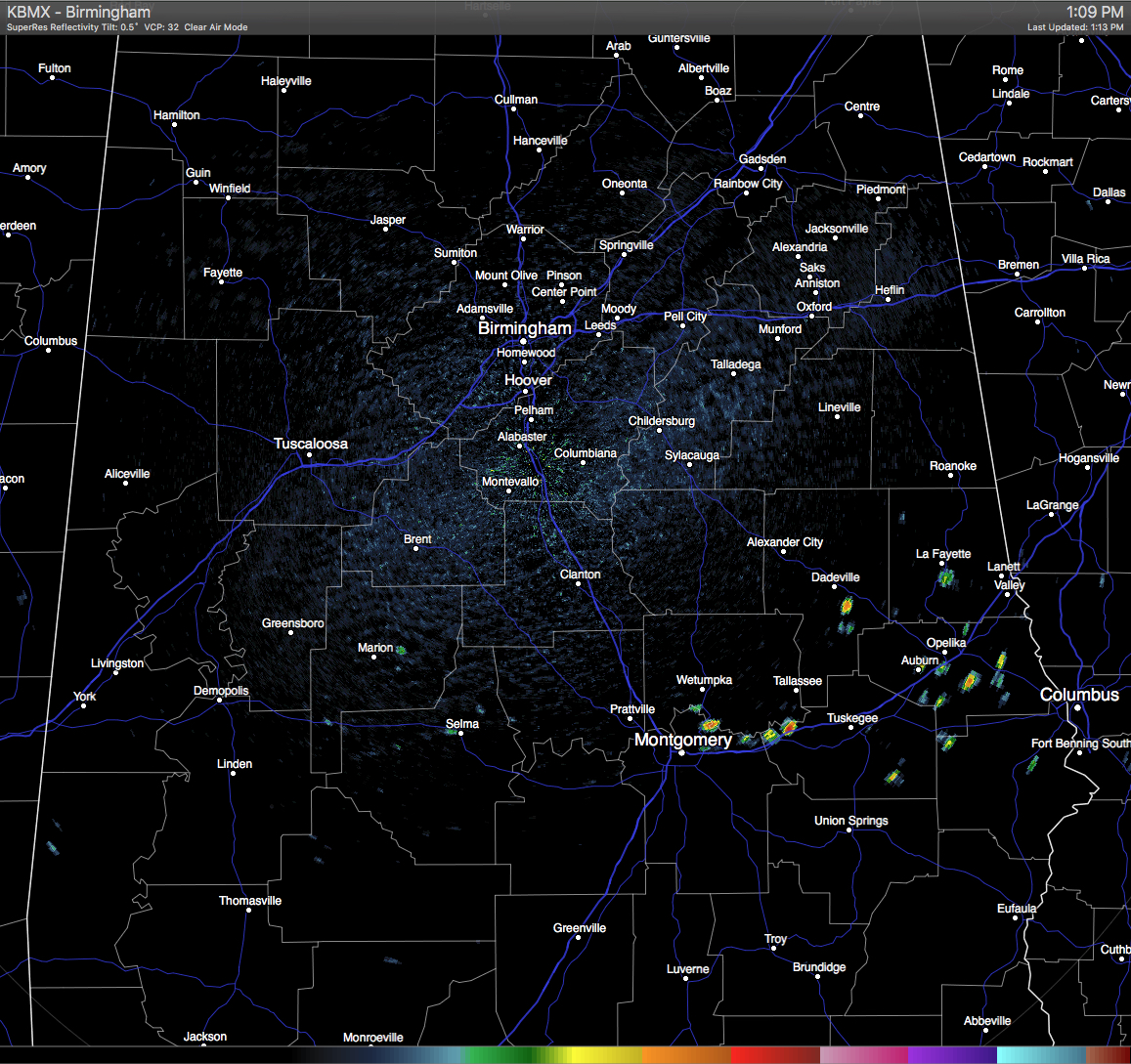
Hot and humid conditions out there at this hour for Central Alabama, with partly to mostly clear skies and only a few scattered showers down in the southeastern part of the area on the radar at this moment, especially from the Montgomery area along I-85 to the Georgia state line.. Of course the eyes are on Tropical Depression Nine to see if it is ever going to get its act together, and where exactly it is going to go.
TEMPERATURES AT THIS HOUR: Here is a list of temperature observations from across the area at this hour:
Birmingham 91
Tuscaloosa 91
Gadsden 91
Anniston 91
Cullman 88
Jasper 95
Alexander City 90
Selma 90
Montgomery 91
CODE YELLOW AIR QUALITY: The Air Quality Index for the Birmingham Metropolitan Area is in the “Code Yellow” for particulate matter 2.5. Unusually sensitive people should consider limiting prolonged outdoor exertion.
TODAY’S CLIMATOLOGY FOR BIRMINGHAM: The normal high for August 30th is 89, while the normal low is 67. The record high for today was set back in 1995 at 100. The record low was set back in 1992 at 54.
REMAINDER OF TODAY: Hot and humid for the remainder of the afternoon, with partly to mostly clear skies, and with a very slight chance of widely scattered afternoon and evening showers and thunderstorms. Afternoon highs will mostly be in the low to mid 90s. The odds of any one spot getting rain is about one in eight.
WEDNESDAY’S WEATHER: Same forecast on a different day… hot and humid, with partly to mostly clear skies, and with a very slight chance of widely scattered afternoon and evening showers and thunderstorms. Afternoon highs will mostly be in the low to mid 90s. The odds of any one spot getting rain is about one in eight.
HEADED TO THE BEACH: The weather generally looks great for the Central Gulf Coast through the Labor Day weekend, with mostly sunny days, fair nights, and only widely scattered showers. The exception is Thursday with that risk of rain for Panama City Beach due to the tropical system. However, rip tides are likely tomorrow and Thursday… the surf will settle down by the Labor Day weekend as TD 9 moves into the Atlantic and away from the region. Highs on the immediate coast will be in the upper 80s, with low to mid 90s inland. See a very detailed Gulf Coast forecast here.
TROPICAL DEPRESSION NINE: Deep convection once again increased in association with TD9 this morning, and satellite images show that very heavy rains continue over portions of western Cuba, where significant flooding is likely occurring. However, the overall organization of the system has not changed much since last night. There is little change to the forecast track, and some strengthening to tropical storm strength is expected before making landfall on the northern peninsula of Florida. Another Hurricane Hunter flight is scheduled this afternoon, so we’ll see what that report says.
REST OF THE TROPICS: There are two other systems on the board; Hurricane Gaston is packing estimated winds of 105 mph, Gaston is moving eastward, away from the U.S. It will be close to the Azores this weekend as a “post tropical” North Atlantic storm. Tropical Depression Eight is a disorganized system is just east of the Outer Banks of North Carolina; it will turn northeast out to sea today. Still some chance it becomes a tropical storm.
ON THIS DAY IN 1988: Thunderstorms drenched Georgia and the Carolinas with heavy rain, soaking Columbia, SC, with 4.10 inches in three hours. Fresno CA was the hot spot in the nation with a record high of 109 degrees. Duluth MN tied their record for the month of August with a morning low of 39 degrees.
THE BLOG IS ON TWITTER: Be sure to follow the Alabama Wx Weather Blog on Twitter. Just click here to start following our feed.
WEATHERBRAINS: This is the show all about weather featuring many familiar voices, including our meteorologists at ABC 33/40. You can listen anytime on the web, or on iTunes. You can find it here.
ADVERTISE WITH US: Deliver your message to a highly engaged audience by advertising on the AlabamaWX.com website. The site enjoyed 10.2 MILLION pageviews in the past 12 months. Don’t miss out! We can customize a creative, flexible and affordable package that will suit your organization’s needs. Contact Bill Murray at (205) 687-0782.
Category: Alabama's Weather
About the Author (Author Profile)
Scott Martin is an operational meteorologist, professional graphic artist, musician, husband, and father. Not only is Scott a member of the National Weather Association, but he is also the Central Alabama Chapter of the NWA president. Scott is also the co-founder of Racecast Weather, which provides forecasts for many racing series across the USA. He also supplies forecasts for the BassMaster Elite Series events including the BassMaster Classic.Subscribe
If you enjoyed this article, subscribe to receive more just like it.


