

Storms Developing Along Front
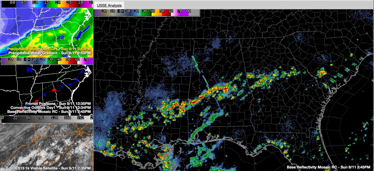
Showers and thunderstorms are firing this afternoon along a stationary front just south of I-20.
They extend along a relatively narrow line from Butler to Linden to south of Marion and Maplesville to Rockford to south of Ashland.
The line is moving little and the individual cells are pushing east northeast along it. These cells are training along the same lime. This will result in some heavy rain.
The storms shouldn’t become severe, but lots of lightning has developed quite quickly, so be in a safe place. When thunder roars, go indoors. There will be some gusty winds.
Clouds are breaking up across the area, which has allowed temperatures to rise to near 90F and is helping to fuel the thunderstorms.
Hot weather will be the word through much of the coming week, with only isolated showers and storms each afternoon and evening, driven by the heating. Showers and storms should increase by the end of the week.
Category: Alabama's Weather
About the Author (Author Profile)
Bill Murray is the President of The Weather Factory. He is the site's official weather historian and a weekend forecaster. He also anchors the site's severe weather coverage. Bill Murray is the proud holder of National Weather Association Digital Seal #0001 @wxhistorianSubscribe
If you enjoyed this article, subscribe to receive more just like it.


