

Storms Are Firing Ahead of the Cold Front
This afternoon, we are still standing on the platform waiting for a delayed train, which is coming in the form of a slow moving cold front. That front is analyzed to be along a line from Little Rock to Shreveport this afternoon.
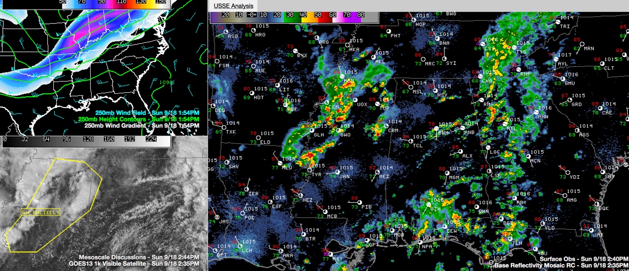
Two distinct regions of precipitation are affecting Alabama.
1. Showers are firing over Central Alabama in the vicinity of the I-59 corridor.
2. Storms are firing over Mississippi that will move into Alabama later.
The showers over Central Alabama now are not very significant. They will produce some brief heavy rain and some lightning as they continue to spread eastward.
The storms over Mississippi will be stronger. There are several reasons:
1. There is drier air aloft in a pre-frontal trough that is now into western Alabama. This is allowing some clearing over West Alabama and Mississippi. This is allowing for some destabilization of the atmosphere.
2. There is an upper level jet max extending from southern Missouri into southern Illinois, Indiana and Ohio. Alabama and Mississippi are in the right rear quadrant of this jetmax. This positioning allows for additional lift.
3. There is an upper level disturbance crossing the Mississippi River. It is weakening, but it has additional lift with it.
4. Finally, there is the front.
The lift from the front, the increasingly unstable air, the lift from the upper level jet and the lift from the upper level disturbance is allowing storms to fire over northern Mississippi.
There is sufficient shear to keep the storms organized as well.
These storms will move into Alabama over the next few hours. They will produce heavy rain, lots of lightning and gusty winds.
The Storm Prediction Center did issue a mesoscale discussion, which is a heads up as to whether a watch will be issued. They said the chance was only 20%. Can’t rule out a few warnings however.
The storms should weaken slowly after sunset, but could continue into the overnight hours before dying.
Category: Alabama's Weather
About the Author (Author Profile)
Bill Murray is the President of The Weather Factory. He is the site's official weather historian and a weekend forecaster. He also anchors the site's severe weather coverage. Bill Murray is the proud holder of National Weather Association Digital Seal #0001 @wxhistorianSubscribe
If you enjoyed this article, subscribe to receive more just like it.


