

Midday Nowcast: Fall is Here, But Summer Doesn’t Want to Leave
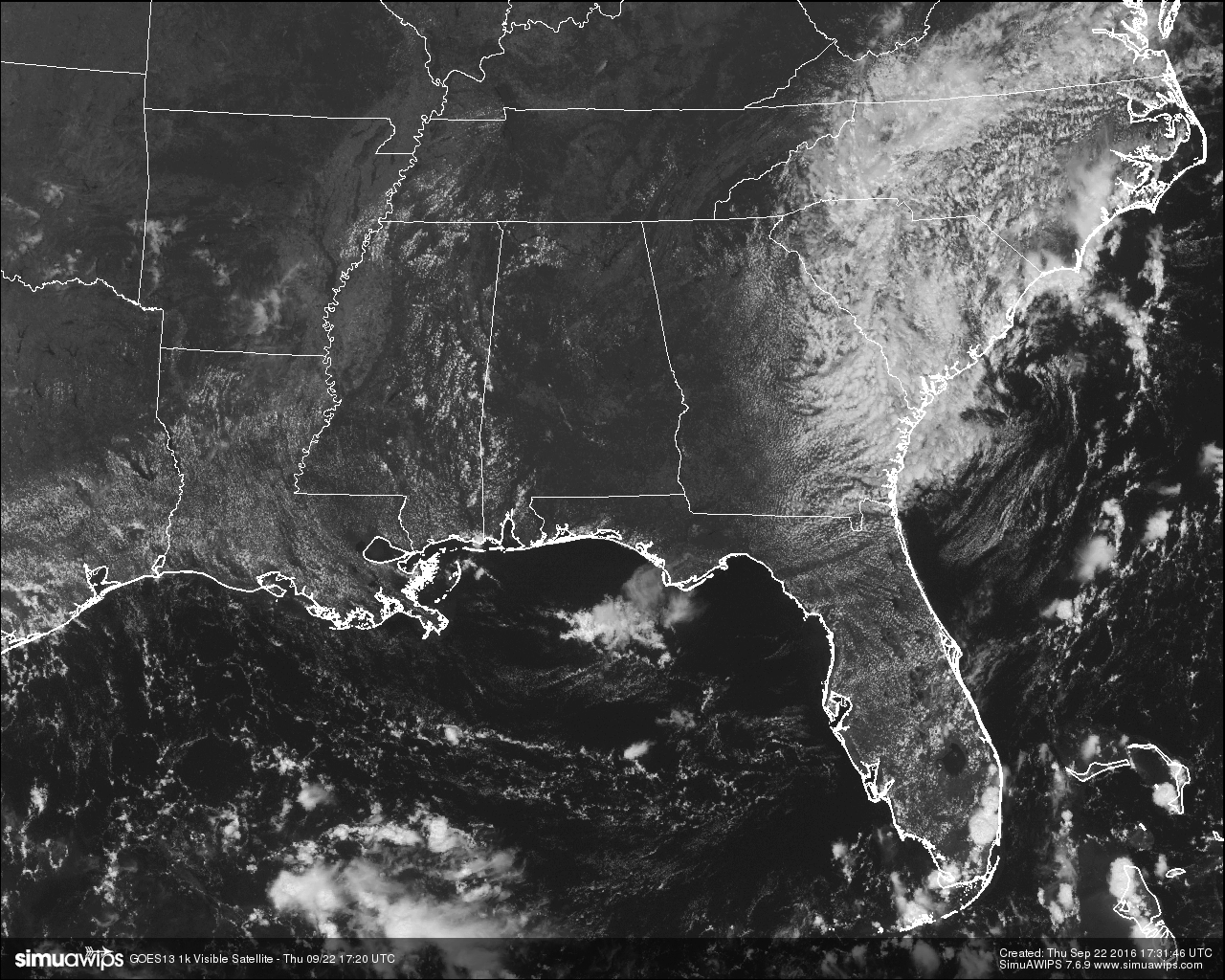
As of 9:21 AM CDT, we have officially crossed over into Astronomical Fall, but it sure doesn’t feel like it outside. As you will see below, temperature readings have already made it up into the upper 80 across Central Alabama at the noon hour, and with almost completely clear skies across the area, they will continue to climb to the low to mid 90s without any interruption. And just like the past few days, radar is completely free of any precipitation and will stay that way through Sunday.
TEMPERATURES ACROSS CENTRAL ALABAMA AT NOON:
Birmingham 88
Tuscaloosa 89
Gadsden 86
Anniston 88
Cullman 87
Alexander City 90
Auburn 87
Selma 88
Montgomery 88
CARBON COPY FORECAST FOR TOMORROW:
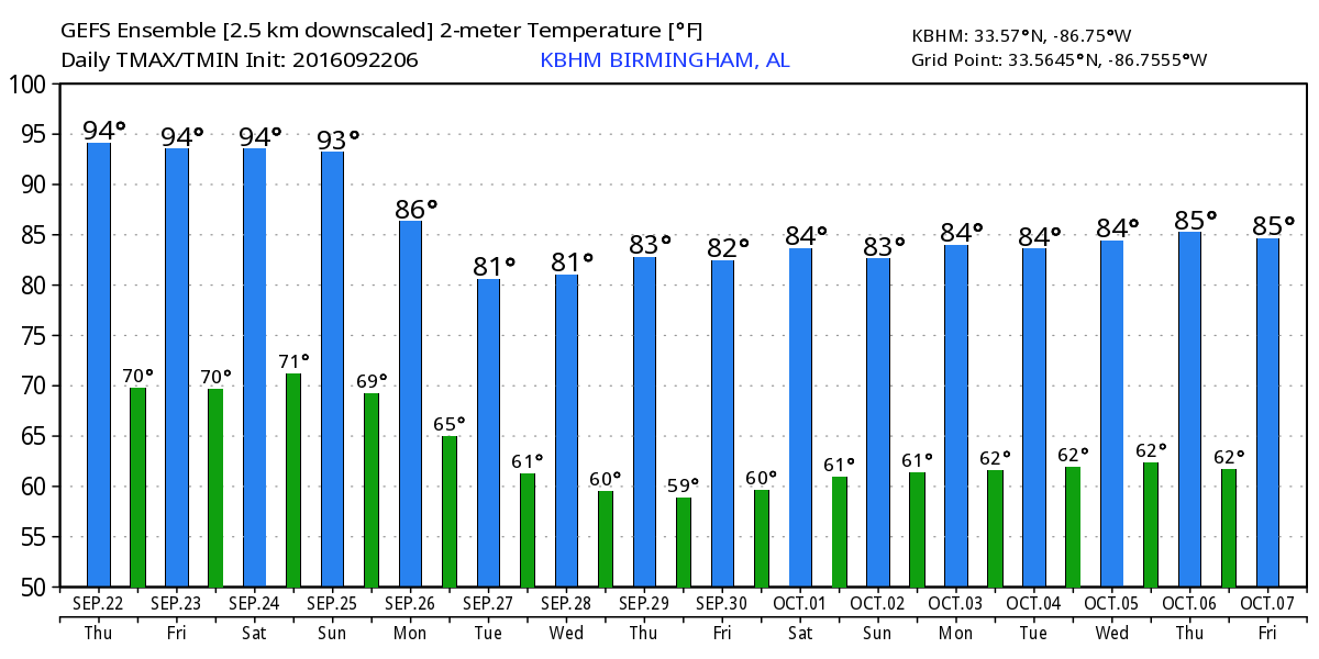
Not much change in the weather with the upper ridge in control of our pattern. Mostly sunny and hot, with afternoon highs in the low to mid 90s across Central Alabama. Any showers or storms that develop will be confined to South Alabama, well out of our area. Highs will be approximately 10 degrees above our normal high for this part of the year, but with lower dewpoint levels, the heat will not be unbearable.
NEXT WEEK:
The upper ridge is weakened by an approaching trough, and a cold front will creep closer to Alabama early in the week. This will mean an increase in clouds, a chance of showers, and lower daytime temperatures. Unfortunately, the latest GFS/ECMWF (global model) runs suggest the front won’t be able to push through Alabama, but with it stalling just west and north of here, it looks like there will be some change of badly needed showers each day through the week. And, because of the clouds and showers highs will drop into the low to mid 80s, which is pretty close to average for late September in Alabama (the average high here doesn’t fall into the 70s until early October).
NORMS AND RECS FOR TODAY IN BIRMINGHAM:
The normal high for September 22nd is 83, while the normal low is 61. The record high for today was set back in 1925 at 100. The record low was set back in 1983 at 39.
CODE YELLOW AIR QUALITY ALERT:
Ozone and Particulate Matter 2.5 level will be high enough to raise the “Code Yellow” Air Quality Alert for the Birmingham metropolitan area today. Unusually sensitive people should consider limiting prolonged outdoor exertion.
HEADED TO THE BEACH:
About 8 to 10 hours of sunshine daily on the coast from Gulf Shores to Panama City Beach through the weekend with only widely scattered storms. Highs in the upper 80s on the immediate coast, with low 90s inland. See a very detailed Gulf Coast forecast here.
TROPICS:
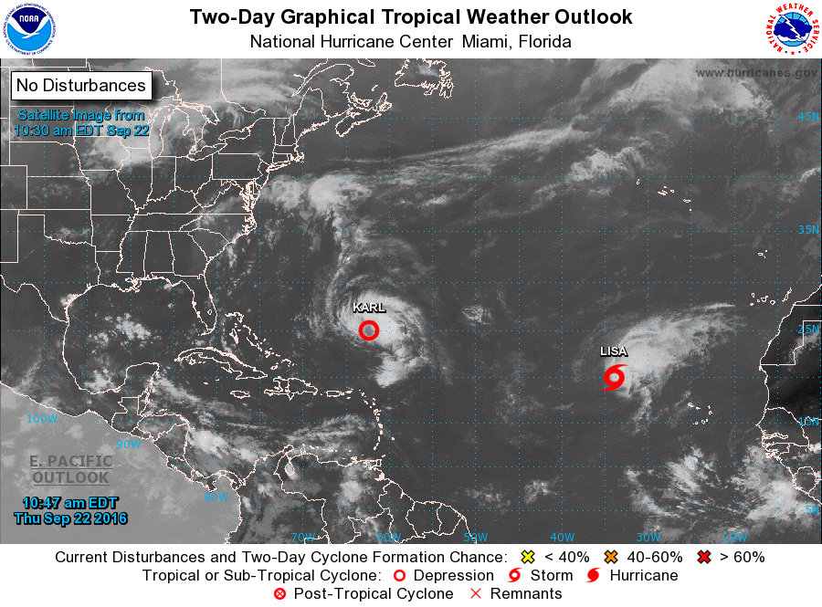
Tropical Depression Karl and Tropical Storm Lisa will recurve over the open Atlantic and are no threat to land; the rest of the Atlantic basin is quiet.
ON THIS DAY IN 1989:
Hurricane Hugo roared ashore just north of Charleston, as a massive Category 4 storm with winds near 140 mph and a storm tide around 20 feet. The hurricane leveled beachfront properties and toppled trees, leaving much of the coastal areas in absolute ruin. Hugo remained strong as it moved into western North Carolina, producing hurricane-force wind gusts all the way to Charlotte. Thirteen people in South Carolina and one person in North Carolina died as a result of the storm (as well as six in Virginia and one in New York). Hurricane Hugo caused $7 billion in damage in the U.S. mainland, making it the costliest hurricane at the time. When adjusted for inflation, it currently ranks as the ninth most costly hurricane in U.S. history, causing almost $13 billion in damage.
THE BLOG IS ON TWITTER:
Be sure to follow the Alabama Wx Weather Blog on Twitter. Just click here to start following our feed.
WEATHERBRAINS:
This is the weekly netcast that’s all about weather featuring many familiar voices, including our meteorologists at ABC 33/40. You can listen anytime on the web, or on iTunes. You can find it here.
ADVERTISE WITH US:
Deliver your message to a highly engaged audience by advertising on the AlabamaWX.com website. The site enjoyed 10.2 MILLION pageviews in the past 12 months. Don’t miss out! We can customize a creative, flexible and affordable package that will suit your organization’s needs. Contact Bill Murray at (205) 687-0782.
Category: Alabama's Weather
About the Author (Author Profile)
Scott Martin is an operational meteorologist, professional graphic artist, musician, husband, and father. Not only is Scott a member of the National Weather Association, but he is also the Central Alabama Chapter of the NWA president. Scott is also the co-founder of Racecast Weather, which provides forecasts for many racing series across the USA. He also supplies forecasts for the BassMaster Elite Series events including the BassMaster Classic.Subscribe
If you enjoyed this article, subscribe to receive more just like it.


