

Midday Nowcast: We Stay Hot Through The Weekend
WE STAY HOT THROUGH THE WEEKEND:
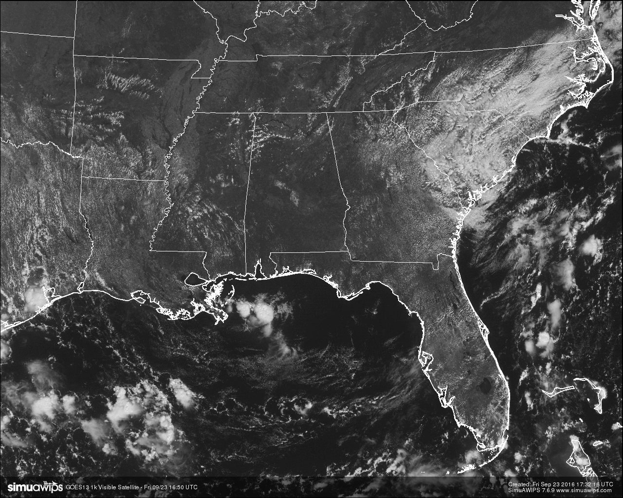
At the noon hour across Central Alabama, skies are clear except for a few cumulus clouds over the northwestern part of the area. That also means that the radar is clear of any precipitation. Unfortunately, that will be the story for the remainder of the day. Skies will remain mostly clear and the chance of an afternoon shower is so small that its not even worth mentioning. Afternoon highs will be in the low to mid 90s, but fortunately the dewpoints will be in the low 60s so the heat will be bearable. Skies will be partly to mostly clear tonight with the overnight lows in the upper 60s to low 70s.
CODE YELLOW AIR QUALITY ALERT:
Ozone and Particulate Matter 2.5 level will be high enough to raise the “Code Yellow” Air Quality Alert for the Birmingham metropolitan area today. Unusually sensitive people should consider limiting prolonged outdoor exertion.
TEMPERATURES ACROSS CENTRAL ALABAMA AT NOON:
Birmingham 90
Tuscaloosa 91
Gadsden 88
Anniston 90
Cullman 89
Alexander City 90
Auburn 90
Selma 90
Montgomery 91
NORMS AND RECS FOR TODAY IN BIRMINGHAM:
The normal high for September 23rd is 83, while the normal low is 61. The record high for today was set back in 1931 at 99. The record low was set back in 1999 at 42.
NO CHANGE FOR THE WEEKEND:
The upper ridge will still be in control of our weather pattern, so that means mostly sunny skies and hot each day, with afternoon highs in the low to mid 90s. The chance for rain on either day is so small that there is really no need in mentioning it in the forecast. Nights will be fair with overnight lows in the upper 60s to low 70s.
HEADED TO THE BEACH:
About 8 to 10 hours of sunshine daily on the coast from Gulf Shores to Panama City Beach through the weekend with only widely scattered storms. Highs in the upper 80s on the immediate coast, with low 90s inland. See a very detailed Gulf Coast forecast here.
NEXT WEEK:
The long awaited pattern change begins. A strong upper ridge, now over the western U.S., will approach, and drive a cold front in our direction. Clouds increase Monday, and showers are possible as the front gets closer. Unfortunately it won’t be a really big, widespread rain like we need, but at least we have a chance of getting a little rain in the bucket. Monday’s high will drop into the mid 80s.
A lingering shower is possible Tuesday, but cooler, drier air will begin to roll into the state, and it looks like we will enjoy some rather refreshing weather Wednesday through Friday with sunny pleasant days, clear cool nights, and low humidity. Highs will be in the 77-80 degree range, with lows down in the 50s. The GFS is suggesting we could see some 40s over the Tennessee Valley of far North Alabama early Wednesday morning.
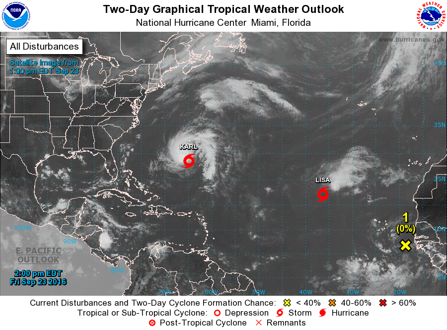
TROPICS:
Tropical Storm Karl will recurve in the Atlantic tonight, passing just east of Bermuda, and will head out to sea in the North Atlantic. And, to the east, Tropical Storm Lisa is expected to dissipate over the weekend far from land. A few wave coming off the coast of Africa has some potential for development in 3-5 days; just something to watch for now.
ON THIS DAY IN 2005:
Hurricane Rita reached the Texas/Louisiana border area near Sabine Pass as a category-3 hurricane with maximum sustained winds near 120 mph. A storm surge of at least 15 feet flooded parts of Cameron, Jefferson Davis, Terrebonne and Vermilion parishes, where sugar cane crop losses were estimated near $300 million. An 8-foot storm surge in New Orleans overtopped the provisionally-repaired levees (from Hurricane Katrina damage) and caused additional flooding. A total of 10 fatalities were reported, and preliminary damage estimates ranged between $4-5 billion.
THE BLOG IS ON TWITTER:
Be sure to follow the Alabama Wx Weather Blog on Twitter. Just click here to start following our feed.
WEATHERBRAINS:
This is the weekly netcast that’s all about weather featuring many familiar voices, including our meteorologists at ABC 33/40. You can listen anytime on the web, or on iTunes. You can find it here.
ADVERTISE WITH US:
Deliver your message to a highly engaged audience by advertising on the AlabamaWX.com website. The site enjoyed 10.2 MILLION pageviews in the past 12 months. Don’t miss out! We can customize a creative, flexible and affordable package that will suit your organization’s needs. Contact Bill Murray at (205) 687-0782.
Category: Alabama's Weather
About the Author (Author Profile)
Scott Martin is an operational meteorologist, professional graphic artist, musician, husband, and father. Not only is Scott a member of the National Weather Association, but he is also the Central Alabama Chapter of the NWA president. Scott is also the co-founder of Racecast Weather, which provides forecasts for many racing series across the USA. He also supplies forecasts for the BassMaster Elite Series events including the BassMaster Classic.Subscribe
If you enjoyed this article, subscribe to receive more just like it.


