

Midday Nowcast: A Cooler Day, But Even Cooler Temperatures Are On Their Way
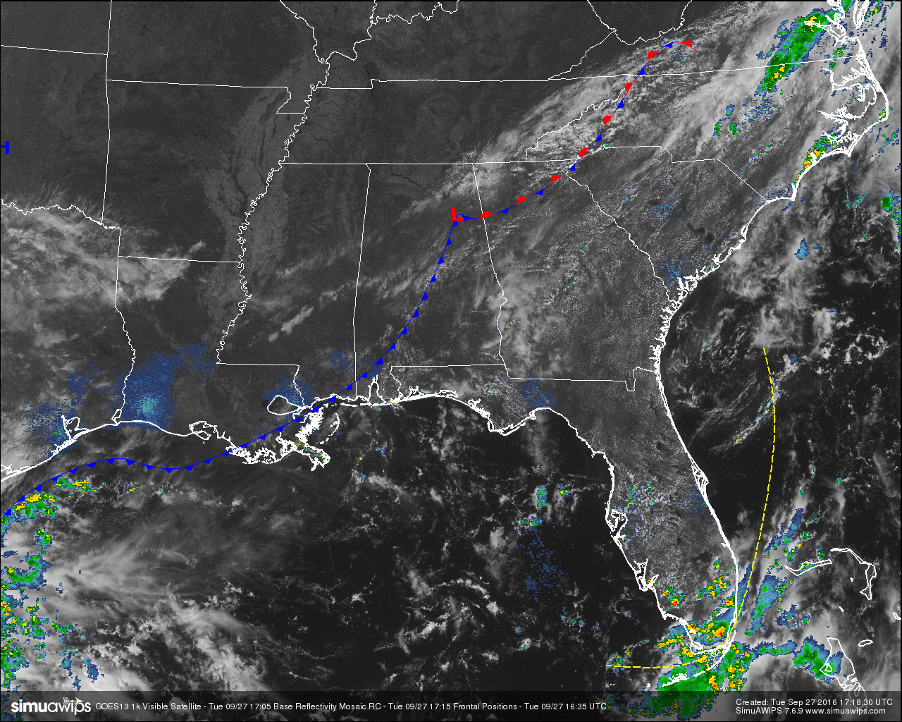
COLD FRONT IS STILL DRAPED ACROSS THE STATE:
Skies are currently mostly clear out there across Central Alabama, but the big difference is that the current temperatures for the most part are five to ten degrees cooler than this same time yesterday. The cold front is currently located from Mobile County up to the northwest to Etowah County, and it becomes an occluded front from there off to the east through the northern parts of Georgia.
The front is expected to move southward later today and tonight, and any rain chances will remain out ahead and along of it. It looks like the best chances for anyone receiving any showers and storms will be in the locations south of I-20 and east of I-65. The odds for any one spot in those areas will be around one in three today. Highs will be in the mid to upper 80s, and any rain development that forms today should be completely diminished by 9PM tonight.
Areas behind the cold front will have partly to mostly clear skies and will stay dry today. Temperatures will still be warm today as the short wave that will be bringing us even cooler and drier air will not arrive until the midday hours on Thursday. Afternoon highs will be in the low to mid 80s.
CODE YELLOW AIR QUALITY ALERT:
Ozone and Particulate Matter 2.5 levels will be below criteria needed to raise an Air Quality Alert for the Birmingham metropolitan area today. No actions will be needed.
TEMPERATURES ACROSS CENTRAL ALABAMA AT THIS HOUR:
Birmingham 77
Tuscaloosa 79
Gadsden 79
Anniston 84
Cullman 77
Alexander City 85
Auburn 82
Selma 84
Montgomery 84
NORMS AND RECS FOR TODAY IN BIRMINGHAM:
The normal high for September 27th is 81, while the normal low is 59. The record high for today was set back in 1998 at 94. The record low was set back in 1889 at 42.
TOMORROW’S FORECAST:
The day will start off nice, cool, and refreshing, with the morning temperatures in the 50s. The skies will be mostly sunny with afternoon highs in the low to mid 80s.
HEADED TO THE BEACH:
Just a few widely scattered storms around today, otherwise mostly sunny days and fair nights through the weekend from Gulf Shores to Panama City Beach. Highs in the 80s See a very detailed Gulf Coast forecast here.
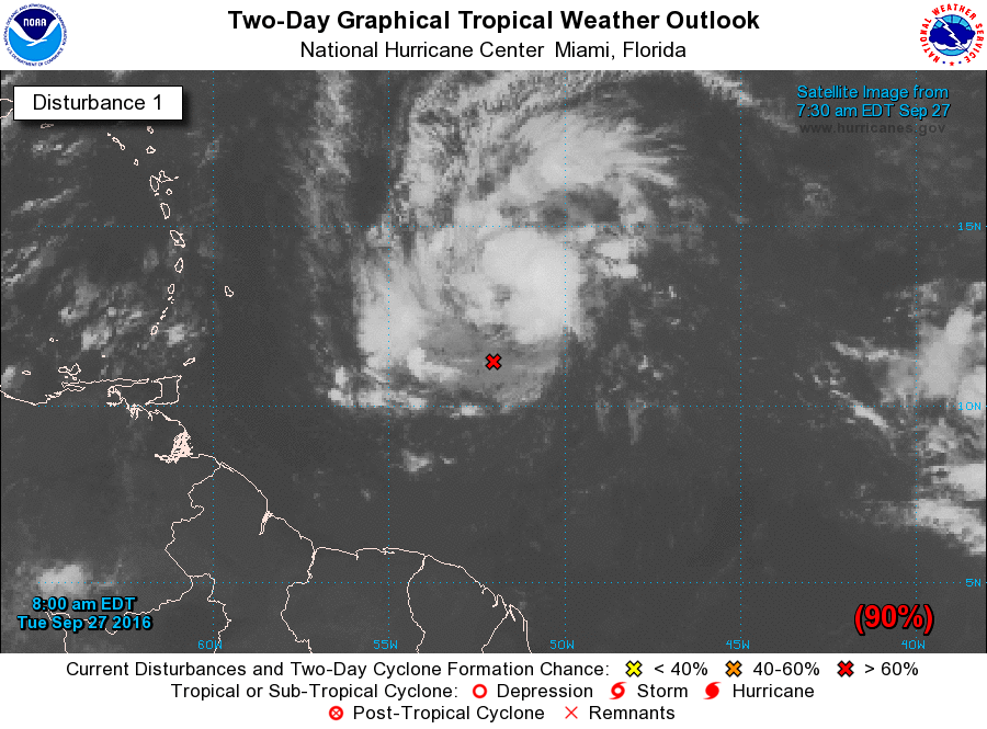
THE TROPICS:
“Invest 97L” is the one to watch; it is in the Atlantic, and will approach the Windward Islands tonight. A high chance this becomes Tropical Storm Matthew in coming days as it moves through the Caribbean. Just about all models suggest “Matthew” will make a hard right turn in the Caribbean, then moving northward through the channel between Cuba and Haiti; if this turn happens it won’t be a Gulf of Mexico problem. It remains to be seen if this will threaten the U.S. East Coast… way too early to anyone to know.
ON THIS DAY IN 1988:
Thunderstorms developing ahead of a cold front produced large hail in southeastern Wyoming during the afternoon, with tennis ball size hail reported at Cheyenne. Strong winds ushering the cold air into the north central U.S. gusted to 59 mph at Lander WY.
THE BLOG IS ON TWITTER:
Be sure to follow the Alabama Wx Weather Blog on Twitter. Just click here to start following our feed.
WEATHERBRAINS:
This is the weekly netcast that’s all about weather featuring many familiar voices, including our meteorologists at ABC 33/40. You can listen anytime on the web, or on iTunes. You can find it here.
ADVERTISE WITH US:
Deliver your message to a highly engaged audience by advertising on the AlabamaWX.com website. The site enjoyed 10.2 MILLION pageviews in the past 12 months. Don’t miss out! We can customize a creative, flexible and affordable package that will suit your organization’s needs. Contact Bill Murray at (205) 687-0782.
Category: Alabama's Weather
About the Author (Author Profile)
Scott Martin is an operational meteorologist, professional graphic artist, musician, husband, and father. Not only is Scott a member of the National Weather Association, but he is also the Central Alabama Chapter of the NWA president. Scott is also the co-founder of Racecast Weather, which provides forecasts for many racing series across the USA. He also supplies forecasts for the BassMaster Elite Series events including the BassMaster Classic.Subscribe
If you enjoyed this article, subscribe to receive more just like it.


