

Invest 97L Has Been Upgraded to Tropical Storm Matthew
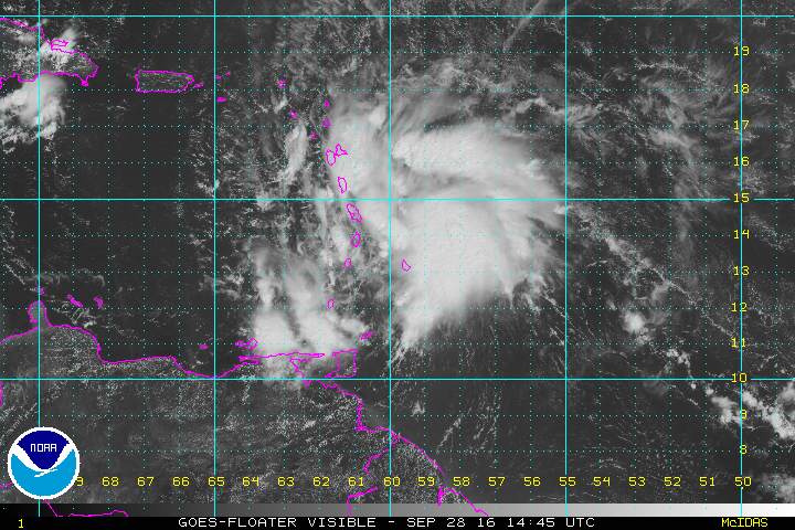
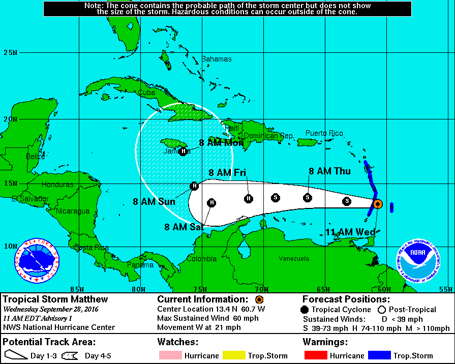
A little before 10AM CDT this morning, the National Hurricane Center have determined from surface observation and data taken from Hurricane Hunter aircraft that a closed circulation has formed in Invest 97L and have upgraded the wave into Tropical Storm Matthew. At the moment, maximum sustained winds are topping out at 60 MPH, and the storm is moving to the west at 21 MPH. Minimum pressure is at 1008 mb at this time.
Matthew is forecasted to continue on its current motion for the next couple of days, with slow strengthening expected. Sometime during the day on Saturday, the storm will be approaching a ridge that will sharply turn it to the north-northwest. By Monday, the center of Matthew will be approaching Jamaica, according to the forecast track by the NHC.
This storm doesn’t appear to be a threat to the Gulf of Mexico, but we’ll keep our eyes on it if there is any change in the forecast.
Category: Alabama's Weather
About the Author (Author Profile)
Scott Martin is an operational meteorologist, professional graphic artist, musician, husband, and father. Not only is Scott a member of the National Weather Association, but he is also the Central Alabama Chapter of the NWA president. Scott is also the co-founder of Racecast Weather, which provides forecasts for many racing series across the USA. He also supplies forecasts for the BassMaster Elite Series events including the BassMaster Classic.Subscribe
If you enjoyed this article, subscribe to receive more just like it.


