

Midday Nowcast: You Think Today is Great, Wait Until Tomorrow
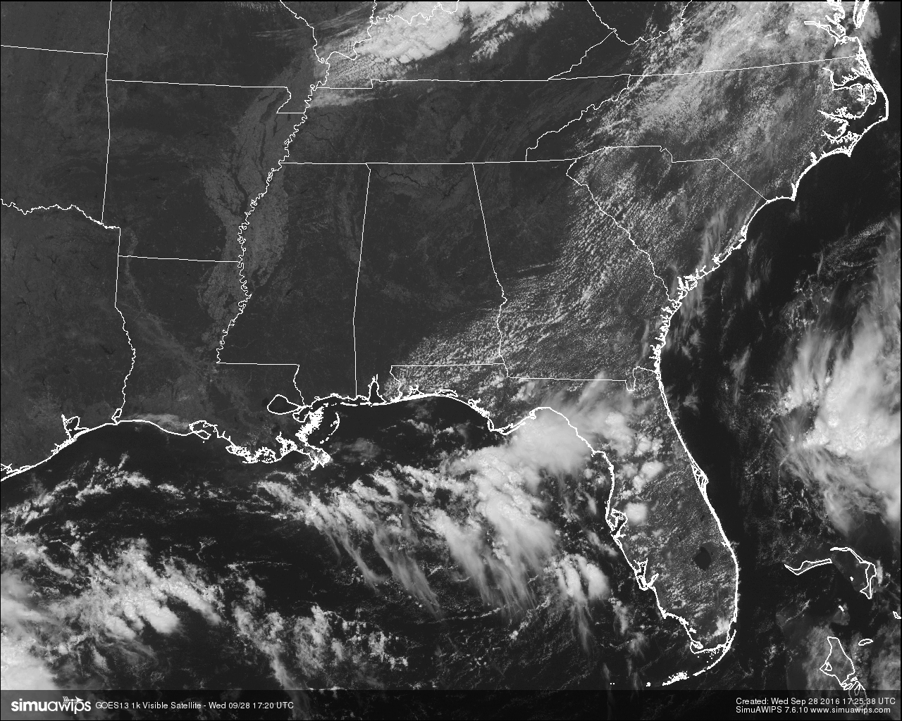
If you haven’t been outside today at all, what are you doing? There is a case of severe clear for the skies over Central Alabama at this hour. It is warm out there, but not too warm, and dewpoints are low at this point as well meaning that it feels great. Our afternoon highs in the mid to upper 80s will actually feel comfortable. But if you think that is great, wait until you walk outside tomorrow.
Of course, the only bad news is that we are not going to receive any rain in the area today, or anytime soon. The Birmingham Water Works has issued a Stage 1 Drought Advisory, and is asking customers to become water-wise after the lack of rain over the past 45 days. Low levels in Lake Purdy and higher water demand is what led to this advisory being issued.
CODE YELLOW AIR QUALITY ALERT:
Ozone levels will be high enough to raise an Air Quality “Code Yellow” Alert for the Birmingham metropolitan area today. Unusually sensitive people should consider limiting prolonged outdoor exertion.
TEMPERATURES ACROSS CENTRAL ALABAMA AT THIS HOUR:
Birmingham 82
Tuscaloosa 81
Gadsden 81
Anniston 83
Cullman 77
Alexander City 84
Auburn 84
Selma 82
Montgomery 87
NORMS AND RECS FOR TODAY IN BIRMINGHAM:
The normal high for September 28th is 81, while the normal low is 58. The record high for today was set back in 1986 at 94. The record low was set back in 1942 at 42.
TOMORROW’S FORECAST:
The sun will be out in full force on Thursday, but the reinforcing shot of cooler air will have blown in, and temperatures will be much cooler than today. Early morning lows will range throughout the 50s in Central Alabama, with a few colder pockets in the 40s. As the day progresses, temperatures area-wide will be below normal for this time of year, and will top out in the mid to upper 70s during the afternoon. Dewpoints are expected to remain low, so it will really feel like Fall out there. It will be breezy out there at times as well with winds out of the northwest averaging 10-15 MPH.
HEADED TO THE BEACH:
Just a few widely scattered storms today, otherwise mostly sunny days and fair nights will continue through the weekend with highs in the 80s from Panama City Beach to Gulf Shores. See a very detailed Gulf Coast forecast here.
BARBER VINTAGE MOTORCYCLE FESTIVAL: This event runs from Friday October 7 through Sunday October 9 at the Barber Motorsports Park. No real skill in a specific forecast this far out, but October is our driest month of the year, and for now we see nothing to suggest any big rain event on these three days. Get ticket information right here.
THE TROPICS:
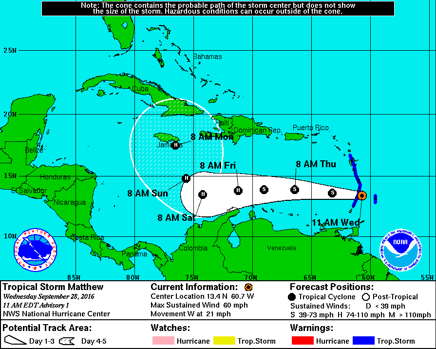
Tropical Storm Matthew was upgraded from “Invest 97L” a little before 10AM CDT this morning. At this time, maximum sustained winds are at 60 MPH, and movement is to the west at 21 MPH. It is forecasted to continue on its path for the next few days and strengthen into a hurricane before meeting a ridge that will force it to turn to the north on Saturday. It will be very close to Jamaica on Monday if it holds to the forecast track. Matthew doesn’t appear to be a threat to the Gulf of Mexico as of yet, but we’ll keep our eyes on it if there needs to be any change in the forecast.
ON THIS DAY IN 1988:
Thunderstorms developing ahead of a cold front in the central U.S. produced severe weather from northern Texas to the Lower Missouri Valley during the late afternoon and evening hours. Hail three inches in diameter was reported at Nolan TX, and wind gusts to 80 mph were reported at Lawrence KS. Thunderstorms drenched downtown Kansas City MO with up to four inches of rain, leaving some cars stranded in water six feet deep.
THE BLOG IS ON TWITTER:
Be sure to follow the Alabama Wx Weather Blog on Twitter. Just click here to start following our feed.
WEATHERBRAINS:
This is the weekly netcast that’s all about weather featuring many familiar voices, including our meteorologists at ABC 33/40. You can listen anytime on the web, or on iTunes. You can find it here.
ADVERTISE WITH US:
Deliver your message to a highly engaged audience by advertising on the AlabamaWX.com website. The site enjoyed 10.2 MILLION pageviews in the past 12 months. Don’t miss out! We can customize a creative, flexible and affordable package that will suit your organization’s needs. Contact Bill Murray at (205) 687-0782.
Category: Alabama's Weather
About the Author (Author Profile)
Scott Martin is an operational meteorologist, professional graphic artist, musician, husband, and father. Not only is Scott a member of the National Weather Association, but he is also the Central Alabama Chapter of the NWA president. Scott is also the co-founder of Racecast Weather, which provides forecasts for many racing series across the USA. He also supplies forecasts for the BassMaster Elite Series events including the BassMaster Classic.Subscribe
If you enjoyed this article, subscribe to receive more just like it.


