

Midday Nowcast: Wonderful Weather for Us; Matthew Is Now A Hurricane
NOW YOU CAN SAY FALL HAS ARRIVED:
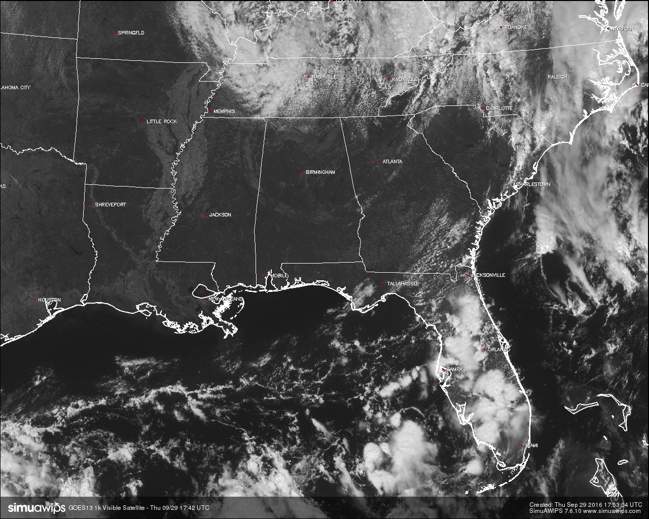
I know, I know… You are saying to yourself, “Wasn’t the first day of Fall nearly a week ago,” and you would be correct. Today is the first time that we have a true taste of what Fall weather is supposed to be like. Temperatures at the noon hour are averaging seven to ten degrees cooler than this time yesterday, and along with dewpoints in the area in the 40s and 50s, it makes it feel even better. It is a little breezy out there, with northerly to north-northwesterly winds averaging around 10 to 15 MPH, it will make those temperatures feel a little cooler.
The only bad news about our weather is that we need rain, and looking at the latest run of the GFS through Sunday October 9th, we will be dry throughout the next 10 days. This is actually not rare, as October is usually our driest month of the year, historically. On four separate years, October was completely dry (1897, 1899, 1901, and 1924). On average, it rains on six days of the month, and only on one of those days include thunderstorms. That was just a small peak into the climatology of October.
For the rest of this afternoon and evening, we will have a case of severe clear with very comfortable temperatures. Afternoon highs will mainly be in the mid 70s, with some communities in the southern parts of Central Alabama getting into the upper 70s to 80. A few clouds may move in over the northern parts of the area, otherwise skies will be clear and it will be cool tonight. Overnight lows will be in the lower 50s for most, with the colder pockets in the 40s.
NO AIR QUALITY ALERT:
Ozone and Particulate Matter 2.5 levels will be below criteria to raise an Air Quality Alert for the Birmingham metropolitan area today.
TEMPERATURES ACROSS CENTRAL ALABAMA AT THIS HOUR:
Birmingham 73
Tuscaloosa 73
Gadsden 72
Anniston 72
Cullman 68
Alexander City 77
Auburn 79
Selma 75
Montgomery 78
NORMS AND RECS FOR TODAY IN BIRMINGHAM:
The normal high for September 29th is 81, while the normal low is 58. The record high for today was set back in 1904 at 96. The record low was set back in 1967 at 40.
TOMORROW’S FORECAST:
Nearly a carbon copy forecast for your Friday… Other than a few clouds in the extreme northern parts of the area, skies will be clear, and afternoon highs will be in the mid to upper 70s for the most part, with a few places in the southern part of the area reaching the low 80s. Yet, it will be another day without rain in Central Alabama.
FRIDAY NIGHT FOOTBALL:
Skies will be clear at kickoff time with temperatures starting off in the low to mid 70s and falling off into the upper 50s to low 60s by the final whistle. There may be a few clouds floating over the extreme northern parts of the area, but no rain at all with those.
HEADED TO THE BEACH:
Mostly sunny days and fair nights will continue through the weekend and early next week with highs in the 80s from Panama City Beach to Gulf Shores. Only isolated storms are expected from Sunday through Wednesday. See a very detailed Gulf Coast forecast here.
BARBER VINTAGE MOTORCYCLE FESTIVAL: This event runs from Friday October 7 through Sunday October 9 at the Barber Motorsports Park. No real skill in a specific forecast this far out, but October is our driest month of the year, and for now we see nothing to suggest any significant chance of rain event on these three days. Get ticket information right here.
THE TROPICS:
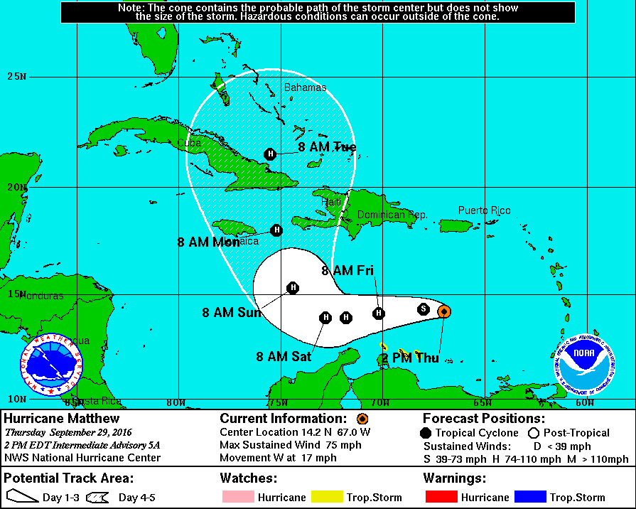
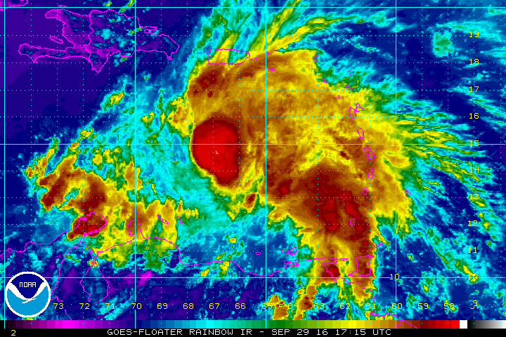
Matthew has been upgraded to a hurricane (as I typed this entry), with maximum sustained winds at 75 MPH, gusts to 85 MPH, and the minimum pressure at 993 mb (29.32 inches). Matthew is moving to the west at 17 MPH and is expected to stay on that course for the next couple of days. It is expected to sharply turn to the north sometime during the Saturday night and Sunday morning time frame, with the eye located somewhere to the north of the eastern side of Cuba on Tuesday morning.
Odds are very high Matthew will stay well east of the Gulf of Mexico; it remains to be seen if it will move into any part of the U.S. East Coast, or stays offshore. Looks like a close call, and those from the Outer Banks of North Carolina to Cape Cod will need to keep a very close eye on this next week.
ON THIS DAY IN 1986:
A week of violent weather began in Oklahoma which culminated in one of the worst flooding events in the history of the state. On the first day of the week early morning thunderstorms caused more than a million dollars damage in south Oklahoma City. Thunderstorms produced 4 to 7 inches of rain from Hobart to Ponca City, and another round of thunderstorms that evening produced 7 to 10 inches of rain in north central and northeastern sections of Oklahoma.
THE BLOG IS ON TWITTER:
Be sure to follow the Alabama Wx Weather Blog on Twitter. Just click here to start following our feed.
WEATHERBRAINS:
This is the weekly netcast that’s all about weather featuring many familiar voices, including our meteorologists at ABC 33/40. You can listen anytime on the web, or on iTunes. You can find it here.
ADVERTISE WITH US:
Deliver your message to a highly engaged audience by advertising on the AlabamaWX.com website. The site enjoyed 10.2 MILLION pageviews in the past 12 months. Don’t miss out! We can customize a creative, flexible and affordable package that will suit your organization’s needs. Contact Bill Murray at (205) 687-0782.
Category: Alabama's Weather
About the Author (Author Profile)
Scott Martin is an operational meteorologist, professional graphic artist, musician, husband, and father. Not only is Scott a member of the National Weather Association, but he is also the Central Alabama Chapter of the NWA president. Scott is also the co-founder of Racecast Weather, which provides forecasts for many racing series across the USA. He also supplies forecasts for the BassMaster Elite Series events including the BassMaster Classic.Subscribe
If you enjoyed this article, subscribe to receive more just like it.


