

Matthew Close to Cat Five Intensity

We haven’t seen a category five hurricane in the Atlantic Basin since 2007, a year that saw two of them (Felix and Dean).
Matthew may be about to change that.
Hurricane Matthew has been intensifying rapidly for the past 24 hours in the Central Caribbean. Between 4 p.m. CDT yesterday and 4 p.m. today, Matthew’s central pressure dropped from 993 millibars to 949 millibars, or 44 millibars. That officially satisfies the 42 millibar drop that defines rapid deepening.
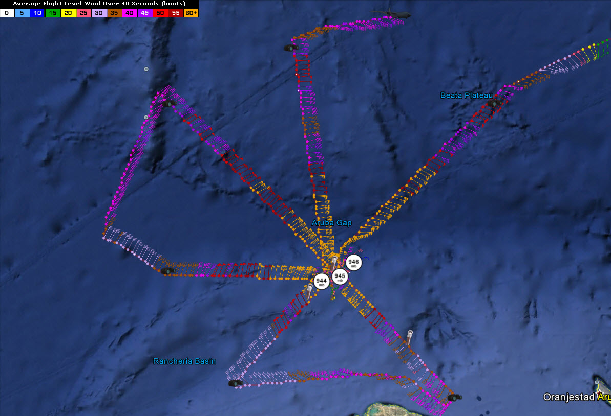
Its central pressure has dropped to 944 millibars shortly before 8:30 p.m. CDT tonight, a 51 millibar drop in 28.5 hours. The plane estimated surface winds of 158.8 mph, which is very close to the category five threshold of 160 mph. The eye is closed with a diameter of 12 nautical miles.
The storm continues moving west southwest. It is expected to turn northwest tomorrow night and will impact Jamaica Sunday night and Monday. It is forecast to have top winds of 120 mph at that time, making it a category three hurricane. But it could be stronger.
It will cross eastern Cuba and move through the Bahamas Tuesday and Wednesday. It is too early to tell if Matthew will strike the U.S. The general indication is that the hurricane will turn north and northeast after coming menacingly close to the coast between Florida, the Carolinas, Mid-Atlantic and Northeast.
There were six category five hurricanes between 2003 and 2005. Wilma was the last in that group, and the last major hurricane to hit the United States.
Category: Tropical
About the Author (Author Profile)
Bill Murray is the President of The Weather Factory. He is the site's official weather historian and a weekend forecaster. He also anchors the site's severe weather coverage. Bill Murray is the proud holder of National Weather Association Digital Seal #0001 @wxhistorianSubscribe
If you enjoyed this article, subscribe to receive more just like it.


