

Matthew in Radar No Man’s Land
Lots of interest in Hurricane Matthew which remained a major hurricane this morning as a Category 4 storm. I was looking for weather radar from Jamaica and ran across this image which is a collection of all of the weather radars across the Caribbean.
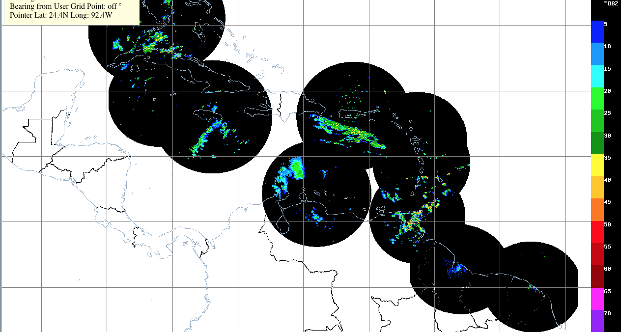
I thought it was interesting to note that Matthew is currently in a no man’s land for radar coverage, so there is not much to see at the moment. There does appear to be an outer band of Matthew that is close to the southeast coast of Jamaica that extends to the southwest. The Jamaica weather radar is likely to be the one to give us the best radar image for Matthew as it moves by just to the east of the eastern end of the island.
The eye of Matthew has become obscured on visible satellite images this morning and this is often an indication of weakening. Microwave images showed a distinct dry slot over the southwestern and western portions of the circulation. NHC has noted that there has been a persistent, but inexplicable, cluster of deep convection located a couple of degrees to the east of the hurricane and the effect of this feature on Matthew’s intensity evolution is unknown.
An Air Force Hurricane Hunter aircraft investigated the northeastern eyewall, the strongest part of the circulation, and found that the winds had decreased somewhat from earlier this morning. The intensity is set to 120 knots on the latest NHC advisory. The vertical shear is not forecast to become much stronger while Matthew is in the Caribbean, so the hurricane should remain near category 4 status for the next 36-48 hours. Once Matthew moves into the Atlantic, some increase in shear along with a decrease sea surface temperatures should result in some weakening.
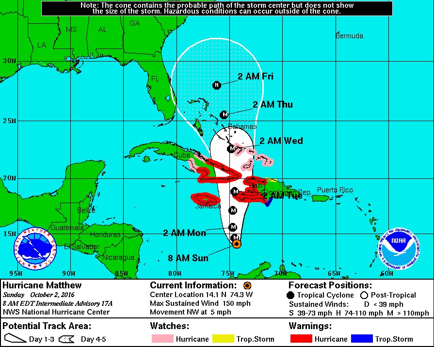
The motion of the storm is still somewhat questionable. After a northwestward motion, the center has meandered westward during the past few hours. Matthew is still expected to turn northward as it moves between a mid-level ridge to the east and a weak trough over the Gulf of Mexico during the next few days. Later in the forecast period, the global models show the ridge to the northeast of Matthew getting slightly stronger and this would induce a turn toward the left in the 3 to 5 day time frame. The forecast from NHC is shown above and it also identifies the areas with hurricane watches and warning.
-Brian-
Category: Tropical
About the Author (Author Profile)
Brian Peters is one of the television meteorologists at ABC3340 in Birmingham and a retired NWS Warning Coordination Meteorologist. He handles the weekend Weather Xtreme Videos and forecast discussion and is the Webmaster for the popular WeatherBrains podcast.Subscribe
If you enjoyed this article, subscribe to receive more just like it.


