

Sunny and Breezy Saturday
The dry cold front has pushed down into South Alabama and we are seeing nearly severe clear across the state this afternoon. There are a few clouds across the northeastern corner of the state near Scottsboro, but other than that, it is a sunny and gorgeous day.
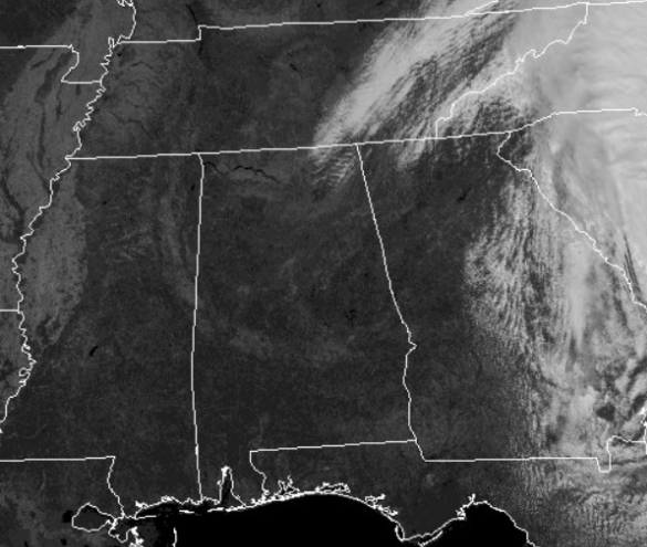
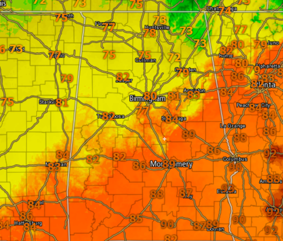
Temperatures are in the upper 70s and lower 80s through out Central Alabama, and it remains breezy due to the frontal passage and the pressure gradient between the high pressure moving into the Ohio Valley and Matthew along the Southeast Coast. Dew points are falling as drier air moves into the state, and that is why we are seeing a fire danger in portions of the state.
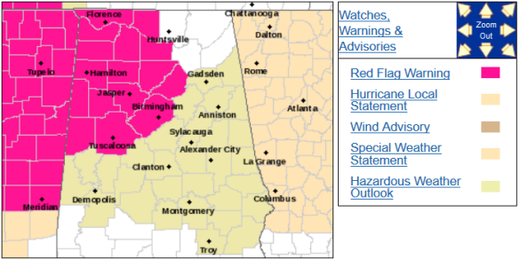
RED FLAG WARNING: The National Weather Service in Birmingham has issued a red flag warning for dry and breezy conditions…which is in effect from 1 PM this afternoon to 6 PM CDT this evening. A red flag warning means that critical fire weather conditions are either occurring now….or will shortly. A combination of strong winds…low relative humidity…and warm temperatures can contribute to extreme fire behavior.
HURRICANE MATTHEW: Matthew finally made landfall along the South Carolina Coast this morning, just northeast of Charleston near McClellanville.
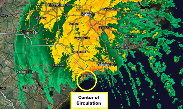
The center of Hurricane Matthew was located near latitude 33.7 North, longitude 79.0 West. Matthew is moving toward the northeast near 12 mph, and this motion is expected to continue today. On the forecast track, the center of Matthew will continue to move near or over the coast of South Carolina this afternoon, and be near the coast of southern North Carolina by this evening.
Maximum sustained winds remain near 75 mph with higher gusts. Although weakening is forecast during the next 48 hours, Matthew is expected to remain near hurricane strength while the center is near the coasts of South Carolina and North Carolina. Hurricane-force winds extend outward up to 25 miles from the center and tropical-storm-force winds extend outward up to 185 miles. A wind gust of 59 mph was measured at a Myrtle Beach, and a gust to 69 mph was observed at Charleston. The minimum central pressure reported by an Air Force plane was 972 mb (28.70 inches).
Lots of wind continues with this system, but that threat is slowly decreasing and the serious threat is a inland flooding event that is developing through the Carolinas.
Category: Alabama's Weather
About the Author (Author Profile)
Macon, Georgia Television Chief Meteorologist, Birmingham native, and long time Contributor on AlabamaWX. Stormchaser. I did not choose Weather, it chose Me. College Football Fanatic. @Ryan_StinnetSubscribe
If you enjoyed this article, subscribe to receive more just like it.


