

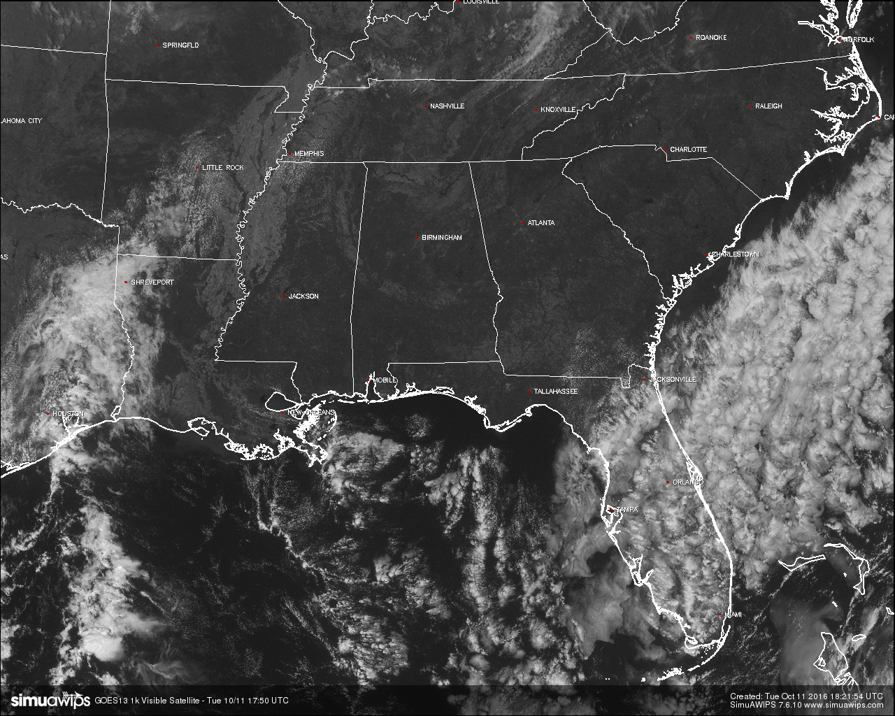
A Beautiful But Dry Day At The Midday Hour
A LITTLE COOLER TODAY BUT STILL NO RAIN:
An absolutely wonderful outside at this hour across Central Alabama, with sunshine in full-force and most temperatures in the mid to upper 70s. A nice little breeze out of the east averaging around 5-10 MPH, and with dew points in the 40s, really makes today feel great. Unfortunately, these great conditions also bring a hazard to the area. It will be 23 days since the last time measurable rain has fallen at the Birmingham Airport, and it doesn’t look like any significant rainfall for the area for at least the next seven days.
FIRE ALERT FOR 46 NORTH & CENTRAL ALABAMA COUNTIES:
The Alabama Forestry Commission (AFC) has upgraded the Fire Danger Warning, issuing a Fire Alert for 46 counties in north Alabama effective immediately. This order for Autauga, Bibb, Blount, Calhoun, Chambers, Cherokee, Chilton, Clay, Cleburne, Colbert, Coosa, Cullman, Dallas, DeKalb, Elmore, Etowah, Fayette, Franklin, Greene, Hale, Jackson, Jefferson, Lamar, Lauderdale, Lawrence, Lee, Limestone, Lowndes, Macon, Madison, Marion, Marshall, Montgomery, Morgan, Perry, Pickens, Randolph, Russell, Shelby, St. Clair, Sumter, Talladega, Tallapoosa, Tuscaloosa, Walker, and Winston counties was issued today by the AFC. While under a Fire Alert, burn permits will be issued at the discretion of the State Forester.
TEMPERATURES ACROSS CENTRAL ALABAMA AT 1:15 PM CDT:
Birmingham 77
Tuscaloosa 77
Gadsden 75
Anniston 75
Cullman 75
Alexander City 76
Auburn 73
Selma 75
Montgomery 76
NO AIR QUALITY ALERT TODAY:
Ozone and Particulate Matter 2.5 levels will be too low to raise the “Code Yellow” Air Quality Alert for the Birmingham metropolitan area today. No actions needed.
NORMS AND RECS FOR TODAY IN BIRMINGHAM:
The normal high for October 11th is 77, while the normal low is 53. The record high for today was set back in 1919 at 88. The record low was set back in 1906 at 35.
REST OF TODAY:
Clear skies throughout the rest of the day through the overnight hours tonight, and the wind will become calm by tonight. Afternoon highs will be at or just over 80 degrees, with overnight lows ranging in the 40s and 50s. A few colder pockets could reach the upper 30s.
TOMORROW’S FORECAST:
The morning will start off rather cool again, but will begin to warm nicely under sunny skies. Afternoon highs will be at or just over 80 degrees. With winds out of the east around 5 MPH, along with dew points in the mid 40s, its going to be another beautiful and comfortable Fall day.
HEADED TO THE BEACH:
Sunny days, clear nights on the coast from Gulf Shores to Panama City Beach through the week, with highs mostly in the 80s and lows mostly in the 60s. See a very detailed Gulf Coast forecast here.

TROPICS:
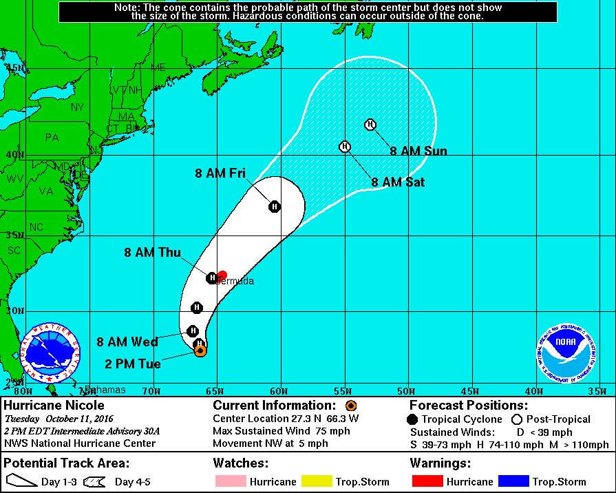
Nicole has restrengthened into a hurricane as of the 1:00 PM CDT update from the National Hurricane Center, with maximum sustained winds at 75 MPH. Nicole is moving to the northwest at 5 MPH, and will continue on that track throughout the day before starting to move towards the northeast and picking up in forward speed. It will be very close, if not making landfall on Bermuda by Thursday morning, before being quickly ushered out to sea by a trough moving off of the U.S., and expected to become post-tropical by Saturday. Nicole is no threat to the U.S. at all. The rest of the Atlantic Basin is quiet.
ON THIS DAY IN 1989:
Much of the nation enjoyed “Indian Summer” type weather. Nine cities in the central U.S. reported record highs for the date as temperatures warmed into the 80s and 90s. Record highs included 90 degrees at Grand Island NE and 97 degrees at Waco TX. Strong winds along a cold front crossing the Northern High Plains Region gusted to 80 mph at Ames Monument WY during the early morning.
THE BLOG IS ON TWITTER:
Be sure to follow the Alabama Wx Weather Blog on Twitter. Just click here to start following our feed.
WEATHERBRAINS:
This is the weekly netcast that’s all about weather featuring many familiar voices, including our meteorologists at ABC 33/40. You can listen anytime on the web, or on iTunes. You can find it here.
ADVERTISE WITH US:
Deliver your message to a highly engaged audience by advertising on the AlabamaWX.com website. The site enjoyed 10.2 MILLION pageviews in the past 12 months. Don’t miss out! We can customize a creative, flexible and affordable package that will suit your organization’s needs. Contact Bill Murray at (205) 687-0782.
Category: Alabama's Weather
About the Author (Author Profile)
Scott Martin is an operational meteorologist, professional graphic artist, musician, husband, and father. Not only is Scott a member of the National Weather Association, but he is also the Central Alabama Chapter of the NWA president. Scott is also the co-founder of Racecast Weather, which provides forecasts for many racing series across the USA. He also supplies forecasts for the BassMaster Elite Series events including the BassMaster Classic.Subscribe
If you enjoyed this article, subscribe to receive more just like it.


