

Another Nice Midday & The Dry Streak Continues for Central Alabama
24 DAYS IN A ROW WITHOUT RAIN:
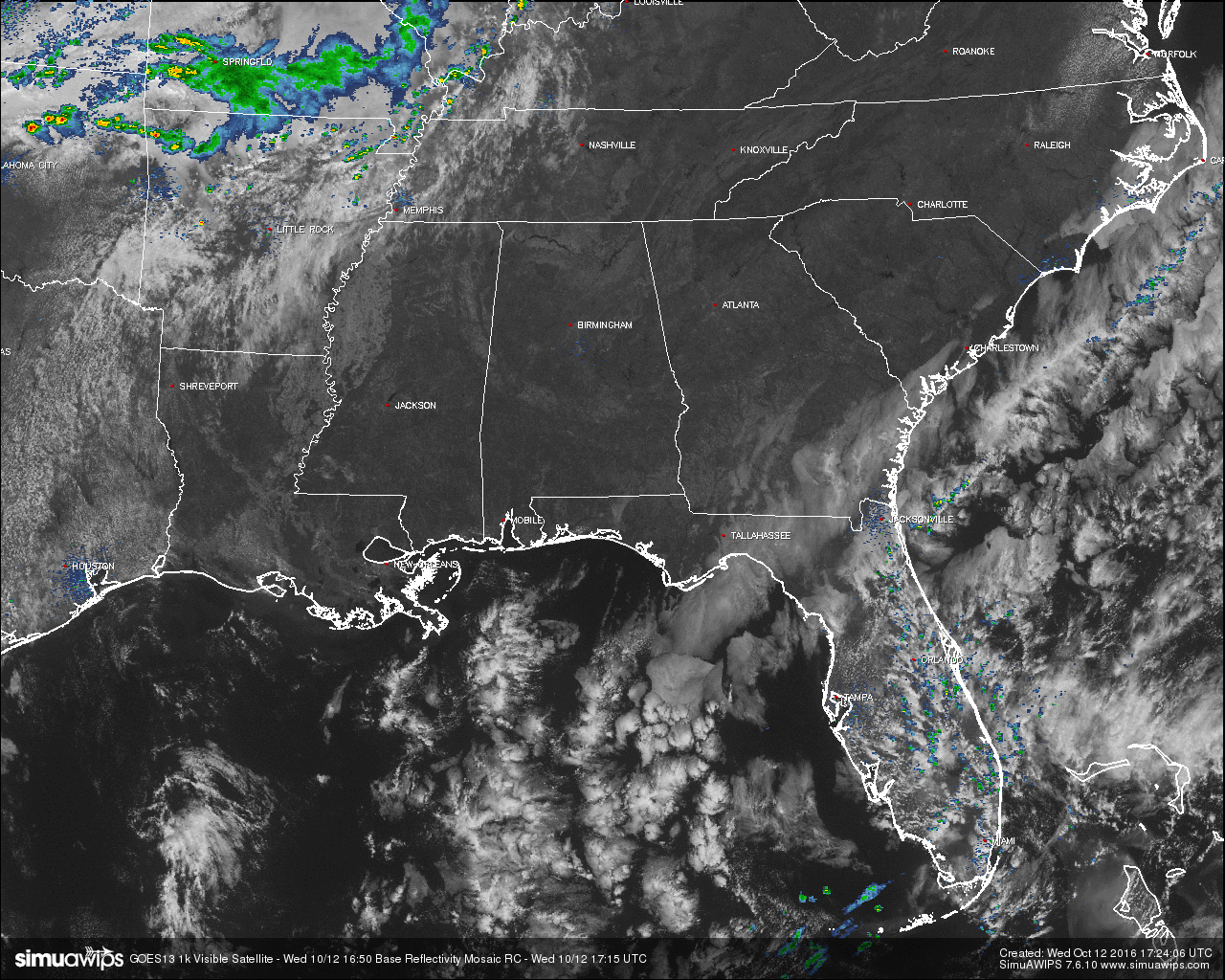
Another beautiful day across Central Alabama with nice temperatures, lower dewpoints, and a cobalt-blue sky overhead. With that being said, the only down side is that we have now reached 24 consecutive days at the Birmingham Airport without any measurable rainfall. We are really dry and could use any rainfall we can get.
FIRE ALERT FOR 46 NORTH & CENTRAL ALABAMA COUNTIES:
The Alabama Forestry Commission (AFC) has upgraded the Fire Danger Warning, issuing a Fire Alert for 46 counties in north Alabama effective immediately. This order for Autauga, Bibb, Blount, Calhoun, Chambers, Cherokee, Chilton, Clay, Cleburne, Colbert, Coosa, Cullman, Dallas, DeKalb, Elmore, Etowah, Fayette, Franklin, Greene, Hale, Jackson, Jefferson, Lamar, Lauderdale, Lawrence, Lee, Limestone, Lowndes, Macon, Madison, Marion, Marshall, Montgomery, Morgan, Perry, Pickens, Randolph, Russell, Shelby, St. Clair, Sumter, Talladega, Tallapoosa, Tuscaloosa, Walker, and Winston counties was issued today by the AFC. While under a Fire Alert, burn permits will be issued at the discretion of the State Forester.
This Fire Alert will remain in effect until rescinded by the State Forester, at which time conditions will have changed sufficiently to reduce the occurrence and frequency of wildfires. The Commission is urging everyone to exercise all necessary safety precautions when doing any type of outdoor burning, and to call the Alabama Forestry Commission to obtain a burn permit. While under the Fire Alert, permits for outdoor burning in these counties will be restricted and issued on an individual basis.
TEMPERATURES ACROSS CENTRAL ALABAMA AT 12:15 PM CDT:
Birmingham 75
Tuscaloosa 75
Gadsden 72
Anniston 73
Cullman 73
Alexander City 75
Auburn 72
Selma 75
Montgomery 76
CODE YELLOW AIR QUALITY ALERT TODAY:
Particulate Matter 2.5 levels are high enough to raise the “Code Yellow” Air Quality Alert for the Birmingham metropolitan area today. Unusually sensitive people should consider limiting prolonged outdoor exertion.
NORMS AND RECS FOR TODAY IN BIRMINGHAM:
The normal high for October 12th is 76, while the normal low is 52. The record high for today was set back in 1963 at 91. The record low was set back in 1932 at 37.
REST OF TODAY:
Skies will remain sunny and clear throughout the remainder of the afternoon hours, with clear skies during the evening and overnight hours. Afternoon highs will be in the low 80s area-wide, with overnight lows ranging in the upper 40s to mid 50s.
TOMORROW’S FORECAST:
A cool start to the morning with clear skies and temperatures in the 50s at 7:00 AM. Skies will remain mostly clear throughout the remainder of the daylight hours with a few high clouds possible. It will be a warmer day across Central Alabama, with highs reaching the mid to upper 80s for the southern two-thirds of the area, with low to mid 80s for the northern third. Once again, no rain and no relief to our drought situation.
HEADED TO THE BEACH:
Sunny days, clear nights on the coast from Gulf Shores to Panama City Beach through early next week, with highs mostly in the 80s and lows mostly in the 60s. See a very detailed Gulf Coast forecast here.

TROPICS:
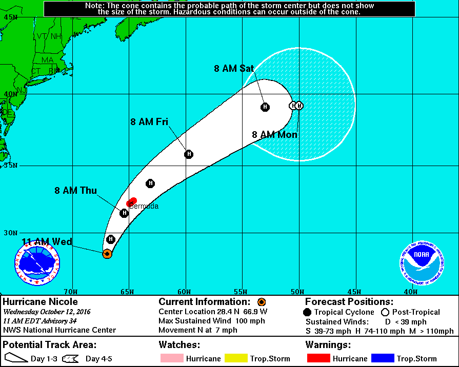
Hurricane Nicole is now packing maximum sustained winds of 100 MPH as of the latest update from the National Hurricane Center. She has made her turn northwards and will continue to turn to the northeast throughout the remainder of the day. Nicole will be approaching Bermuda during the night tonight and throughout the morning tomorrow, either making landfall on the island, or passing by very close during the morning and afternoon hours on Thursday as a category 2 storm (96-110 MPH). After that, weakening should start to occur as Nicole will encounter cooler waters and increasing shear, before being picked up by a frontal boundary and ushered quickly out to sea. The rest of the Atlantic Basin is quiet.
ON THIS DAY IN 1987:
Floyd, the only hurricane to make landfall the entire season, moved across the Florida Keys. Floyd produced wind gusts to 59 mph at Duck Key, and up to nine inches of rain in southern Florida. Sixteen cities in the Ohio Valley and the Middle Mississippi Valley reported record low temperatures for the date. Record lows included 27 degrees at Paducah KY, and 24 degrees at Rockford IL and Springfield IL.
THE BLOG IS ON TWITTER:
Be sure to follow the Alabama Wx Weather Blog on Twitter. Just click here to start following our feed.
WEATHERBRAINS:
This is the weekly netcast that’s all about weather featuring many familiar voices, including our meteorologists at ABC 33/40. You can listen anytime on the web, or on iTunes. You can find it here.
ADVERTISE WITH US:
Deliver your message to a highly engaged audience by advertising on the AlabamaWX.com website. The site enjoyed 10.2 MILLION pageviews in the past 12 months. Don’t miss out! We can customize a creative, flexible and affordable package that will suit your organization’s needs. Contact Bill Murray at (205) 687-0782.
Category: Alabama's Weather
About the Author (Author Profile)
Scott Martin is an operational meteorologist, professional graphic artist, musician, husband, and father. Not only is Scott a member of the National Weather Association, but he is also the Central Alabama Chapter of the NWA president. Scott is also the co-founder of Racecast Weather, which provides forecasts for many racing series across the USA. He also supplies forecasts for the BassMaster Elite Series events including the BassMaster Classic.Subscribe
If you enjoyed this article, subscribe to receive more just like it.


