

I See Some Rain On The Radar At Midday In Central AL
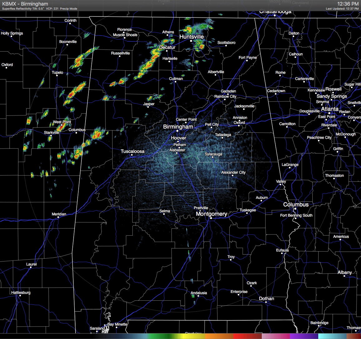
WE HAVE RAIN ON THE RADAR:
Believe it or not, we have some scattered showers that have developed ahead of the cold front in north and northwestern parts of the state at this midday hour. Good news is that a few of these showers have already put down over 1/2 inch of rain as they are moving off to the east-northeast. With instability levels being low at this moment, along with the pre-frontal low-level westerly flow, any strong thunderstorm development is really being hampered. No watches or warnings are in effect for the state at this time.
For those of us in Central Alabama who are not receiving any rain, skies are partly cloudy out there, but enough sunshine is making it through to be quite warm out there again. The latest reading at the Birmingham Airport has the temperature at 87.8 degrees, putting it just 0.2 below the record high set back in 1941. It could be another record-breaking day, but it will be a close call with the approaching clouds and rainfall. Timing is everything.
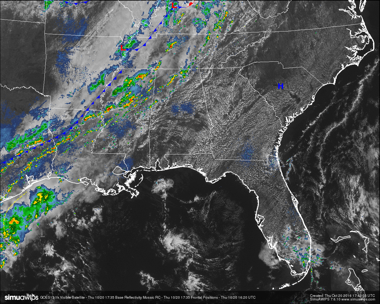
Right now, the cold front is just now moving into the extreme northwestern parts of Mississippi, draping back to the southwest through Southeastern Arkansas, through North and Northwestern Louisiana, and back into Texas. Most of the shower and thunderstorm activity is lined up just ahead and along the front, with some scattered development well out ahead of it. Good news: rain is coming. Bad News: Not enough to make any difference in our drought situation.
BURN BAN AND FIRE ALERT:
A Drought Emergency continues in effect, banning any outdoor burning for the northern two-thirds of the state. A Fire Alert remains in effect for the whole state. Only those counties outside of the Drought Emergency can burn outdoors after obtaining a burn permit from the Alabama Forestry Commission, but these will be restricted and issued on an individual basis. Click here for more information.
TEMPERATURES ACROSS CENTRAL ALABAMA AT 12:30 PM CDT:
- Birmingham 88
- Tuscaloosa 84
- Gadsden 84
- Anniston 84
- Cullman 74
- Alexander City 90
- Auburn 84
- Selma 86
- Montgomery 84
AIR QUALITY:
Both Ozone and Particulate Matter 2.5 levels will be below criteria to raise an Air Quality Alert for the Birmingham metropolitan area today. No actions needed.
NORMS AND RECS FOR TODAY IN BIRMINGHAM:
The normal high for October 20th is 74, while the normal low is 49. The record high for today was set back in 1941 at 88. The record low was set back in 1964 at 32.
REST OF TODAY:
A good amount of sunshine combined with a westerly low level flow will allow the temperatures to rise near record levels again today. Skies will be partly to mostly clear until later this afternoon with the approach of the cold front. Afternoon highs will once again be in the mid to upper 80s, to a few 90 degree readings in the southern parts of the area. The chance of rain and storms will increase as we continue through the afternoon and evening hours. Temperatures will begin to drop as the front passes through the area. Overnight lows will be in the 50s.
SPC is continuing the Marginal Risk for severe storms for the northwestern part of the state for the main risk of damaging winds. Good news is that instability values are marginal, at best. Along with the pre-frontal low-level westerly flow, this will limit thunderstorm intensity and should keep storms from reaching severe criteria.
TOMORROW’S FORECAST:
What a difference in temperatures between today and Friday. Skies will probably start off partly to mostly cloudy during the early morning, but will begin to clear out as the day progresses. Early morning lows will start off on the low to mid 50s, and afternoon temperatures will only rise into the upper 60s to the low 70s. It will be quite breezy at times, with winds out of the north averaging around 5-10 MPH. For the evening, skies will be clear and temperatures will quickly drop off into the low to mid 60s at 6PM for kickoff at high school football games, and in the upper 40s to low 50s by 10PM. Winds will begin to drop to around 5 MPH out of the north by that time. Overnight lows will be in the 40s, with a few colder spots in the 30s.
The better chances of showers and storms will be in the northwestern parts of the area, and gradually lowers as you move to the southeast. Rain totals will be 1/2 inch or less, with many communities getting less than 1/10 inch. Afternoon highs will still be warm, in the 80s. Once the front passes, any rain chances will be done.
HEADED TO THE BEACH:
Sunny days, fair nights on the coast from Gulf Shores to Panama City Beach through next week. Highs in the 80s today, and in the 70s tomorrow and over the weekend. See a very detailed Gulf Coast forecast here.
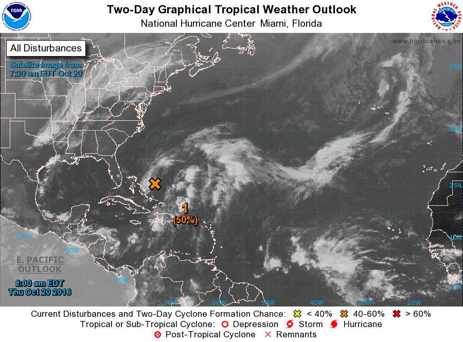
TROPICAL UPDATE:
Still no sign of any organization in the wave east of the Bahamas. There is still some chance this develops in coming days, and it will move north and is no threat to the U.S.
ON THIS DAY IN 1983:
Remnants of Pacific Hurricane Tico caused extensive flooding in central and south central Oklahoma. Oklahoma City set daily rainfall records with 1.45 inch on the 19th, and 6.28 inches on the 20th.
THE BLOG IS ON TWITTER:
Be sure to follow the Alabama Wx Weather Blog on Twitter. Just click here to start following our feed.
WEATHERBRAINS:
This is the weekly netcast that’s all about weather featuring many familiar voices, including our meteorologists at ABC 33/40. You can listen anytime on the web, or on iTunes. You can find it here.
ADVERTISE WITH US:
Deliver your message to a highly engaged audience by advertising on the AlabamaWX.com website. The site enjoyed 10.2 MILLION pageviews in the past 12 months. Don’t miss out! We can customize a creative, flexible and affordable package that will suit your organization’s needs. Contact Bill Murray at (205) 687-0782.
Category: Alabama's Weather
About the Author (Author Profile)
Scott Martin is an operational meteorologist, professional graphic artist, musician, husband, and father. Not only is Scott a member of the National Weather Association, but he is also the Central Alabama Chapter of the NWA president. Scott is also the co-founder of Racecast Weather, which provides forecasts for many racing series across the USA. He also supplies forecasts for the BassMaster Elite Series events including the BassMaster Classic.Subscribe
If you enjoyed this article, subscribe to receive more just like it.


