

A Few Showers Out There At Midday in Central Alabama
THERE ARE A FEW SHOWERS OUT THERE AT MIDDAY:
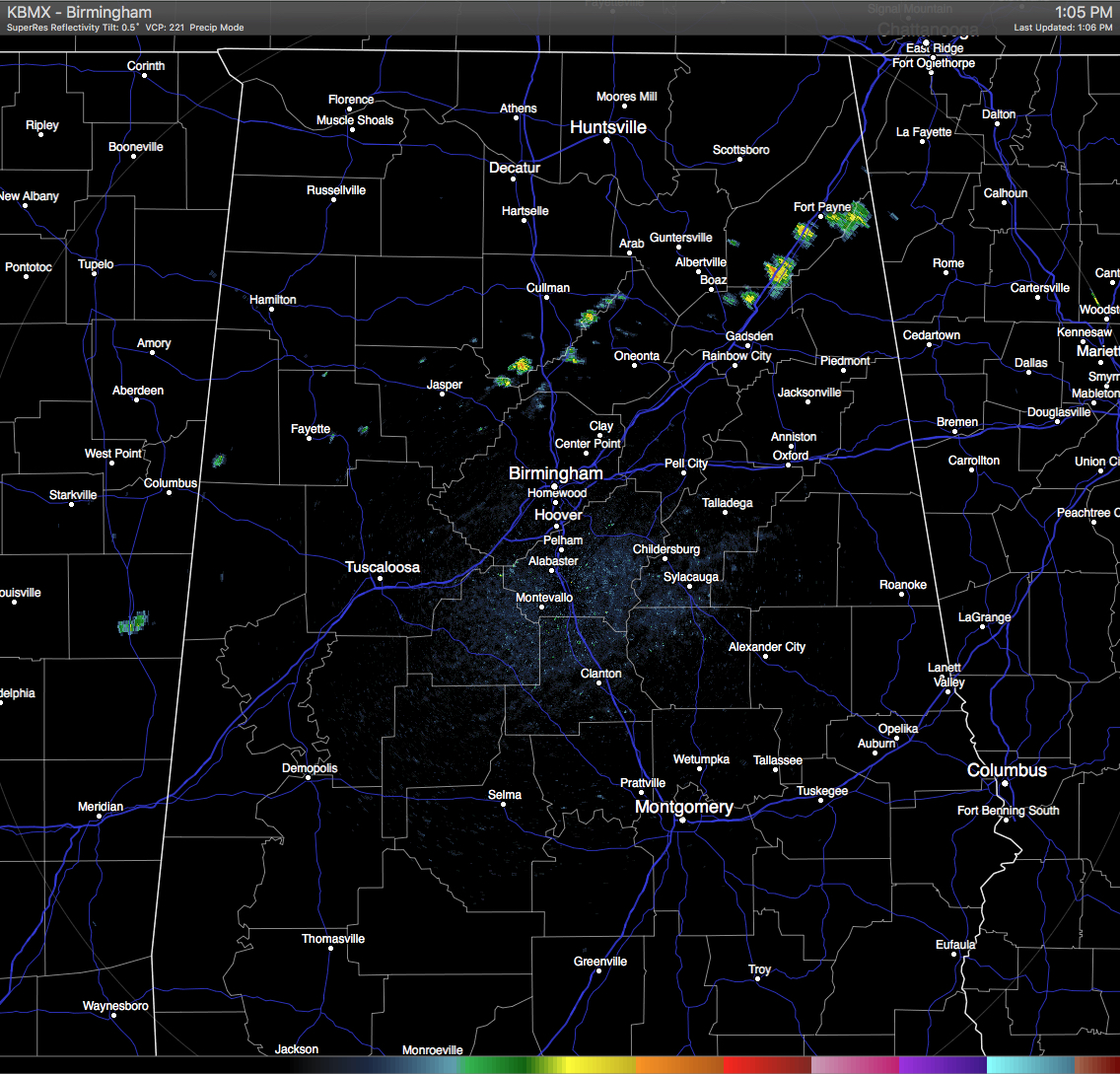
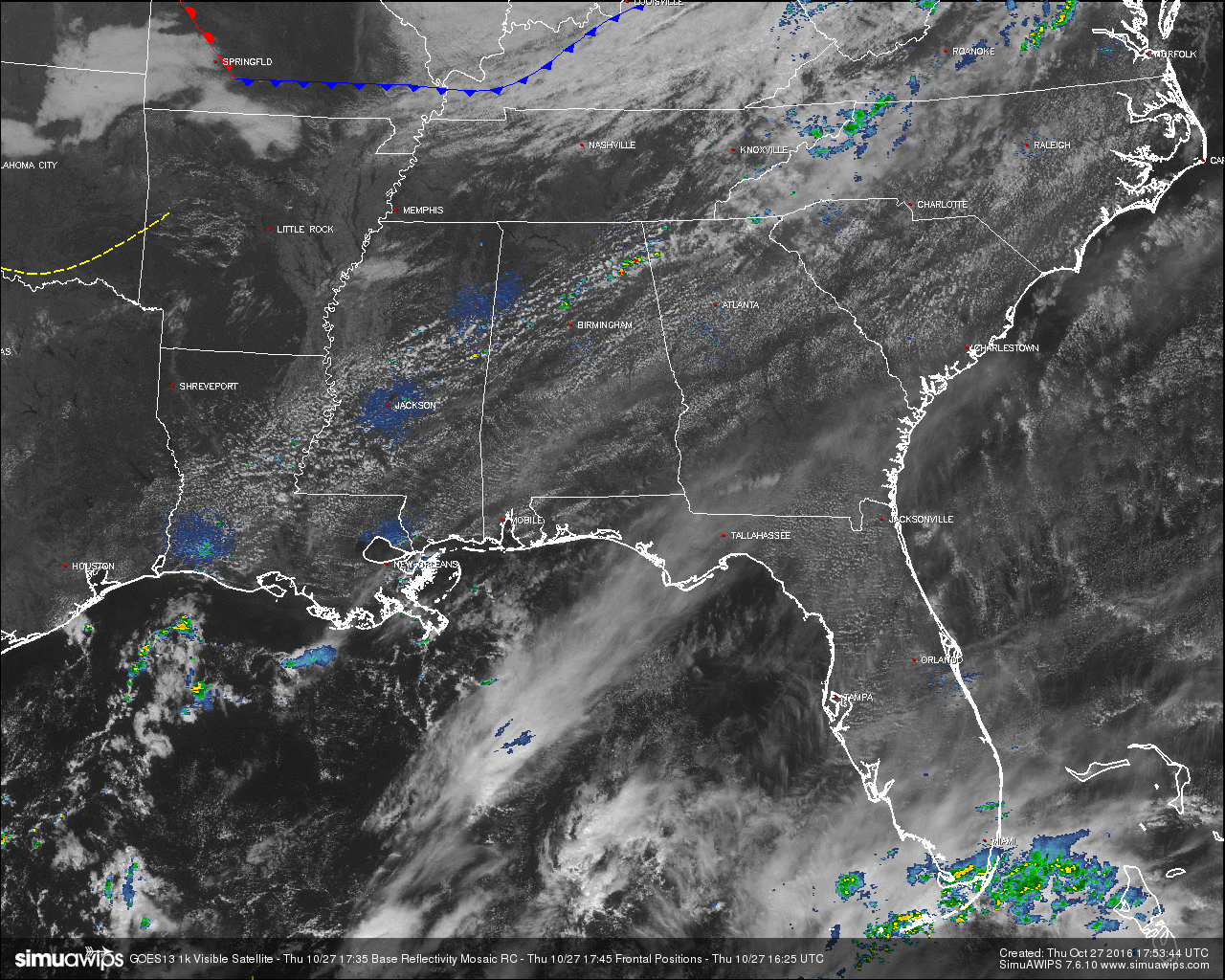
Looking at the sky at this midday hour and you wouldn’t believe that there are a few showers out there. To me it would like another typical October day in 2016 across Central Alabama. At this time, skies are partly cloudy to mostly clear according to where you are located, and we do actually have some scattered showers on radar. A few light to moderate showers have popped up over Walker and Cullman Counties and are currently moving into Western Blount Counties. If these can hold together, they would be able to knock the dust down for an hour or two, just not much moisture with these at all.
Brian Peters posted an update to our drought situation earlier today, and what little rain we have out there at this time will not help our drought situation at all. Maybe, just maybe, we will have another shot at rain towards the end of next week.
BURN BAN AND FIRE ALERT:
A Drought Emergency continues in effect, banning any outdoor burning for the northern two-thirds of the state. A Fire Alert remains in effect for the whole state. Click here for more information.
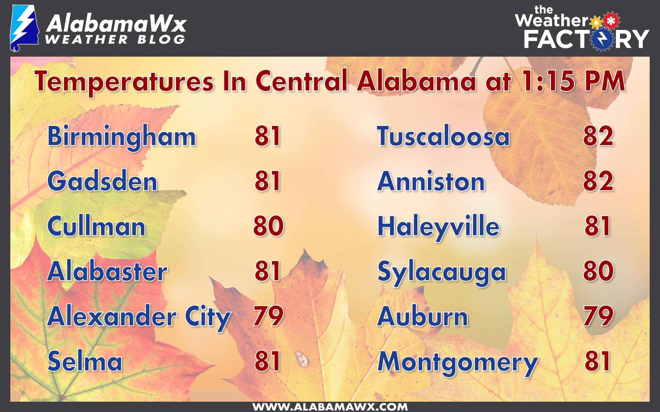
TEMPERATURES ACROSS CENTRAL ALABAMA:
CODE YELLOW AIR QUALITY ALERT:
Particulate Matter 2.5 levels will be high enough to raise a Code Yellow Air Quality Alert for the Birmingham metropolitan area today. Unusually sensitive people should consider limiting prolonged outdoor exertion.
NORMS AND RECS FOR TODAY IN BIRMINGHAM:
The normal high for October 27th is 71, while the normal low is 47. The record high for today was set back in 1940 at 88. The record low was set back in 1957 at 28.
REST OF TODAY:
Very few people will be fortunate enough to receive rain today. Skies will be partly to mostly cloudy, with only a very small risk of an isolated shower or two. Odd for any one spot receiving any rain is less that one in eight. Afternoon highs will be in the low to mid 80s throughout the area, with winds out of the southwest averaging 5 MPH. Skies will start to clear out later this evening and during the overnight hours, with lows reaching the 50s and 60s.
FRIDAY’S FORECAST:
Mostly sunny to sunny skies and very warm outside tomorrow, with highs reaching the mid to upper 80s throughout Central Alabama. Some spots could be close to tying or breaking the record high. Skies will remain clear for the evening, with temperatures in the 70s at 6PM and falling into the 60s by 10PM. Overnight lows will be in the 50s and 60s.
HEADED TO THE BEACH:
Sunny days, fair nights on the coast through the weekend and early next week. Highs will be in the low 80s and lows in the 60s. See a very detailed Gulf Coast forecast here.
TROPICAL UPDATE:
Tropical cyclone formation is not expected during the next 5 days across the Gulf of Mexico, Caribbean Sea, and the North Atlantic Ocean.
ON THIS DAY IN 1988:
Low pressure brought snow and gale force winds to the Great Lakes Region, and snow and high winds to the north central U.S. Winds gusted to 47 mph at Lansing MI, and reached 55 mph at Pierre SD.
THE BLOG IS ON TWITTER:
Be sure to follow the Alabama Wx Weather Blog on Twitter. Just click here to start following our feed.
WEATHERBRAINS:
This is the weekly netcast that’s all about weather featuring many familiar voices, including our meteorologists at ABC 33/40. You can listen anytime on the web, or on iTunes. You can find it here.
ADVERTISE WITH US:
Deliver your message to a highly engaged audience by advertising on the AlabamaWX.com website. The site enjoyed 10.2 MILLION pageviews in the past 12 months. Don’t miss out! We can customize a creative, flexible and affordable package that will suit your organization’s needs. Contact Bill Murray at (205) 687-0782.
Category: Alabama's Weather
About the Author (Author Profile)
Scott Martin is an operational meteorologist, professional graphic artist, musician, husband, and father. Not only is Scott a member of the National Weather Association, but he is also the Central Alabama Chapter of the NWA president. Scott is also the co-founder of Racecast Weather, which provides forecasts for many racing series across the USA. He also supplies forecasts for the BassMaster Elite Series events including the BassMaster Classic.Subscribe
If you enjoyed this article, subscribe to receive more just like it.


