

Midday Nowcast: A Few Sprinkles Remain
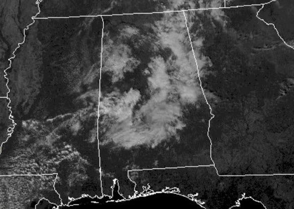
How about the rain this morning over portions of Alabama? It sure was a treat for some and there continues to be some returns on the radar now, but as these push slowly southeast they are slowly vanishing from the radar screen.
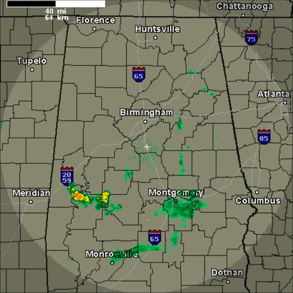
The rest of today, the upper-level feature responsible for the clouds and light rain will continue to push off towards the southeast and through the evening hours, the sky will clear as northwesterly flow bring a reinforcing shot of drier air into the state the next few days.
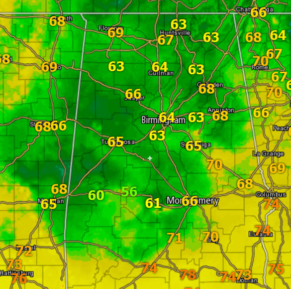
Temperatures are being held down with upper 50s and lower to mid 60s his afternoon, but through the evening hours, the sky will clear and we will see temps fall back into the 40s for most of us overnight.
WEDNESDAY THROUGH FRIDAY: Expect a sky full of sunshine, a general warming trend as we are going to see mainly sunny days and clear, chilly nights. For tomorrow, we will see temps climb into the low 70s, and then upper 70s Thursday, and some spots could see 80 degrees Thursday afternoon. Friday looks to be near identical to Thursday with upper 70s and perhaps some low 80s out there, but clouds will be on the increase as a cold front approaches the state.
FRIDAY NIGHT FRONT: A major storm system will move out of the Rockies and into the Northern Plains Friday, with blizzard conditions developing over the Dakotas. A trailing cold front will approach Northwest Alabama Friday night, and that front is expected to bring showers to Alabama late Friday night into early Saturday morning. No drought buster, and rain amounts will be generally under 1/2 inch, but we will take what we get…The main window for rain comes from 9:00 pm Friday through 9:00 am Saturday.
CHILLY WEEKEND WEATHER: Much colder air invades Alabama following the front. The day on Saturday will feature a clearing sky and many spots in North/Central Alabama will struggle to climb out of the 50s for highs. Now on Sunday, expect a blustery and chilly day with lower and mid 50s for highs despite full sunshine. A chilly north breeze of 10-20 mph will make it feel colder. It will easily be the coldest air so far this season; most places will drop into the 20s early Monday morning, which will be that first frost or freeze for many of us this season.
ON THIS DATE IN 2006: An F2 tornado caused severe damage through eastern portions of the city of Montgomery. The tornado damage path was approximately 6.8 miles long and 250 yards wide at its widest point. The tornado touched down approximately 1.4 miles southwest of the Shakespeare Festival and tracked northeastward. The tornado crossed Interstate 85 at Bell Road and continued northeastward to the Atlanta Highway…just west of Taylor Road. Numerous trees were snapped off or downed along the path with minor roof damage to numerous homes. Near the Atlanta Highway…the tornado crossed the A.U.M. ball field complex and struck the Montgomery Postal Processing and Distribution Center and Post Office. The main doors of the post office were blown in and portions of the roof were lifted off to the north. Numerous trees were snapped off at ground level on the south and west sides of the building. A tractor trailer was completely turned around and moved 30 yards and flipped over. Other postal vehicles and cars in the parking lot were moved or received significant damage. Just to the north…the tornado produced major damage to the Fun Zone Skating Rink, where more than 30 preschoolers were playing. Two children suffered injuries but there were no fatalities. This was a large metal building structure which was nearly totally destroyed. Several vehicles were tossed around and significantly damaged or crushed by debris from the building. As the tornado crossed the Atlanta Highway, several metal power poles were either significantly bent or downed. At the Saddleback Ridge Apartment Complex, at least two apartment buildings lost their roofs and portions of the second floor. The tornado continued another 2.25 miles northeastward ending in a field just south of Wares Ferry Road. Six people suffered minor injuries. The tornado touched down at approximately 1025 AM CST and lifted around 1035 AM CST.
Category: Alabama's Weather
About the Author (Author Profile)
Macon, Georgia Television Chief Meteorologist, Birmingham native, and long time Contributor on AlabamaWX. Stormchaser. I did not choose Weather, it chose Me. College Football Fanatic. @Ryan_StinnetSubscribe
If you enjoyed this article, subscribe to receive more just like it.


