

New Tornado Warning: NW Cullman County Until 9:30 PM CST
UPDATE AT 9:10 PM
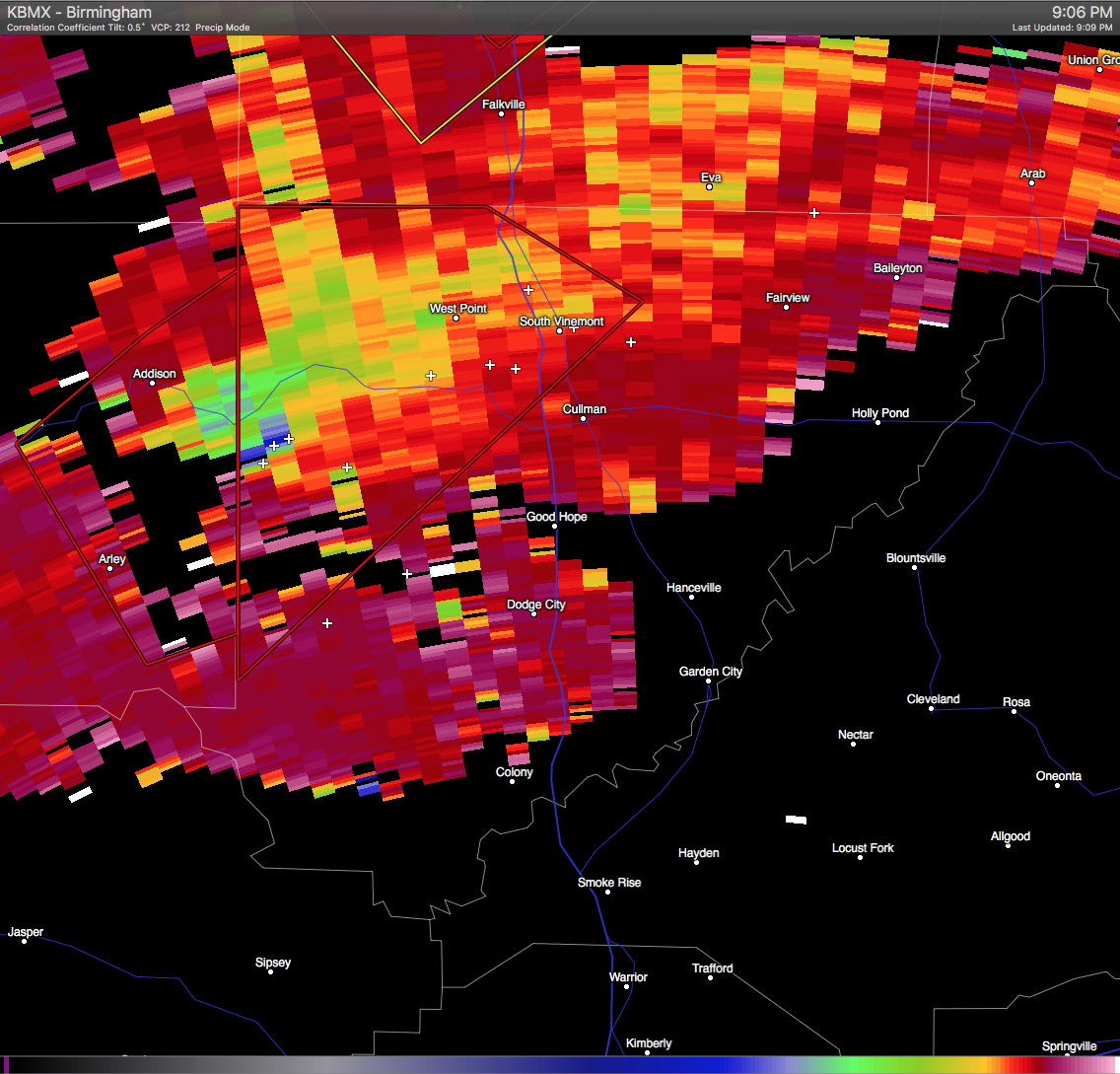
Major debris now being shown on the Correlation Coefficient right on the Cullman/Winston County line as the storm is moving to the northeast. Seek shelter immediately if you are in the path of this storm, Especially the communities of West Point and Vinemont.
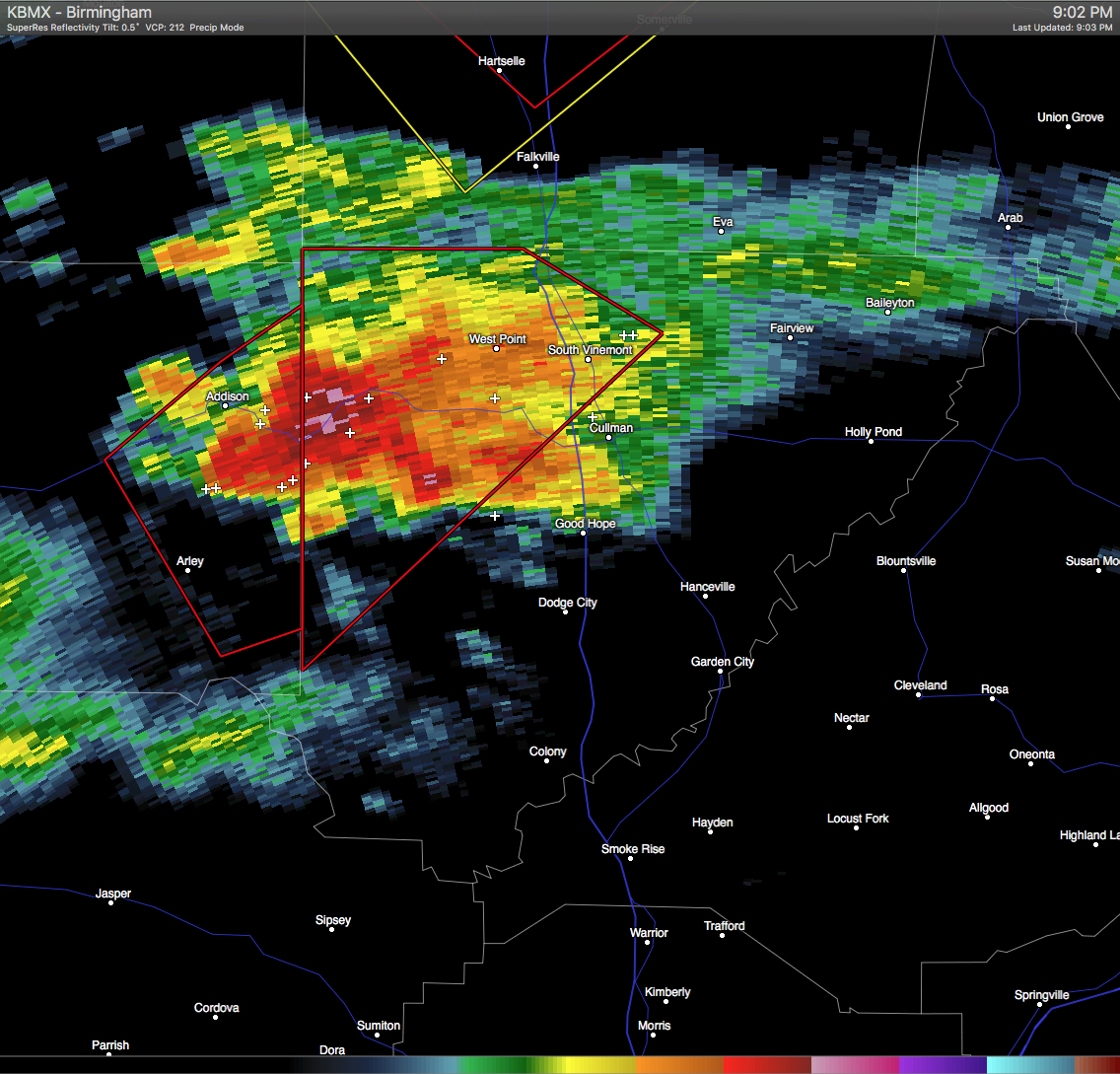
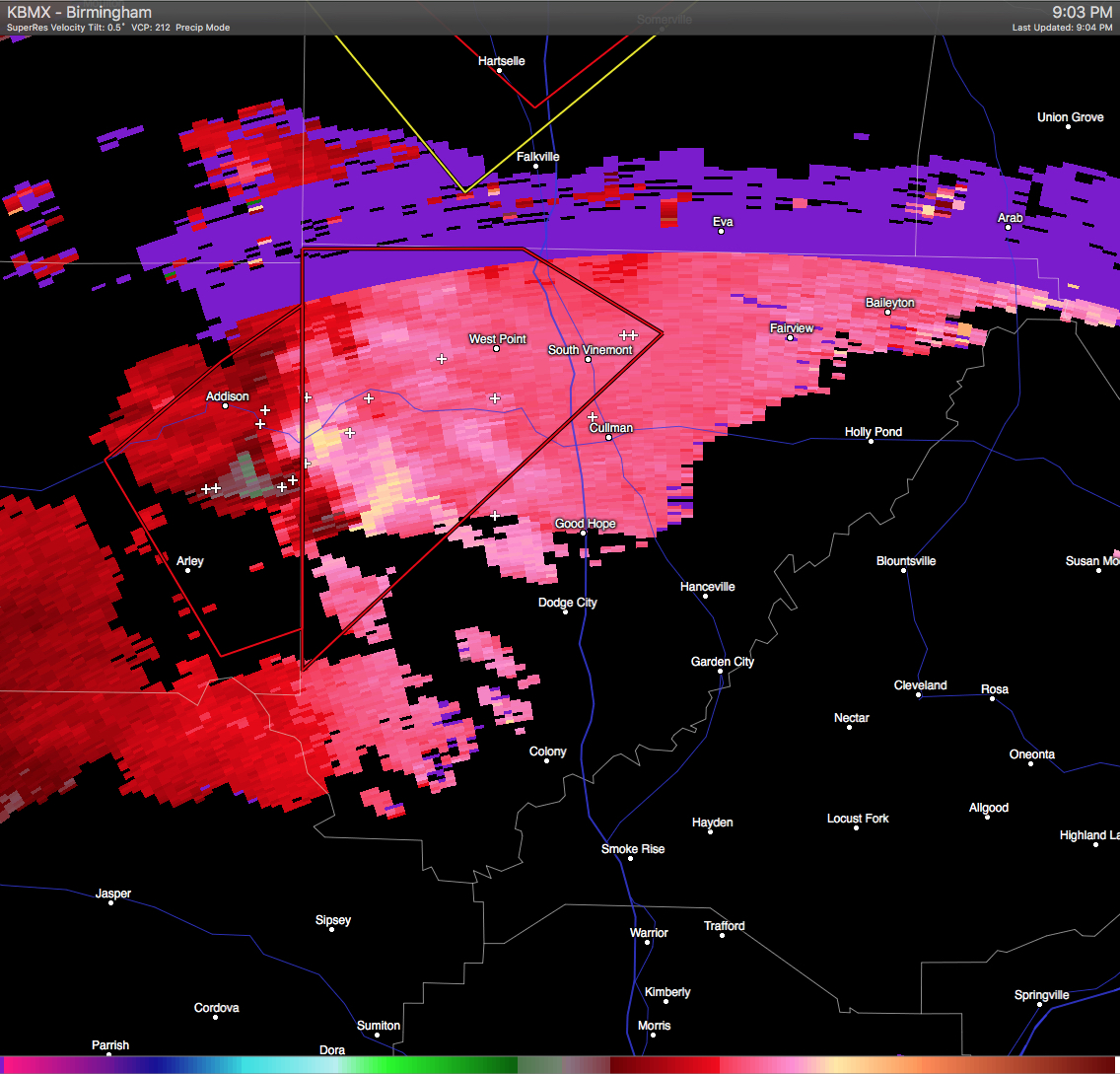
A severe thunderstorm capable of producing a tornado was located over Helicon and near Arley, and was moving to the northeast at 35 MPH. If you are in the path of this storm, you need to seek shelter immediately! Locations in the path of this storm are listed below:
SARDIS, LOGAN, BATTLEGROUND, WEST POINT, BALDWIN AND CRANE HILL.
Category: Alabama's Weather, Severe Weather
About the Author (Author Profile)
Scott Martin is an operational meteorologist, professional graphic artist, musician, husband, and father. Not only is Scott a member of the National Weather Association, but he is also the Central Alabama Chapter of the NWA president. Scott is also the co-founder of Racecast Weather, which provides forecasts for many racing series across the USA. He also supplies forecasts for the BassMaster Elite Series events including the BassMaster Classic.Subscribe
If you enjoyed this article, subscribe to receive more just like it.


