

Squall Line Coming Together
Showers and thunderstorms have increased in coverage over Mississippi and Louisiana as we see the first signs of a squall line coming together tonight ahead of our upper level system.
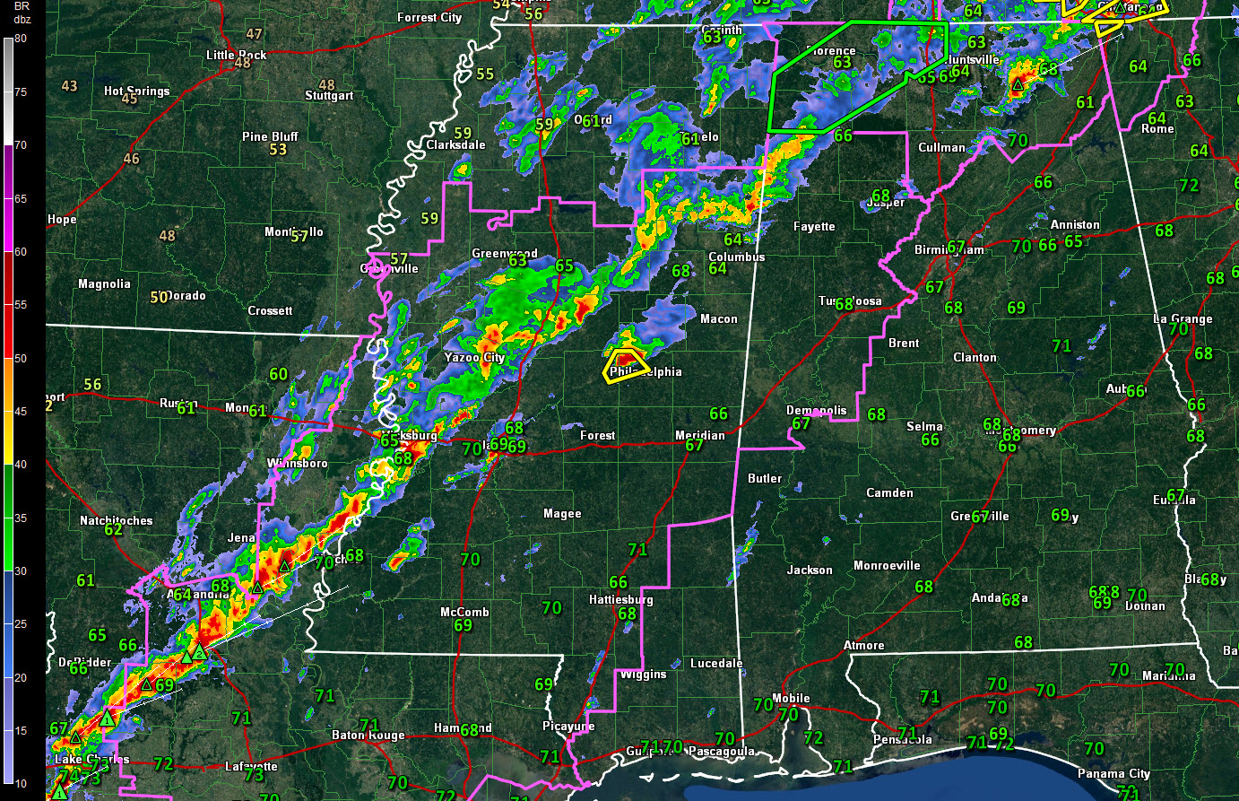
All of Alabama south of the Tennessee River is unstable tonight. This instability boundary extends from alnog the Tennessee River southwestward into Central Mississippi and Central Louisiana.
In Alabama, tornado warnings are now in effect for eastern Morgan, SE Madison and NE Jackson Counties, along the warm front.
There are currently two severe thunderstorm warnings over Central Mississippi.
A non-warned storm is south of the Columbus radar. It is showing signs of organization and that will likely continue as it is in an environment of strong speed shear. There is a good supply of low level helicity, so we will be watching it for potential tornado development. Spotters near the Air Force Base show no rotation and no wall cloud. This storm will affect northern Lamar and Marion Counties. The most dangerous part of the storm will pass near Sulligent.
The squall line should become wider and more solid as we head into the post midnight hours. The line will advance slowly southeastward, reaching the I-59 Corridor between 4-5 a.m. It will progress on our of East Central Alabama by 10 a.m or so.
A tornado watch remains in effect until 5 a.m. for much of Central Alabama.
The line should bring around one inch of rainfall with another quarter inch or so behind the main line.
Storm surveys will be conducted tomorrow across parts of Winston County where there has been sporadic damage.
Category: Severe Weather
About the Author (Author Profile)
Bill Murray is the President of The Weather Factory. He is the site's official weather historian and a weekend forecaster. He also anchors the site's severe weather coverage. Bill Murray is the proud holder of National Weather Association Digital Seal #0001 @wxhistorianSubscribe
If you enjoyed this article, subscribe to receive more just like it.


