

Severe Weather Threat Continues
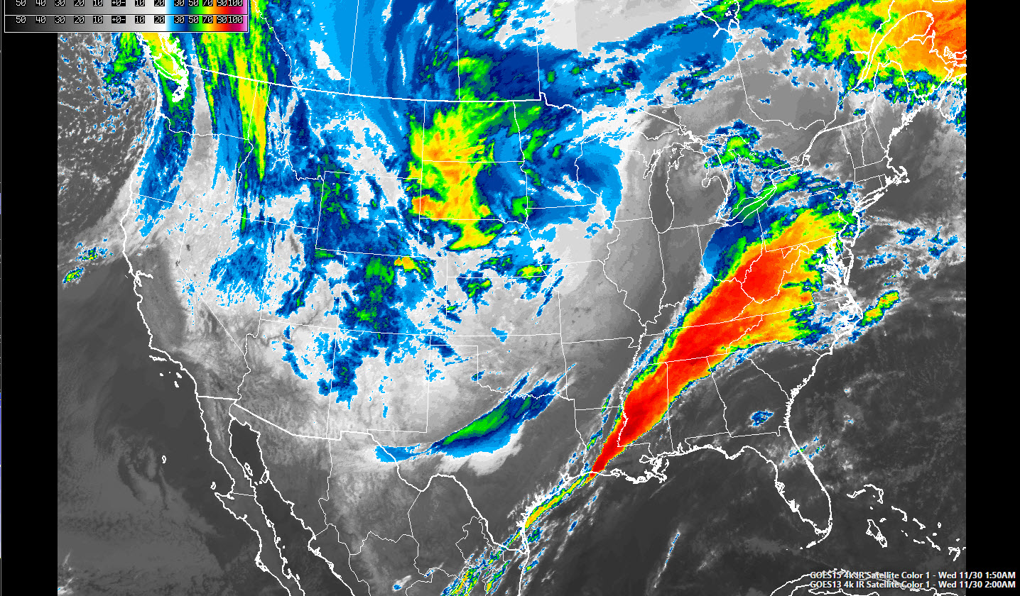
Our line of storms is growing in size and intensity early this morning. It extends from near Huntsville to Winfield in Marion County to near Columbus MS to Jackson and into Central Louisiana.
There are several severe thunderstorm warnings across the Tennessee Valley and one tornado along the Tennessee borer in Jackson County.
There are no discrete storms ahead of the main line now, and hence less in the way of warnings. But there is still a decent supply of instability and strong wind shear ahead of the line of storms, so severe weather is still possible, including tornadoes. A tornado watch remains in effect until 5 a.m. Additional tornado watches will be required later this morning almost certainly.
Cloud tops are cooling over southwestern Mississippi, where the storms are becoming quite strong. As these storms continue to expand and grow, heavy rains will become a threat as they expand northeastward. This heavy rain could spread into Central Alabama later this morning. We need the rain, but hopefully it won’t come at the expense of flash flooding.
There is also a second confluent zone developing ahead of the main line along and south of I-59 in West Alabama. This could spell more heavy rain with time.
Category: Severe Weather
About the Author (Author Profile)
Bill Murray is the President of The Weather Factory. He is the site's official weather historian and a weekend forecaster. He also anchors the site's severe weather coverage. Bill Murray is the proud holder of National Weather Association Digital Seal #0001 @wxhistorianSubscribe
If you enjoyed this article, subscribe to receive more just like it.


