

New Tornado Watch Issued Until 10:00 AM CST
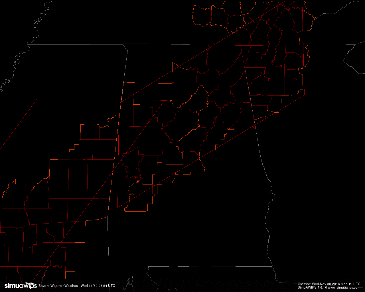
A new Tornado Watch has been issued for portions of Western through Northern Alabama, Northwestern Georgia, and Southeastern Tennessee until 10:00AM CST. Here is a list of Central Alabama counties within this new watch.
BIBB, BLOUNT, JEFFERSON, WALKER, FAYETTE, GREENE, HALE, LAMAR, PICKENS, SUMTER, TUSCALOOSA, CHILTON, PERRY, SHELBY, ST. CLAIR, TALLADEGA, CALHOUN, CLEBURNE, CHEROKEE, ETOWAH, MARENGO
Primary threats include a few tornadoes possible, isolated damaging wind gusts to 70 mph possible, and isolated large hail events to 1 inches in diameter possible.
A band of intermittently severe thunderstorms, with embedded qlcs mesovortices and supercell structures, will pose a continuing tornado risk as it accelerates eastward through the remainder of the early/mid-morning hours. A supercell or two also may still develop in the warm sector ahead of the line, also offering tornado potential.
Remember, a Tornado Watch means conditions are favorable for tornadoes and severe thunderstorms in and close to the watch area. Persons in these areas should be on the lookout for threatening weather conditions and listen for later statements and possible warnings.
Category: Alabama's Weather, Severe Weather
About the Author (Author Profile)
Scott Martin is an operational meteorologist, professional graphic artist, musician, husband, and father. Not only is Scott a member of the National Weather Association, but he is also the Central Alabama Chapter of the NWA president. Scott is also the co-founder of Racecast Weather, which provides forecasts for many racing series across the USA. He also supplies forecasts for the BassMaster Elite Series events including the BassMaster Classic.Subscribe
If you enjoyed this article, subscribe to receive more just like it.


