

Dry Through Friday; Mild Christmas Weekend
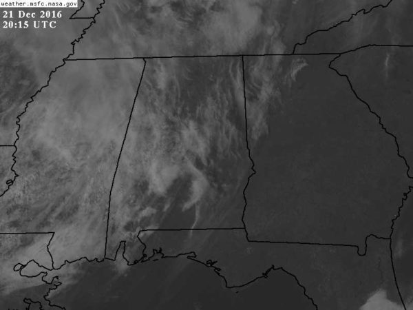
THIS AFTERNOON: The sky is partly sunny, with temperatures mostly in the 55-60 degree range across North/Central Alabama….
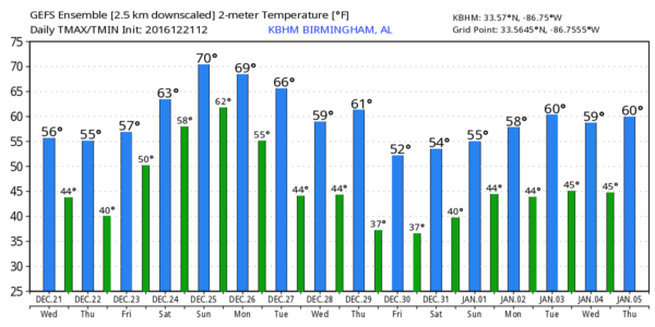
Tomorrow and Friday will stay dry and pleasant, with partly sunny days and fair nights. Afternoon highs will be around 60 degrees.
CHRISTMAS WEEKEND: Moisture levels will rise as a southerly flow begins, and a few scattered showers are possible both days. The most widespread rain over the weekend will most likely come on Saturday over far North Alabama, for places near the Tennessee border. The sky will be generally cloudy with a high in the low 60s Sunday, followed by 70 degree warmth Christmas afternoon.
These are the warmest Christmas days on record, based on data from Birmingham…
77 2015
74 1987
73 1982, 1942
72 1964
71 1926, 1922
70 1901
69 1971
68 1974, 1904
NEXT WEEK: A cold front will stall out just north of here, so we will have a chance of showers on Monday and Tuesday. The main dynamic support will be way to the north, so rain probably won’t be too heavy. Then, another cold front arrives later in the week with another chance of showers Thursday, followed by colder air Friday and over the New Years weekend. See the Weather Xtreme video for maps, graphics, and more details…
WEATHER BRAINS: Don’t forget you can listen to our weekly 90 minute netcast anytime on the web, or on iTunes. This is the show all about weather featuring many familiar voices, including our meteorologists here at ABC 33/40.
CONNECT: You can find me on all of the major social networks…
Facebook
Twitter
Google Plus
Instagram
Look for the next Weather Xtreme video here by 7:00 a.m. tomorrow…
Category: Alabama's Weather
About the Author (Author Profile)
James Spann is one of the most recognized and trusted television meteorologists in the industry. He holds the AMS CCM designation and television seals from the AMS and NWA. He is a past winner of the Broadcast Meteorologist of the Year from both professional organizations.Subscribe
If you enjoyed this article, subscribe to receive more just like it.


