

Warm Christmas Weekend Ahead
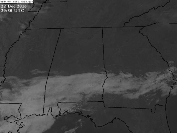
THIS AFTERNOON: The sky is bright and sunny across the northern half of Alabama this afternoon; clouds are confined to the southern counties of the state…
A weak surface front is passing through; north of the front temperatures are in the 50s over the northern third of the state; communities south of the front are in the 60s. Tonight will be clear and chilly; most places drop into the 35-39 degree range by early tomorrow morning.
TOMORROW THROUGH CHRISTMAS DAY: Tomorrow will be dry and pleasant with a partly sunny sky; the high should be in the low 60s for most places. Then, a pronounced warm-up will take place over the weekend with an upper ridge and southerly low level flow. We rise into the mid 60s Saturday, followed by a high between 70 and 75 degrees on Christmas afternoon. This is our second warm Christmas in a row… here is a list of the warmest temperatures recorded on December 25 (based on data from the Birmingham Airport)…
77 2015
74 1987
73 1982, 1942
72 1964
71 1926, 1922
70 1901
69 1971
68 1974, 1904
A few showers are possible over far North Alabama early Saturday morning, otherwise the weekend looks mostly dry, despite mostly cloudy conditions. The chance of a shower for any one spot during the day Saturday and Sunday is only about one in ten.
TO THE NORTHWEST: A major storm system will bring blizzard conditions to parts of Wyoming and the Dakotas Sunday, with a risk of severe storms to the south across sections of Kansas and Oklahoma. But, the good news is that there is no risk of severe weather in Alabama this year on Christmas Day.
NEXT WEEK: We stay warm Monday through Wednesday with a stalled front north of the state; we could see a few widely scattered showers on these three days, but nothing widespread or heavy. Rain is likely by Thursday with a cold front approaching from the north, and it looks like this will push through Thursday night, followed by sharply colder temperatures Friday, with highs potentially dropping into the 40s, and lows in the 20s. See the Weather Xtreme video for maps, graphics, and more details.
DROUGHT MONITOR: New data this morning still shows a severe to exceptional drought for much of the state…
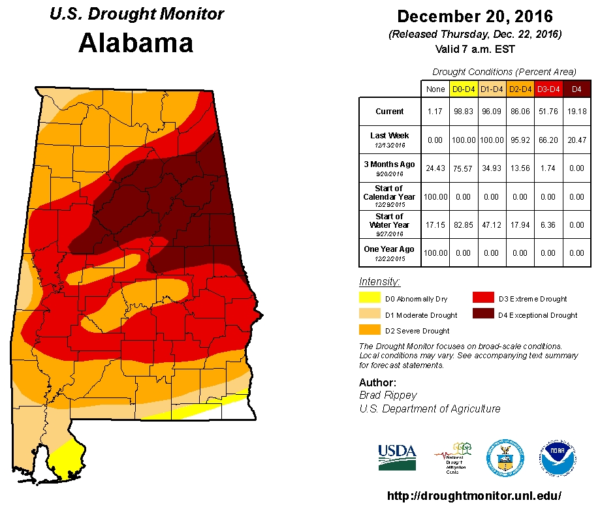
Many communities are still over 10 inches below average for the year.
WEATHER BRAINS: Don’t forget you can listen to our weekly 90 minute netcast anytime on the web, or on iTunes. This is the show all about weather featuring many familiar voices, including our meteorologists here at ABC 33/40.
CONNECT: You can find me on all of the major social networks…
Facebook
Twitter
Google Plus
Instagram
Look of the next Weather Xtreme video here by 7:00 a.m. tomorrow…
Category: Alabama's Weather
About the Author (Author Profile)
James Spann is one of the most recognized and trusted television meteorologists in the industry. He holds the AMS CCM designation and television seals from the AMS and NWA. He is a past winner of the Broadcast Meteorologist of the Year from both professional organizations.Subscribe
If you enjoyed this article, subscribe to receive more just like it.


