

A Word About The Late Week Winter Mischief
Seeing lots of buzz about this across social media, and while I addressed it on the discussion early this morning, I wanted to make a few quick points at midday.
The new GFS run (12Z) has come in very aggressive with the idea of snow for North Alabama Saturday. Please understand, the map below is NOT a forecast, but just model output.
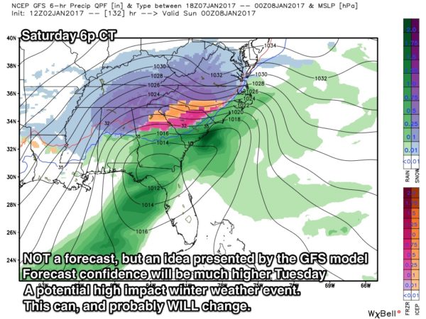
The latest run (00Z) of the reliable European model was not as aggressive, with just light snow amounts for North Alabama Friday night and Saturday morning. We will get the new 12Z Euro run by 12:30-1:00 p.m. CT today.
It is simply impossible to provide an accurate forecast of the potential winter event now; we need to get past today’s turbulent weather, and look at new data late tonight before we make a first detailed forecast tomorrow morning. For now, there is no reason to cancel anything! Just, just be aware of the possibility, and check the blog very early tomorrow morning (I will probably update this winter outlook later today after the new Euro arrives).
Stay tuned, and don’t forget we have an active severe weather threat going on through tonight! Here is the new SPC severe weather outlook through tonight.. highest tornado threat is over South Alabama, but one or two can’t be ruled out as far north as U.S. 278…
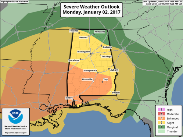
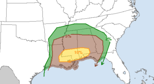
For North/Central Alabama, the core severe weather threat comes from about 4:00 p.m. to 12:00 midnight. The risk lingers after midnight for Southeast Alabama.
Category: Alabama's Weather
About the Author (Author Profile)
James Spann is one of the most recognized and trusted television meteorologists in the industry. He holds the AMS CCM designation and television seals from the AMS and NWA. He is a past winner of the Broadcast Meteorologist of the Year from both professional organizations.Subscribe
If you enjoyed this article, subscribe to receive more just like it.


